At the Airport
Check-in
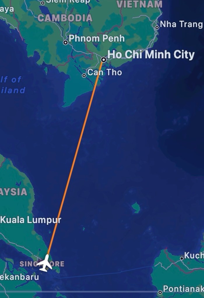
Singapore Airlines flies out of Ho Chi Minh City Tan Son Nhat Airport Terminal 2, dedicated to international departures (domestic destinations depart from Terminal 1). Singapore Airlines operates seven check-in counters from Row E of the terminal in the middle of the departure hall, with Door D1 being the closest entrance to the check-in counters. There are four queues set up at Row E catering for Business Class, Economy Class, Singapore Airlines Elite Gold/Silver members, and Internet Check-in. The two counters serving Business Class passengers are located at the front of the row (E1/E2 are nearer to the terminal’s entrance. There was a ground staff at the line ensuring that only Business Class passengers were allowed in the queue. The agent checking us in was friendly and professional, and processed our check-in with much efficiency. Singapore Airlines had an unusual arrangement for Business Class passengers in Tan Son Nhat Airport. Other than the usual lounge access, we were given two aeditions options – a USD20 voucher to be spent at eateries in the terminal, or a 30-minute massage. We opted for the lounge access. As two of our friends were flying in Economy Class, the ground staff also issued them with the lounge access pass without us asking for it (two of us were Elite Gold members and were able to bring our friends into the lounge). The ground staff gave us directions to the lounge, our boarding gate and timing before we left the check-in counter.


Le Saigonnais Lounge
Singapore Airlines does not have a SilverKris Lounge presence in Ho Chi Minh Airport, it uses Le Saigonnais Lounge, a third-party paid lounge serving other airlines, such as Emirates, EVA Air and Japan Airlines. The lounge is located on level 3, in the left corner of Terminal 2 between Gates 17 and 18. Le Saigonnais Lounge is a fairly large lounge with bright natural light, thanks to the floor-to-ceiling windows facing the tarmac. The lounge is decorated with Indochrine elements, merging Vietnamese and French elements. The French elements are seen in the European-style lampposts dotted in the part of the lounge near its entrance. A bulk of the lounge has Vietnamese elements, seen in the screens deployed around the lounge; the conical bamboo hat that is so iconic of Vietnam is seen in the decoration on the ceiling of the lounge, as well as the various Vietnamese clothing displayed in the fore lounge.


Most of the lounge is furnished with dining tables for two, spreading along the perimeter of the lounge from the entrance to the innermost part. I reckon the best seats are those by the large floor-to-ceiling windows facing the apron, where we could relax and do some plane spotting. The only different types of seating are found at the back of the lounge. There is only one long table at the back of the lounge catering for single travellers who want to do some work before their flight. Le Saigonnais Lounge has a small business centre in the back corner, equipped with three PCs. Beside this business centre, occupying the other back corner, sits a four-seater dining table. There are also some dining tables placed on a raised platform along a set of curved railings next to the buffet area. These would be the best seats for enjoying the food from the buffet due to their proximity,


The buffet line is located by the entrance on the oval-shaped kitchen island behind the lounge reception. The food offering is arranged into two sections: half of the oval facing the beverage stations houses the warm food, while the other half facing the lounge is stocked with desserts and starters. I find the food selection to be rather thin, and there is only one Vietnamese food – beef pho on offer. The other food options are seafood fried rice, fried fish, congee with condiments, and a small selection of vegetarian warm food. Half of the dessert section is dedicated to condiments for pho and bread, leaving only half of the dessert section stocked with fruits, mochi and pudding. Despite the small selection, other than the soggy fried fish, the food available is quite delicious. Beverages are found on the table by the wall opposite the buffet line, serving up a good selection of wine, soft drinks and Vietnamese coffee and tea. Le Saigonnais Lounge is equipped with two shower cubicles located inside the toilet. These toilets are more utilitarian then luxury with a newly segregated dry area inside each shower cubicle. Usage of these shower facilities is on a first-come, first-served basis and can be requested from the staff at the lounge, who will then provide towels and shower amenities.


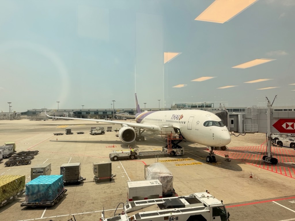
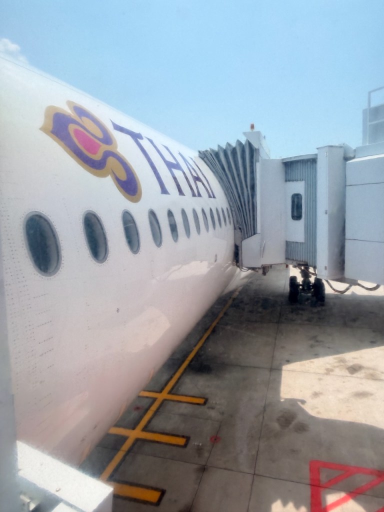
The Aircraft
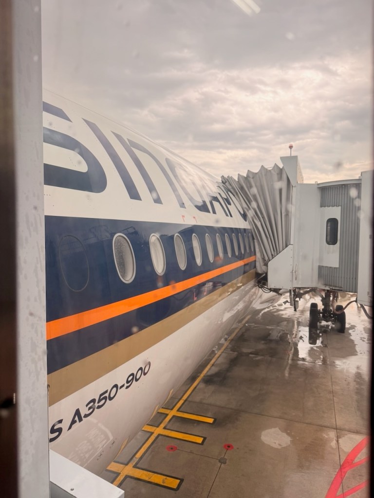
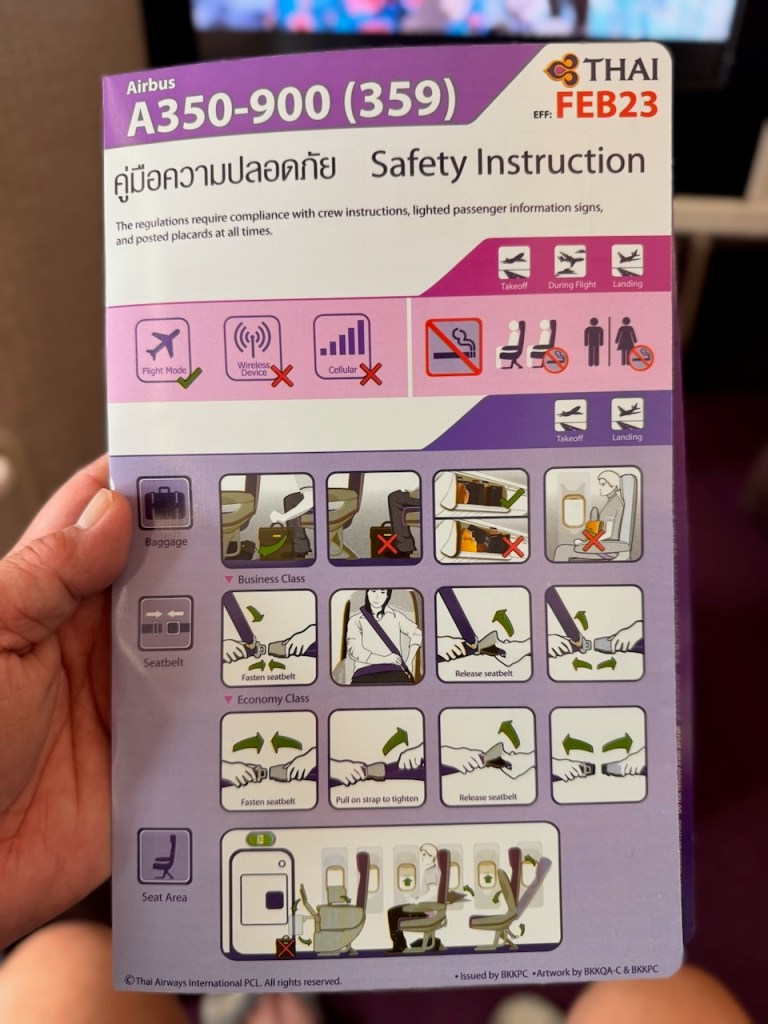
Singapore Airlines operates three daily flights using its A350-900, both Medium Haul and Long Haul variants, as well as its B787-10 aircraft between Ho Chi Minh City and Singapore. We flew on its A350-900 Long Haul aircraft featuring the Jamco Business Class seats (2013 iteration) for this leg.


Cabin
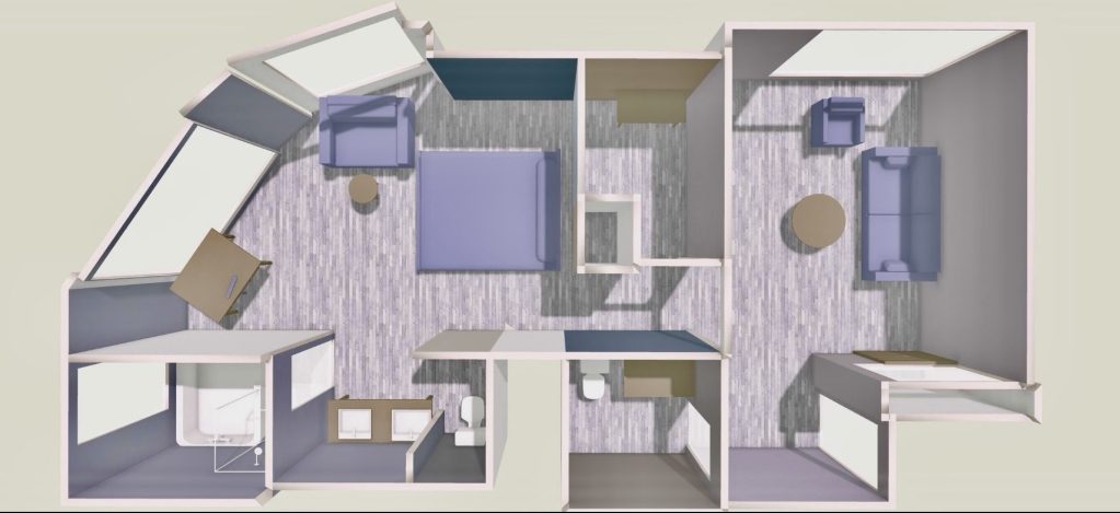
The A350-900 Long Haul aircraft that we took features a three-class cabin: Business, Premium Economy and Economy Class. Singapore Airlines does not sell Premium Economy service on this leg; passengers can opt to pay extra for these Premium Economy seats. However, the food catering will be that of Economy Class. Singapore Airlines A350-900 Long Haul Variant has a total of 253 seats with 42 seats in Business Class, 24 seats in Premium Economy Class and 187 seats in Economy Class. The Business Class cabin is further segregated into the larger forward cabin that houses 26 seats and a smaller aft cabin with 16 seats. Singapore Airlines A350-900 Long Haul Business Class emits a quiet luxury vibe with warmth, balanced and restrained designs. The soft, earthy colour schemes created a smooth environment which lowers visual stress. The airlines predominantly use brown, from the sand colour seen in the footwell and cabinetry to the harsher chocolate brown in the seats and carpet, coupled with the softer warm lighting that created a relaxing vibe in the cabin and gave the cabin a more residential hotel-like feel. The lack of overhead bins above the centre row and separating the cabin into forward and aft created an airy and spacious feel in the Business Class cabin.


There are three Business Class lavatories on Singapore Airlines’ A350-900 Long Haul variant serving all 42 Business Class passengers. One located at the front of the aircraft behind the cockpit, and another two between the two Business Class cabins. The Business Class lavatories exuded a premium feel with the dark brown wooden laminate fixed onto the sink cabinetry, and the sand brown backsplash at the sink enhances its premium look. The size of these lavatories is pretty much standard, but the mirror made it feel larger than it actually is. Singapore Airlines stocked its Business Class lavatories with additional Payot-branded amenities like lotion, eau de toilette and facial mist. Apart from these premium amenities, Singapore Airlines is one of the few airlines in the world that provides standard amenities such as dental kits and shavers in its lavatories even on a short flight.


Seat Features
The seats on Singapore Airlines A350-900 Long Haul Business Class are arranged in a 1-2-1 configuration, ensuring all 42 passengers get direct aisle access. Each seat is 28” wide with a pitch of 60” that expands to 73” when converted into a flat bed, making it one of the widest Business Class seats. Like all Business Class seats, Singapore Airlines A350-900 Long Haul Business Class seats have four standard modes – upright, flat bed and two in-between lounge modes. The upright mode is the default mode that we were greeted by the seat at the time of boarding. The wide seat and the thick padding, together with the soft plush leather, made the seat feel very comfortable. The flat bed mode on these seats can only be deployed by flipping the seat over on its back instead of pressing a button on the seat controls that is situated on the inside of the aisle-side armrest. There is a mixed review of the comfort levels in the bed mode, with some passengers complaining about how hard it is despite the duvet set that the airlines provided. On top of this, the slanted position with a small footwell does not appeal to every passenger. We were fortunate to be able to snag the bulkhead seats, which feature a larger footrest that spans across the width of the seats, compared to the small angled footwell on the standard seats, which technically allowed us to sleep in various positions. However, I did not manage to flip the seat over to convert to bed mode due to the short flight time. Moreover, the cabin crew already had a hectic schedule feeding all the passengers, and I couldn’t bear to disturb their schedule (based on past experience, the cabin crew would lay down their work to help passengers convert the seat into bed mode). The seat in lounge mode, with the calf rest deployed and its back angled, provided additional comfort that allowed me to laze on the seat in a more relaxed posture. Singapore Airlines A350-900 Long Haul Variant comes in two preset lounge modes (based on the two lounge position buttons on the seat control). The first lounge mode has a seat back slightly angled, and the calf rest slightly raised. This is a good mode for meals or work, as it beats sitting long hours in a stiff upright mode. The second lounge mode is closer to a bed mode, but instead of having the seat all the way flat, the seat back is tilted more, and the calf rest closes the gap between the seats and the footrest. I find this mode best for enjoying the in-flight entertainment or for passengers who want to snooze a little after a meal. The seat comfort in lounge mode is made more comfortable by its ability to customise the angle of recline apart from the preset angle. Despite not having a door, I find a good amount of privacy in these Long Haul Business Class seats due to their high back curved wrap-around shells that act as cocoons. Other than controlling the angle of recline of the seat, the seat control buttons also control the seat lighting and the on/off for the personal TV, as well as call the attendant.


Singapore Airlines A350-900 Long Haul Business Class seats also feature a good amount of storage space. The main storage in the seat is found on the inner armrest area, where there is a fairly deep compartment for us to stow our smaller items. The second storage area is an open shelving beside the seat where we could use to place slimmer items such as laptops and tablets, but items stowed here would have to be removed during taxiing, take-off or landing. As we were sitting in the bulkhead seats, there was significantly more space under the footrest for us to stow our carry-ons and shoes. In the standard Business Class seats, there would be another small compartment beside the TV that can hold small items, but this additional compartment is not present in the bulkhead seats. In the charging department, Singapore Airlines A350-900 Long Haul Business Class seats are fitted with an international power socket and a couple of USB-A charging ports beside the seat. Singapore Airlines A350-900 Long Haul Business Class seats are installed with a large sturdy seat table, stored in the side console. Due to its solid design, fishing out the table from the side console can be a challenge due to its bulk. When deployed, the large table is perfect for multi-course dining for longer flights or working on a laptop with spare space for a drink while working. The Singapore Airlines A350-900 Long Haul Business seat is fitted with a set of three reading lights, apart from the ceiling reading light, on the shell of the seat, corresponding to each seat position.


Inflight Entertainment
Singapore Airlines A350-900 Long Haul Business Class seats are fitted with a large 18″ HD personal display. The large display made watching movies on KrisWorld a joy, and it felt like a movie theatre in the sky. The sharp, crisp picture from the display is not affected even when lying on the seat in bed mode, thanks to the tilt feature built into the screen. However, as this is an older product, the personal TVs are not fitted with touchscreen functions. We select the movies that we want to watch via the IFE controller, which is designed to resemble a PSP console with touchscreen function in the middle part of the controller. As the KrisWorld is also packed with games, the IFE controller is also designed with game controls on it. The entertainment library is packed with loads of entertainment options, from the latest Hollywood blockbusters to regional movies to documentaries and even TV shows. KrisWorld is very well catalogued into intuitive menus, making searching for entertainment a breeze. Singapore Airlines provides noise-cancelling headphones to its Business Class passengers, which are very effective in blocking out ambient noises. In fact, I had to remove my headphones when conversing with the cabin crew. Singapore Airlines provides unlimited complimentary wifi to its Business Class passengers, which is only effective for chatting and social media browsing. The slow speed of the internet does not support video streaming. Economy Class passengers who are members of the airline’s loyalty program, KrisFlyer, are also provided with complimentary unlimited internet access throughout the flight.


Meal Service
As this was a short flight with a total flight time of 2 hrs, meal service began about 30 minutes after taking off when the aircraft reached cruising altitude. Singapore Airlines offers its “Book the Cook” service to its Business Class passengers, where we can select our choice of meals from an extended menu on top of the three options offered in-flight. However, the “Book the Cook” service is only available at selected airports, such as Singapore, Paris, and Beijing, to name a few, and unfortunately, this service is not available for this flight out of Ho Chi Minh City. The options for mains on this flight were Beef Short Ribs, Roasted Chicken Thigh and Rice, and Herb Crusted Barramundi. I opted for the Beef Short Ribs, which were prepared in Sichuan Style and served with egg noodles. Due to the short flight time, the meal was served in one tray. The prawn cake salad appetiser tasted fresh, and the cakes were delicious. Even without the salad dressing, the vegetables in the salad were fresh and tasty. The beef ribs were tender and could be pulled apart without much force, and went very well with the accompanying sauce. The noodles were not soggy and had a certain crunchiness to them. The coffee cake dessert was equally delicious. It was soft and moist, and the coffee taste was not overpowering.


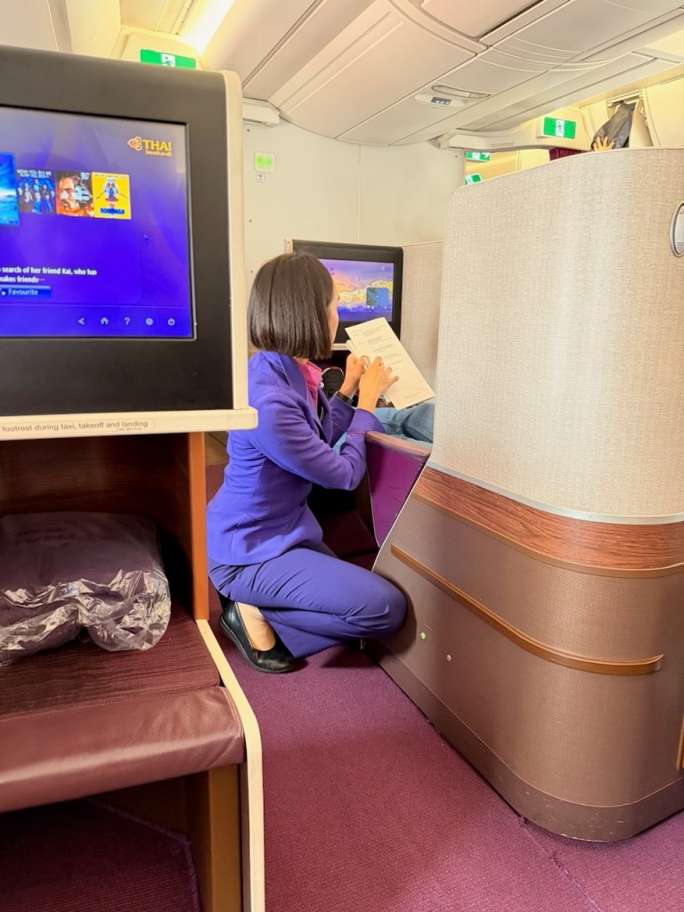
Service
The service we received on board was nothing short of impeccable. After the usual greetings at the door during boarding, and as I was making my way to my seat, I was escorted to my seat by a cabin crew member, Fernanda, who was welcoming Business Class passengers in the cabin. When learning about my seat number, Fernanda was delighted that I managed to snag this highly sought-after seat. Fernanda came across as friendly and sincere and was able to hold a conversation very well. She was cheerful and took care of us very well. She would return to confirm my meal selection and took the extra care to ensure the dish did not contain any of my allergens by going through the ingredients list. When I requested their signature mocktail to be served after the meal, Fernanda remembered without even being prompted. She was meticulous and used her heart to work. The other crew member, Rachel, serving the aisle where my friends were sitting, came across as cheerful. I saw how she took care of my friends and would always pop by to check in on them to see if they needed more drinks. When it came to my allergen, a male leading steward visited my friend and me to check the severity of our allergy if we accidentally consumed the food. This goes to show the crew went above and beyond to ensure guests were not affected by the food that was served onboard. As I was sitting near the galley, I witnessed a lot of teamwork by the crew, with crew members helping each other out to ensure all passengers were being fed shortly after take-off, maximising the time we had to consume the meal. Despite being a turnaround flight and having worked a 2-hour inbound flight, the crew remained enthusiastic and full of energy.

Afterthought
I had a great flight with Singapore Airlines on board their A350-900 (Long Haul Variant). We managed to snag the best seat in the class – the extremely spacious bulkhead seats without needing to sleep on our side. This seat, due to its design, also offered us plenty of stowage space under the seat. The missing centre overhead bin gave the cabin an airy look. Other than the comfortable and spacious seats, what made this flight pleasant was its crew. The cabin crew were very welcoming and friendly. They were seen helping each other with the interest of the passengers in mind. Despite working one 2-hour, hectic flight to Ho Chi Minh City, the crew were still energised.