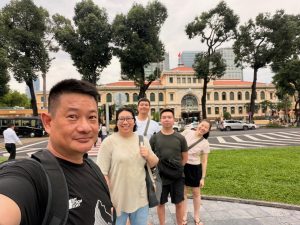
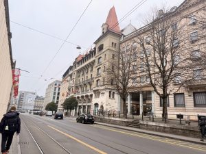
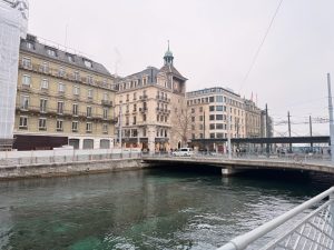
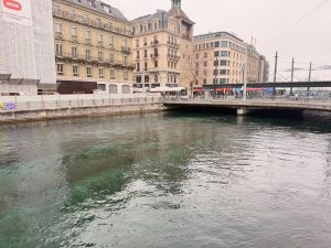
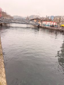
As we have pretty much covered the sights in Ho Chi Minh City, which are mainly located in District 1, we tried to look for sights outside of District 1. At the time of my planning, I chanced upon the rich Chinese Culture in District 5.
Temple Hopping in District 5 – Into the Spiritual Culture
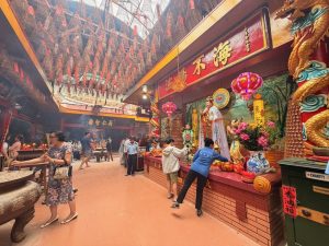
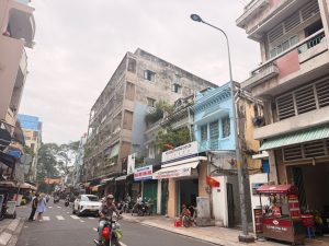
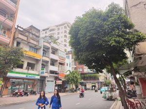
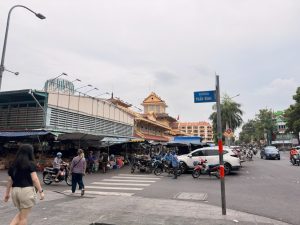
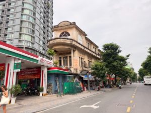
District 5 is where the Chinese immigrants from yesteryears settled down and called this part of Ho Chi Minh City home. There weren’t many sights in District 5, other than several significant Chinese temples and a market that is similar to that in District 1. After visiting the temple, as we were making our way to Binh Tay Market, we noticed District 5 seemed to be a wholesale centre. The interesting thing is that there seems to be some form of organisation of the shops in District 1. We noticed that shops selling the same or similar things tend to be grouped in the same cluster, creating a street that only sells clothes, and yet another with all the shops selling scissors.
Thien Hau Pagoda – The Anchor of Chinese Culture
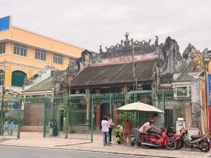
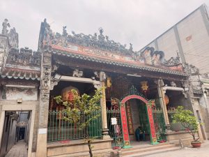
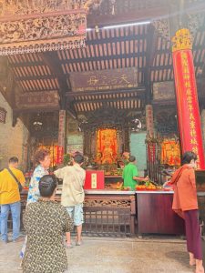
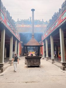
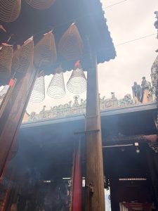
We took a Grab from our hotel to our first stop of the day, Thien Hau Pagoda in Chinatown. Built around 1760, Thien Hau Pagoda is one of the oldest and most historically significant Chinese temples in the city. Almost all original building materials, including the ornate ceramic tiles, reliefs, and incense burners, were imported directly from China. Thien Hau Pagoda is dedicated to the Goddess of the Sea – Mazu. The Chinese believed the Goddess protected them when they traversed the seas. The age of the temple is inscribed on its facade in its exposed red brick dressing and the roof that is marinated with time. The temple is topped with intricate carvings of Chinese mythological characters and animals that are typical of a Chinese temple. Thien Hau Pagoda is a relatively smaller temple with one main hall and an open courtyard in the centre of the temple. A deity sits on each side of the wall after its main entrance. In the centre of the courtyard lies a furnace and a large incense burner. The furnace was believed to have originated from China when the temple was built. From here, we could see more intricate carvings of deities and Chinese mythical animals crowding on the rooftop. In the centre hall sits the deity of the temple – Mazu, dressed in red and elaborately gold-ornamented garments that devotees probably donated. Behind the main hall, the two small side halls worship Guan Gong and the God of Fortune. As Thien Hau Pagoda was not large in size, we left after offering our prayers.
Thien Hau Pagoda in District 5
Close-up look at the facade of Thien Hau Pagoda
Mazu is the main deity installed in Thien Hau Pagoda
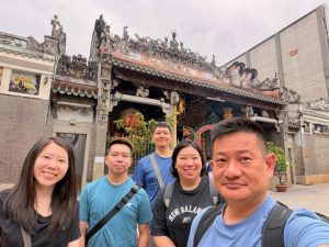
Wefie at Thien Hau Pagoda
Thien Hau Pagoda has a large open-air courtyard in the middle of the temple
The interior of Thien Hau Pagoda
Quam Am Pagoda – The Red and Yellow Temple
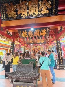
Our next sight in District 5, Quam Am Pagoda, is a 7-minute walk from Thien Hau Pagoda. Decked in a bright red facade, Quam Am Pagoda look newer than Thien Hau Pagoda. But don’t be fooled by the newer facade; Quam Am Pagoda is 20 years older than Thien Hau Pagoda. Built in 1740, it served as a gathering place for the Chinese immigrants to discuss public affairs, help one another, worship gods, and meet their spiritual and cultural demands. Quam Am Pagoda is a bigger temple compared to Thien Hau Pagoda. The interior of this temple looks brighter thanks to its open concept on the sides of the temple that lets a lot of natural light in. The bright red and yellow seen in its facade is also used throughout the temple, contributing to the brightness, together with the LED lights used. In the centre of the front hall is the Goddess of Mercy statue with a more solemn expression. There is a bigger back hall with lots of deities installed along its parameters, where we saw locals coming to pray. The biggest statue is the other Goddess of Mercy with a benevolent expression, and shares the same wall as the one in the front hall. Like the locals, we offered our prayers to the gods in Quam Am Pagoda.
The bright colours painted on the facade of Quam Am Pagoda make it look new despite being around 200 years old
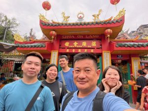
Wefie at the main entrance to Quam Am Pagoda
The interior of Quam Am Pagoda is brightly lit with natural light
The front hall of Quam Am Pagoda
The back hall of Quam Am Pagoda is installed with lots of deities from Chinese mythology
The Goddess of Mercy Statue at the back of the temple has a benevolent look
Binh Tay Market – The Chinese Market
Binh Tay Market is our last stop in District 5, about 10 minutes on foot from Quam Am Pagoda. Along the way, we walked past many shops and realised that most of the shops selling similar items seem to congregate on the same street. Playfully, as we walked past shops selling packaging items, we named the street “Packing Street”, and the one that consists of shops selling toys as “Children Street”. These are, of course, not the official names of these streets, but just us having fun when walking along the street. Other than Quam Am Pagoda, the rest of District 5 seems quiet. Perhaps today was Vesak Day, a day that celebrates the birth, enlightenment and death of Buddha, explaining why more locals are gathering inside the Buddhist temple.
District 5 saw fewer toursits outside of the temples
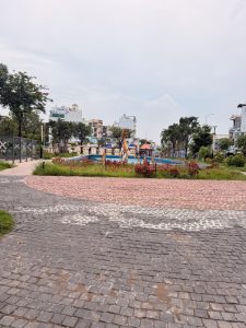
Small garden near Binh Tay Market in District 5
Along the streets of District 5
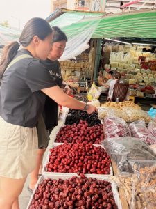
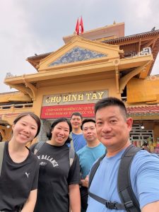
While District 1 has Ben Thanh market, mainly catering to tourists, District 5 has Binh Tay market, which mainly caters to the locals. Binh Tay market is one of the oldest markets in Vietnam, having been around since 1930. Dressed in beige colour, the main building has Chinese elements like dragons and porcelain, topped with Chinese-style roofs. Other than the stalls in the front that see more human traffic flow, the inside of the market is dead, with sparse people shopping and only a handful of shops on the ground floor open for business. However, we noticed the stalls in the surrounding extension of the market seem to have more locals shopping for their daily needs. Seeing there is nothing much we can do here, we got a Grab and went back to our hotel to rest a little and offload the shopping that my friends bought.
Binh Tay Market has Chinese elements in its facade, and felt like catering to the local community
Dried food stall in Binh Tay Market
There are more marketplaces surrounding Binh Tay Market
My friends buying goods from one of the stalls in Binh Tay Market
Wefie with the facade of Binh Tay Market
The stalls surrounding Binh Tay Market
Back to District 1 – Relaxing Shopping Time
We spent the rest of the afternoon relaxing and shopping in District 1. One of the things that we came to know before visiting Ho Chi Minh City is its famous hair spa. The Vietnamese hair spa is famed for its deep scalp cleansing, followed by a hydrotherapy (a semi-circular gadget that the masseuse uses to apply warm water over our hair like a waterfall). Numerous wellness centres in District 1 offer this service. Before starting the session, the therapist used a microscopic device to show the status of our scalp and promised that our scalp would be clean after the treatment (we did not get the post-treatment scalp scan). The session was relaxing, but I thought hydrotherapy was rather gimmicky. Nonetheless, we had a relaxing time as these packages usually come with a head, neck and shoulder massage. After our hair spa treatment, we walked to the Saigon Centre to do some shopping. There are numerous shops, from luxury to sports brands, in this huge building. However, the supermarket here seems a tad more upmarket and caters mainly for foreigners. Subsequently, we headed to the Winmart (local Vietnamese supermarket) in Vincom Centre, just a 5-minute walk from Saigon Centre. We found Winmart to be a better place to stock up on Vietnamese snacks, as it is better stocked and the prices are lower. We returned to our hotel after some shopping and ordered our dinner via GrabFood.
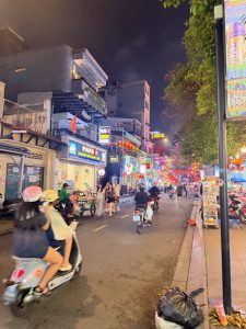
Walking on the streets of District 1
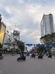
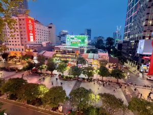
District 1 in Ho Chi Minh City
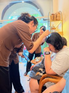
My friend having her scalp analysed before the hair spa
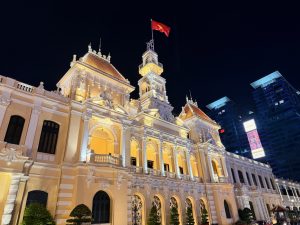
City Hall in District 1 at night
Thoughts on Ho Chi Minh City
I thought there were very limited attractions in Ho Chi Minh City, mainly situated in District 1, which we managed to visit within one afternoon. Having said that, these attractions are located near each other, making it very easy to see them within a short period of time. For those who like to experience the hustle and bustle of the city, cafe hopping, or body wellness massages, Ho Chi Minh City would be a great destination. The city is famed for its many Koi Cafes, where one would literally sit in a sunken pod with koi swimming around them. These Koi Cafes are located a little further from the city centre, but with the affordable cab fare, they are easily reachable. I also thought the cost of the wellness massages was rather affordable, and the quality is good. History buffs or people who want to understand the unification history of the country or the Vietnam War would find this city interesting, with the War Relic Museum and the Independence Palace. However, for those of us who wanted to see more than the city would find it disappointing. There was nothing much nearby to visit, other than Ba Den Mountains and Cu Chi Tunnel. Unlike Hanoi, which has the scenic Halong Bay, Sapa, Ninh Binh, or Danang with Ba Na Mountains, Monkey Hill, and the historic Hue and Hoi An, which make perfect day trips that could extend the trip for additional days. I reckon a three-day trip to Ho Chi Minh City would be sufficient.
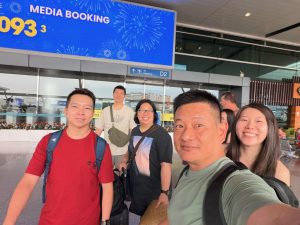
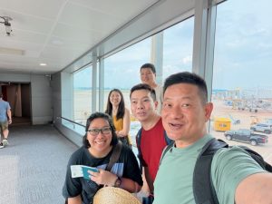
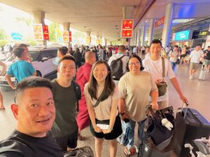
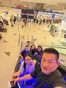
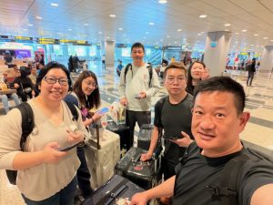
Wefie in front of Ho Chi Minh Airport
One final wefie at the jet bridge before we board the plane bound for home
When it comes to attractions, those in Ho Chi Minh City can be completed within a day. Unlike other cities in Vietnam, like Danang and Hanoi, there are not many day trip attractions outside of Ho Chi Minh City. Cu Chi Tunnel is one of the most famous day trip destinations from Ho Chi Minh City. Most of the day trips to Cu Chi Tunnels usually combine with a river cruise down the Mekong River. However, the day trip we embarked on is one that combined Ba Den Mountains instead.
Ba Den Mountain – The Roof of South Vietnam
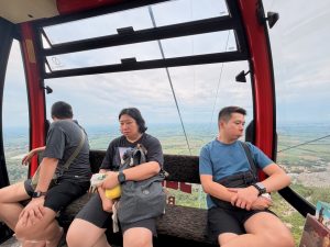
The drive to Ba Den Mountain took about 2½ hours from Ho Chi Minh City. Ba Den Mountain, dubbed as the roof of South Vietnam, is the highest mountain in this part of the country, standing at 986 m. There are two cableways to get to the top of the mountain: the Van Son route, the direct and faster route; and the Tam An route, where visitors are required to change cable car halfway at Hang Pagoda. We took the Van Son route, which took us about 10 minutes to scale to the top of the mountain. As we ascended from the base station, we were treated to endless farmlands in this part of Vietnam, as well as a large lake – Dau Tieng Lake, which is the largest reservoir that spans across three provinces of South Vietnam.
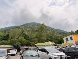
View of Ba Den Mountain from the carpark
Ba Den Mountain is another mountain theme park by Sun World
The cable car that took us almost 1000m up Ba Den Mountain
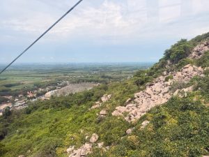
We saw endless farmlands as we ascended the mountain
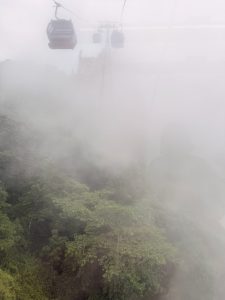
We rode through some low clouds near the top station
My friends in the cable car looking out at the scenary
We alighted the cable car at the top Van Son Station
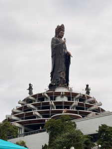
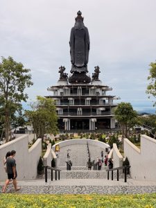
Coming out of the Van Son cable car station, we were greeted by a large 72m tall bronze Goddess of Mercy statue. The Goddess of Mercy, with her benevolent looks, seem to be blessing the landing under the mountain and those of us who came all the way here to visit the mountain. Before giving us our free time to wander around, our guide brought us to the edge of the viewing platform, introducing us to the surroundings while we looked out into this part of Southern Vietnam. We were given one hour to explore the mountains. After the storytelling, and before he gave us the time to roam around, our guide oriented us to the three major sights in Ba Den Mountain. Unlike similar mountains like Ba Na Mountain near Danang, Ba Den Mountain has no amusement parks; this mountain seems to be built for Buddhism.
Our first look at the 72m Goddess of Mercy Bronze statue on top of Ba Den Mountain
The Goddess of Mercy statue, with a benevolent expression, stood on top of a 5-storey building
As it was Vesak Day, my friends performed the Buddha bath ceremony
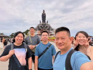
Wefie with the statue of the Goddess of Mercy
The lotus pattern arranged using the floating lamps with the Goddess of Mercy statue
View of the surroundings from the top of Ba Den Mountain
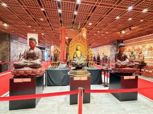
There is an exhibition of Buddha statues on the top level of Ba Den Mountain
There are numerous Buddha statues on exhibit here
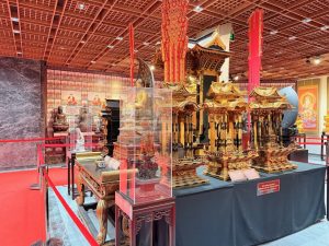
Some of the items on display at the Buddha exhibition
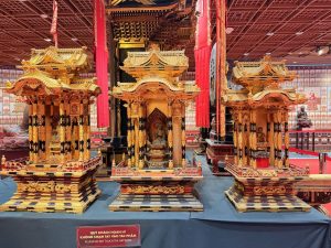
Buddha altars on exhibit
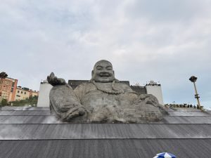
The first sight on the mountain that we went to was the Laughing Buddha Statue that our guide recommended. To get to the lower platform, we had to take a total of 10 escalators that passed through the inside of the stone Laughing Buddha Statue. The interior is especially apparent when at the bottom of the few escalators, where we could see the layers and layers of stone that stacked up to form the Buddha statue. At the bottom of the escalators is a path that leads to the outdoor lower platform. This is where we could see how big the Laughing Buddha Statue was. We waited briefly for the water show, as our guide recommended. The water show is merely a water fountain display with water sprouting out to the rhythm of the music. The show lasted about 3 minutes. There was nothing much to do at this lower platform, and we headed back up to the main level after the show. As we only had 1 hour here, we used about 20 mins to get to the lower platform and watch the water show, and we made the decision to head straight to the Golden Buddha Statue behind the Goddess of Mercy Statue.
The water show on the lower level in front of the Laughing Buddha
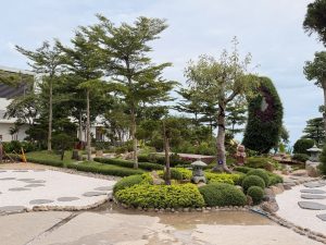
There is a zen garden in the mid-level between the lower and the upper level
One of the five pillars that spans over three levels
One of the many monk statues inside the Laughing Buddha
The interior of the Laughing Buddha is decorated with many monk statues
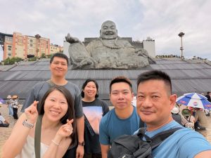
Wefie in front of the Laughing Buddha
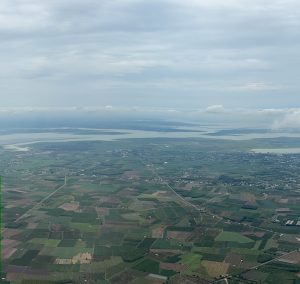
View of the farmlands and the reservoir from the Laughing Buddha viewing platform
The Laughing Buddha is located on the lower levels at the top of Ba Den Mountains
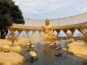
Along the way, we spotted the 5-storey building, at the base of the Goddess of Mercy Statue, housing Buddhist sculptures and art pieces. We would return to visit the gallery if we had sufficient time after the Golden Statue. The Golden Statue sits on top of a small hill behind the gigantic Goddess of Mercy Statue, with very well-marked signs leading us to it along the way. At the top of the hill, the Golden Buddha statue sits solemnly in the middle of an artificial pond. Not just the statue of the Buddha is covered in gold, all the other ornaments like the turtle, lotus flowers and even the rocks are covered in gold. There is nothing much to do here other than offering our prayers to the Buddha. Our 1-hour allocated time is almost up, so we hurried back to Van Son Station, where we met up with our guide and the rest of the tour group. Before heading to our next stop, we stopped by a local restaurant for lunch that is included in the tour price.
The Golden Buddha behind the Goddess of Mercy Statue
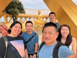
Wefie with the Golden Buddha
View of the Goddess of Mercy statue from the Golden Buddha Statue
Cao Dai Temple – First Temple of Caodaism
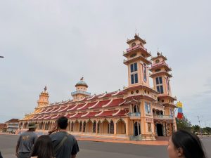
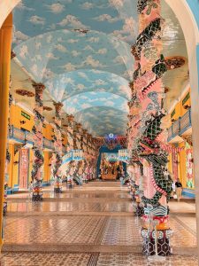
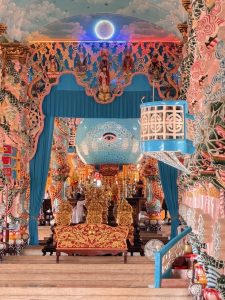
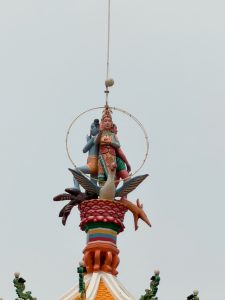
Our next stop, Cao Dai Temple, is a short 30-minute drive away. Caodaism is a religion that was established in Southern Vietnam in 1926. The religion, now has over 1000 followers, blends the teachings of Buddhism, Taoism, Confucianism, and Catholicism. The main object of worship for this young religion is the Left Eye of God. The Cao Dai Temple is situated in a large compound surrounded by fences and controlled entrance gates. The exterior of the temple blends a little of each religion. The twin towers at the front, the tallest feature of the temple, reminded me of the twin towers of Notre-Dame de Paris. However, it differs from the towers of the original Notre-Dame Cathedral in that these towers are topped with Chinese elements, usually found in Pagodas instead of French Gothic elements. The main structure of the temple, with its three-layered roof design, topped with small Chinese Dragon sculptures, seemed to borrow inspiration from Chinese Temples. The tower in the centre of the temple is a weird one, but it seems like a European design structure. There is another single tower at the end of the temple that resembles the top of a Chinese Pagoda. What is interesting here is the statues of the Big Three in Hinduism: Brahma, Vishnu and Shiva, sitting atop this pagoda structure. The interior of the is decorated with rows and rows of columns with Chinese dragon sculptures. Blue sky with clouds decorated with reflective glasses that symbolise stars is the main fresco on the ceiling. The centre area is only accessible to devotees of Caodaism; visitors would have to walk around the temple by its walls. We were brought one round inside the temple by our guide, who explained that the big spherical structure at the end of the temple is the main object of worship. He also mentioned that there is a celluar at the back of the temple under the sphere where past religious leaders were buried. As interesting as the religion is, I had a weird vibe here. Fortunately, we only stopped here for 15 minutes and were on our way to the highlight of this day tour – Cu Chi Tunnel.
Cao Dai Temple has a mix of Oriental and Western architectural elements
Interior of the Cao Dai Temple
The main object of worship in the Cao Dai Temple
The big three in Hinduism on top of Cao Dai Temple
Cu Chi Tunnel – The Resilience of the Vietnamese
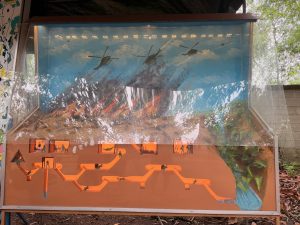
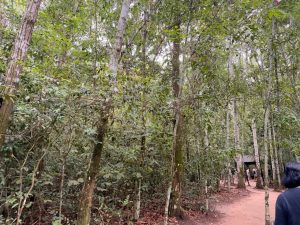
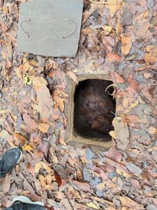
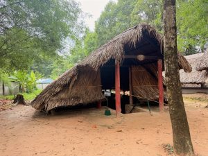
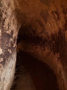
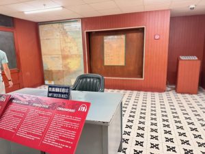
Our next stop, the Cu Chi Tunnel, sits in a forest and is about a 1-hour drive from Cao Dai Temple. Most first-timers to Ho Chi Minh City would make this 2-hour drive trip out of the city to visit the tunnels. Cu Chi Tunnel is a complex tunnel system that stretches 250km underground, which the Vietnamese used to defeat the US military forces during the Vietnam War. The Vietnamese dug the famous tunnels in the middle of the forest to stay hidden, with movements restricted mainly to night. They would live inside the tunnel throughout the duration of the war. The tunnel has facilities such as a kitchen, bedrooms, a war command centre and bunkers, which enabled the Viet Cong to stay hidden in the tunnels for months. After alighting from our van, our guide led us to his giant board that showed the tunnel system on a map. The tunnel network is more complex than I imagined, as not all the tunnels have been discovered to date. There is a model beside the map showcasing the various facilities and how the Viet Cong lived inside the tunnel. We were then brought to a small opening in the ground that could only fit one slim person. This would be where the Viet Congs got in and out of the tunnel and also served as an ambush point.
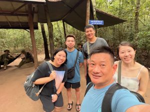
Wefie at the entrance of Cu Chi Tunnel
Dummy bombs used during Vietnam War
Model showcasing the tunnel complex
Map of the Cu Chi Tunnel network
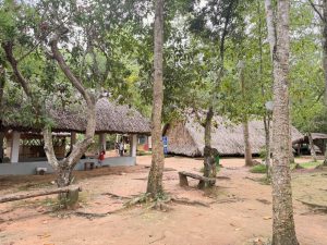
Cu Chi Tunnel is nestled in a forest
The tunnel entrance on the ground that is small enough to fit a Vietnamese soldier
One of the facilities on exhibit in the forest
Wefie with mannequins showcasing Vietnamese soldiers in their uniform
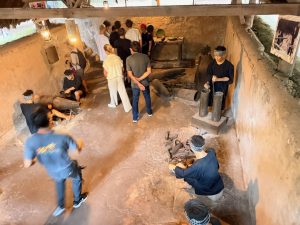
One of the many film rooms showing a documentary on Cu Chi Tunnel, made using a large trench dug by the Viet Congs
Cu Chi Tunnel in the forest north of Ho Chi Minh City
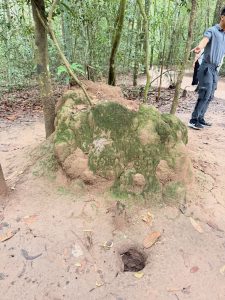
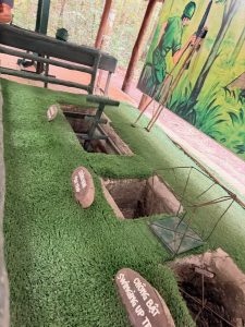
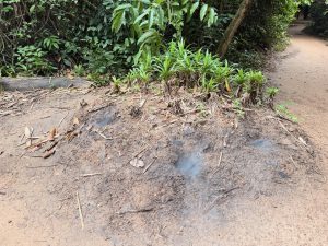
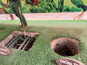
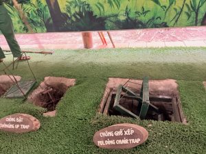
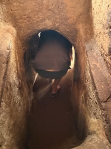
During the tour of the tunnels, we were also shown the various types of traps that were deployed in defence. These deadly traps were made using materials that were found in this forest and seem very effective. The highlight of the trip is the experience of crawling in one of the tunnels. Our guide told us that this tunnel was enlarged for tourists, and the actual tunnel is a lot smaller. The whole tunnel would take us 5 minutes to crawl through, but we came out from the first exit, which is about 50m from the entrance. There are four exits along the way for tourists who do not want to make it to the end of the experiential tunnel. Throughout our time in Cu Chi Tunnel, we saw small holes on the forest floor that seemed like ant holes were actually ventilation points and a number of chimneys disguised as ant mounds. Although this was my second time visiting the tunnels, I was still fascinated by the resilience of the Vietnamese, living underground for years for survival and in the defence of their land. The tunnel is worth a visit. After visiting Cu Chi Tunnel, we made our way back to Ho Chi Minh City. It was raining heavily by the time we reached the city, but the heavy rain did not really affect us since we wanted to eat at the hotel for their seafood buffet dinner.
This termite mould is actually a ventilation shaft for the tunnel
The tank that was used during the Vietnam War is on display in the Cu Chi tunnel area
This trench showcased how the Vietnamese recycled bombs to use during the war
Various traps that were used to defend the tunnel
Terminate nest simulating how the tunnel dwellers dissipate smoke during cooking
Few of the many traps used for defence during the Vietnam War
We were shown the different types of traps used during the war
Different traps are used in different parts of the tunnel
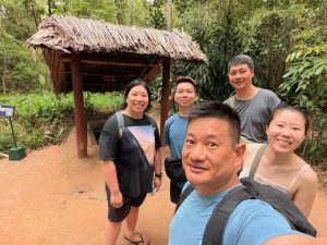
Wefie before we enter Cu Chi tunnel
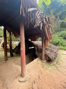
Entrance to the Cu Chi Tunnel
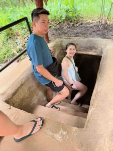
My friends entering the tunnel
We had to bend when going into a small section of the tunnel
Inside the Cu Chi Tunnel, which is enlarged for tourists to experience
Our flight from Singapore landed in Ho Chi Minh City around noon, which gave us time to visit the sites in the city in the afternoon. As some of the more significant sights in District 1 were very close to each other, they make for a great group to visit. The airport around noon was busy. As we neared the immigration, we were taken aback by the number of tourists in line clearing customs. True to what we saw on social media prior to our trip, the immigration was packed like sardines. We estimated it would take around 2 hours to clear immigration. We were unsure what had caused the long wait time, as we saw quite a number of counters were opened (unlike our trip to Tokyo a few years ago, where only two counters were opened to clear immigration), and immigration clearance was as fast as it gets. The only logical explanation was the number of passengers coming into the city. Fortunately, we had purchased Fast Track Service that allowed us to join the queue for expats, which saw significantly shorter lines. We cleared immigration in 20 minutes. As we were being driven to our hotel, it suddenly rained cats and dogs. At this point, we were discussing our options for the afternoon and changes to the plans. There was no way we would want to walk around the city in the heavy downpours. The month of May is the transition month between the dry and wet seasons in Ho Chi Minh City, with frequent sudden heavy downpours and blazing hot weather. We were very lucky during this trip, as it was either overcast most of the time, making the weather pleasant, or somehow we avoided the rain when shopping indoors.
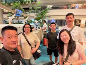
We are checked in and ready for our Ho Chi Minh City trip
We arrived in Ho Chi Minh City after a 2-hour flight
The Historic District 1 Circuit
Fortunately, the rain had stopped after we got to our rooms and settled in. Our historic circuit in District 1 started with Independence Palace, then to Notre-Dame of Saigon, Saigon Central Post Office, Book Street and ended with Cafe Apartment.
Independence Palace – Where the Unification Happened
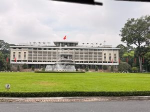
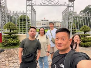
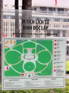
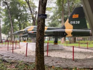
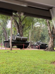
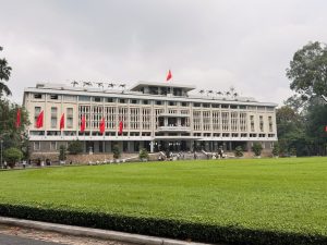
Our first stop of the day is the Independence Palace. This historical landmark witnessed and is the centre of action, playing a significant role in the unification history of Vietnam. Up until 1975, Vietnam was split into two: South Vietnam, with the support of the USA, operated under a republic model; and North Vietnam, with the support of Russia, adopted a communist regime. Thus, the birth of the Vietnam War. The Independence Palace was the centre of action and where important decisions were made during the Vietnam War. The war ended when the North Vietnamese army tank crushed through the front gate of the palace, marking the fall of the South Vietnamese government, unifying the country into one communist regime to this day. The entry fee to the Palace varies, depending on how much one wants to see. The base price for only the Independence Palace costs VND 40,000; Palace and Exhibition (curating the history of Independence Palace) costs VND 80,000; and the all-inclusive price of VND 100,000 includes both entry fee to the Independence Palace and Exhibition as well as an Electric Car ride around the Palace grounds. Initially, we thought the electric car service was a ferrying service around the palace grounds. We were guided to hop onto one car, which brought us around the palace grounds, giving us narrations of the significance of the facilities in the palace grounds. The electric car tour took about 10 minutes, and we were dropped off at the entrance of the palace. I would not recommend this service for those who are short on time or just want to visit the palace.
Our first look at the Independence Palace
Wefie with Independence Palace at its entrance
We are getting ready for our Electric car tour of the palace grounds
Layout of Independence Palace
One of the original aircraft used during the Vietnam War on display in the Independence Palace grounds
We spotted tanks used during the Vietnam War on the grounds of the Independence Palace
Guest House at the back of the Independence Palace
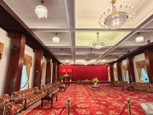
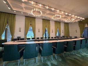
After the electric car tour around the Independence Palace grounds, we headed to the main building. The Independence Palace was the office of the President of South Vietnam and showcased room after room when the palace functioned as the Presidential Office. We started our visit with the rooms on the first floor. On this floor, the first rooms we saw were the State Banquet Hall and the Conference Hall, situated next to the entrance. Both rooms were filled with furniture from the 70s, but in a more elaborate setting. Imagine large rooms with long tables and chairs laid next to each other with chandeliers hanging on top. These rooms look like a page from yesteryears. Despite its age, I thought this furniture was very well preserved. The highlight on the first floor is the Conference Hall in the centre, occupying part of the palace at the back. The Conference Hall is decked in maroon red from carpet to the backdrop on the stage and decorated with multiple chandeliers hanging from the ceiling. This is where the president declared his resignation after the Americans withdrew their support during the Vietnam War. A painting of the Hung Kings, regarded as the first rulers of Vietnam, hung on the wall of the Conference Hall to link the modern Vietnamese State to its ancient origins.
Independence Palace records the significant moments of the unification of Vietnam
The main foyer of the ground floor of Independence Palace
The State Banquet Hall used to host foreign dignitaries
A painting of Hung Kings, believed to be the first kings of Vietnam, hung in the Conference Hall
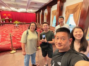
Wefie in the Conference Hall of the Independence Palace
The Conference Hall on the ground floor was and is still used for receptions
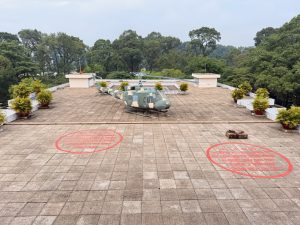
There was nothing much else we could see on the first floor, so we headed to the top floors before making our way down in the building to visit the other rooms. As we were walking towards the 4th floor (the lift only stops on the 3rd floor), we walked past the Cabinet room and the First Lady’s Reception Room. Other than looking at the furniture from the 70s, there seemed to be nothing too interesting on this floor. As we were walking towards the stairs that led to the top floor of the Independence Palace, we saw a small room in a cinema layout. There wasn’t much explanation here, and we can only assume this was used to play movies or propaganda films. The top floor of the palace consists of an air-conditioned room and the rooftop area. Here we saw a helicopter and two red ring markings, which marked the area when bombs were dropped by the North Vietnamese Air Force during the Vietnam War, leading to the subsequent surrender of the South and unification of the country. It is a pity that this significant historic event was not recorded anywhere on this floor. Today, the pavilion on this floor has turned into a place to sell souvenirs and hang out for local visitors to rest and enjoy the air conditioning.
The Cabinet Room, where the President held meetings with his ministers
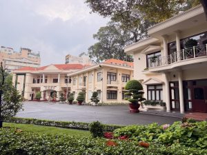
The First Lady’s Reception Room used to host the wives of vsiting heads of state
View of the Independence Palace grounds and the streets from the top of the palace
There is small cinema on the third floor of the palace
The President’s helicopter, seen on the rooftop of the palace, is always ready for the President’s use
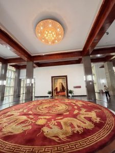
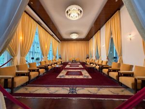
We continued our visit to the Independence Palace on the second floor, where we saw the president’s office, national security council chambers, the vice president’s reception room and some private apartments. At this point, we felt the rooms looked similar and just filled with furniture from yesteryears, so we brushed through the rest of the rooms in the palace. After seeing the rooms on the second floor, we subsequently followed the sign to the bunker in Basement 1. This was the heart of operations during the Vietnam War. There is a president’s office, a bedroom, and rooms and rooms of communications equipment, and also a war room. I reckon visiting the palace is best done with an audio guide, which can be rented at the ticketing counter. The explanations on the walls only mentioned what the rooms are used for, but did not detail the significance of these rooms. Without such a context, we cannot feel the significance of the palace and just see it as another tourist attraction. Our ticket also included entrance to the Exhibition that recorded the transformation of the palace from the Nodorom Palace to the Independent Palace. As we were getting a little “bored” with this place, we skipped the Exhibition and headed to our next stop.
The foyer of the second floor is decorated with a grand carpet with a Vietnamese dragon motif and an elegant chandelier
One of the two President’s reception rooms decked in the royal yellow and an elegant maroon carpet
The other President’s reception room with posh funishings
One of the many reception rooms in the Independence Palace
The command centre next to the President’s office
The command centre in the basement, where the Vietnamese war was fought
Communications centre in the basement of the Independence Palace
The President’s bedroom in the basement during Vietnam War
Last wefie with the Independence Palace before we head out
Notre-Dame Cathedral of Saigon – A Little Bit of French Outside France
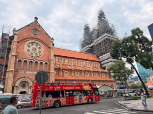
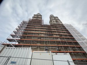
Leaving the Independence Palace, we headed to our next destination in District 1, Notre Dame of Saigon. The cathedral was not far from the palace and took us only 7 minutes from its main entrance. As we were walking along the side of the cathedral, we saw some scaffolding, mainly in the front facade of the cathedral. I read online that the cathedral has been under renovation since 2017 and will not be completed until 2027. However, the cathedral was still open to the public during this 10-year renovation period. To our dismay, the cathedral was closed during our visit. Other than taking the “we were here” pictures, there was nothing much we could do here.
Side view of the Notre-Dame
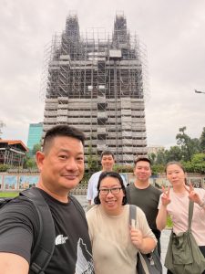
The only thing we can do here is to take a wefie with the Notre-Dame
The facade of Notre-Dame is covered with scaffolding due to ongoing preservation works
Saigon Central Post Office – Oldest Working Post Office
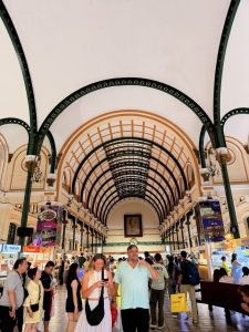
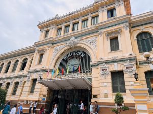
Our next stop is just across from Notre Dame of Saigon, the Saigon Central Post Office. The post office is one of the oldest post offices in Southeast Asia, and it is still functioning today. The facade of the post office looked like some train station in Europe, with European-style casting occupying most of its facade. The beige colour used in the facade made the building look clean and fresh. The interior of the post office looked clean and bright, thanks to the beige colour used and the natural light that would shine through the glass in the central atrium. The interior that is open to the public is relatively small, given how large the post office is. The counters that still serve the locals in their mailing and tax payment needs took up the perimeter of the rectangular concourse. A large portrait of Ho Chi Minh hangs in the centre of the post office, constantly reminding us that this city is named after this legendary leader of Vietnam. Despite the overcast weather, the humid climate motivated us to head into one of the two shops at the wings of the post office in search of air conditioning to cool us off. These shops mainly sell souvenirs representing Vietnam and Ho Chi Minh City. After cooling ourselves down, we headed back out to the main concourse. This is when we saw a booth selling customised stamps. We were able to make stamps with our pictures, either using the instant camera booth or uploading through a link given by the staff. A check with the staff (and subsequently the post office staff) that these stamps can be used as postage. We thought this was a very good souvenir.
The interior of the Saigon Central Post Office
Wefie with the Saigon Central Post Office
The Saigon Central Post Office has a European-influenced facade
Book Street – An Overhyped Street
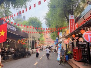
We did not stay in the Central Post Office for too long, as there was nothing much we could do here, other than posting letters and postcards. We headed out to our next destination, the Book Street. Book Street is just next to the Saigon Central Post Office, and as its name suggests, it is a short street selling books. Visitors, foreign and locals alike, come here for the Instagram photo. We did not see anyone buying or even browsing the books on sale here. The trees overshading the two rows of bookshops on the side of the road, coupled with the numerous Vietnamese flags hanging overhead across the road, indeed made this place very Instagrammable. As this is a very short street, it only took us 2 minutes to walk through it (we did not bother taking Instagram pictures here).
Book Street in District 1 is a very short street with shops selling books and souvenirs
These days these shops on Book Street also sells souvenirs
Book Street in Ho Chi Minh City
Wefie on Book Street
Nguyen Hue Walking Street & Cafe Apartment – Coffee in the Centre of District 1
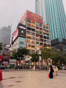
Our next stop, the Cafe Apartment, is a 10 min walk from Book Street. As we were making our way, we unknowingly walked past the Saigon Opera House, sitting quietly in the corner of the road, seemingly waiting for people to discover it. The Opera House is where the famous AO show is performed. We would love to watch this performance that combines acrobatic and dance moves, contrasting the lives of the locals between the country and the city. It is a pity that the show is not on during the period that we were in Ho Chi Minh City. Nguyen Hue Walking Street is the main boulevard in Vietnam, which is an open space with shops and restaurants on both sides of the road. The Cafe Apartment, a nine-storey building filled with cafes, soon came into our sight. It is not hard to spot the apartment building with most of the cafes facing Nguyen Hue Walking Street. From the street, it appears that not all the premises are being occupied. There are several empty properties that face Nguyen Hue Walking Street. The cafe that we wanted to visit sits on the 5th floor of the apartment building. We were initially excited to find a lift that we could use to access the 5th floor. However, using the lift requires a payment of VND5,000. I find it weird that a public facility that we took for granted is chargeable. Since the cafe sits on the 5th floor, we decided to walk up the narrow staircase. We took a rest at the cafe, having some Vietnamese coffee (I had the egg coffee) and some snacks while enjoying the air conditioning in the cafe. There is also an outdoor balcony seating option that overlooks Nguyen Hue Walking Street at the cafe.
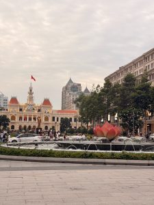
Walking on the Bustling streets of Ho Chi Minh City District 1
We spotted the Opera House sitting quietly on the street
Statue of Ho Chi Minh and the City Hall behind
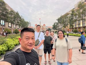
Wefie on Nguyen Hue Walking Street with the Statue of Ho Chi Minh
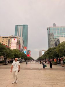
Nguyen Hue Walking Street is a pedestrian walkway in the middle of the road
Walking on Nguyen Hue Walking Street
Wefie with the Cafe Apartment
The Cafe Apartment in District 1
View of Nguyen Hue Walking Street from the Cafe Apartment
Wefie in one of the cafes in the Cafe Apartment
Dinner at Secret Garden
After our fair share of coffee break, it is time for our dinner. I had made a booking on day 3 at this off-the-beaten-path restaurant, Secret Garden. However, a couple of our friends will be on a vegetarian diet on day 3. Seeing that we were near the Secret Garden, we made our way to the restaurant for our first dinner in Ho Chi Minh City. The Secret Garden is only a 7-minute walk from Cafe Apartment. The rooftop restaurant serves authentic Vietnamese cuisine that is also reasonably priced. Weirdly, the restaurant sits atop the residential building, hiding in one corner of District 1, where we would have missed it if not for Google Maps. The restaurant is mainly patronised by locals with a handful of foreigners. The staff were friendly, and the food was delicious. After dinner, we headed back to our hotel to rest for the night.
Wefie before we dig into our dinner
The rooftop restaurant where we had our dinner
Bui Vien Walking Street – A Sensory Overload Street
We wanted to pop into one of the few convenience stores near our hotel to get some breakfast, as we will be having an early start tomorrow for our day trip to Cu Chi Tunnel. Using Google Maps, we spotted a shop on the side street opposite our hotel. Unknowingly, we wandered into the famed Bui Vien Walking Street, one of the two main walking streets in Ho Chi Minh City. Unlike Nguyen Hue Walking Street, Bui Vien Walking Street is louder and flashier. The end of the street where we entered from was quieter with cafes, convenience stores and restaurants. But as we walked further into the street, the seemingly peaceful street seemed to be overtaken by pubs and clubs with loud music and girls dancing on the tables outside the pubs under neon lights that constantly shine into our eyes every now and then. Walking on Bui Vien Walking Street, especially at the pub stretch, was a challenge. We were constantly approached by pub staff trying to pull us into their pub for a drink. We did not like this part of the street as it was very noisy with constant irritation from the neon lights. We headed back to our hotel to rest for the night, as we would have an early start and a long day tomorrow.
Bui Vien Walking Street is famous for its nightlife and pubs
Bui Vien Walking Street has a number of restaurants and convienence stores
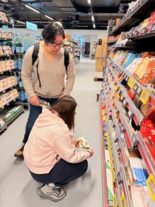
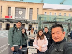
Today is the day we flew out of Switzerland and concluded our trip to the Central European country. Our flight is scheduled for the afternoon, which means that we do not have to leave for the airport early today. We used the remaining hours we had in Switzerland doing some last-minute shopping in the supermarkets near our hotel. During our conversation with the Malaysian Lady in Zurich two days ago, we were advised to check out the supermarkets, as the chocolates there are definitely made in Switzerland and will not be available anywhere else outside of the country. We did find some “treasures” in the two supermarkets that we visited that are near our hotel. After shopping, we headed back to the hotel to pack our purchases into our luggage and then to the airport. Geneva Airport is very accessible from the Geneva city centre. Unlike other cities, where the airport costs at least $10, the 6-minute train ride with very regular train intervals (about 6 to 10 minutes apart) costs only CHF2. And the best thing is that the cost of our train ride to the airport is also covered under the hotel-provided Geneva Transport Card.
Walking on the streets of Geneva to the supermarket for our last minute shopping
My friends doing some last minute shopping in Geneva
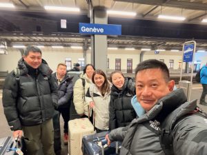
Taking our last wefie with Geneva Train Station
Waiting for our train to Geneva Airport
My friends in the train station at Geneva Airport
After checking into our flight, we spent the rest of the time relaxing in the lounge. As we did not make any big purchases in Switzerland, we skipped the tax refund part.
We arrived in Geneva Airport train station in about 6 minutes from Geneva
Wefie at Geneva Airport entrance
Our last wefie in Geneva
Geneva Airport Train Station
Checking into our flight back home
My friends with their sad faces after checking into our flight back home
Wefie on the flight from Geneva to Jeddah
Flying over the Swiss Alps
My friends on our flight from Jeddah to Singapore
Wefie in Jeddah International Airport where we transit to another flight home
Wefie after arriving back home
Takeaways from our Switzerland Trip
Free Local Transport
Almost all of the cities (except Zurich) we’ve been to on our trip give visitors a complimentary guest card, which grants us free transport within the city that includes trains, trams, buses and even boat rides that saved us money. In order for us to obtain these guest cards, we had to stay in the city for at least one night. Some hotels emailed us the registration link before our arrival, while others will issue these digital guest cards upon check-in. In our experience, we were granted free local transport from the train station to the hotel using the hotel booking for cities which only issue guest cards on arrival. Always check the city’s tourism site to see if there are any guest cards that are given to guests staying overnight.
Swiss Travel Pass Vs Half-Fare Card
The age-old question of the Swiss Travel Pass or Half-Fare Card plagued us when we were planning the trip. We eventually went for the Half-Fare Card for this trip, as we would save more using the Half-Fare card. In order for the Swiss Travel Pass to make sense for us, we had to take intercity trains every day, and we had to like visiting museums in each city. As our trip only requires us to move to a different city every two to three days (except for Bern), having a Swiss Travel Pass (even with the Flex option) worked out to be more expensive. Moreover, we are not museum goers; the inclusion of museums in the Swiss Travel Pass matters little to us. Moreover, the local transport that the Swiss Travel Pass includes is also covered by the local guest cards or the Regional Passes that we have obtained, making getting the pass less attractive to us. I would advise doing the sum and seeing which makes more sense cost-wise before deciding which pass to get.
Regional Travel Passes
Regional Travel Passes can be of exceptional value for money, and there are some passes that offer discounts with our Half-Fare Card. It is advised to look at your itinerary and see if these regional passes cover the places you are visiting. There are at least two regional passes that cover the Jungfrau region. We opted for the Bernese Oberland Pass as it covers a wider area and also our train ride from Lucerne to Interlaken via the Luzern-Interlaken Express. We considered this pass as we wanted to go up to Schilthorn, which is only starting to be covered by this pass since 2025, increasing the value of the pass. Having said that, the Bernese Oberland Pass does not cover the Junfraujoch. However, the pass covers train rides from Interlaken to Grindelwald Terminal, which saved us CHF 6 each way. Like the Half-Fare Card, the Bernese Oberland Pass gave us discounts on the tickets to Jungfraujoch. However, the discount is smaller compared to our Half-Fare Card.
We also bought the Tell Pass that covers all transports, including the cable car rides to the three mountains: Mt Rigi, Mt Pilates and Mt Titlis near Lucerne. Using this Tell Pass gave us great savings compared to getting the individual tickets to these mountains and the train rides (even with our Half-Fare Card). We also made use of this pass to access Mt Stoos on the Stoosbahn and cruises around Lake Luzern. Unlike the Bernese Oberland Pass, the Half-Fare Card does not give us a discount on the Tell Pass.
Glacier Express
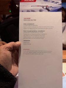
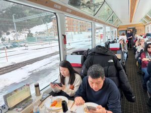
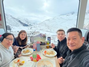
As mentioned in my post on Glacier Express, booking only the seat reservation on the Glacier Express and buying the ticket on the SBB website ended up saving us more. The total cost of a First Class ticket on the Glacier Express is cheaper when booked using this method than a Second Class ticket when booked on the Glacier Express website. Moreover, the separate train ride ticket we have gotten from the SBB website is a day saver ticket, meaning it covers all train rides to all places in Switzerland for the day, perfect for us as we took another train for Zurich from St. Moritz almost immediately after our Glacier Express, saving us another CHF 30 per pax. We also found the three-course meal on the Glacier Express offered exceptional value. At CHF 49 per pax, we were given a full and great quality meal (I reckon it is cheaper than most restaurants in Switzerland). However, do bring your own water, which can be purchased from supermarkets at a lower price compared to the onboard price. A small bottle of mineral water on the Glacier Express costs CHF 7.
Free City Walks
During the course of my planning, I stumbled upon this website, Free Walks Switzerland (click here for their website), that offers free city tours in English and German for the major cities in Switzerland, which would otherwise cost at least CHF 25 per person. The only cost of these walks is a voluntary tip to the guide at the end of the tour. The company organises regular city tour schedules even in winter. Dates are released on the 20th of the preceding month. These Free City tours gave us great insights into the cities we are visiting and a context for the sights we are seeing, and saved us the time to plan what to see in each city. Unfortunately, we did not make use of these Free services as they usually take place between 10 am and 11 am, clashing with our schedules. But at least there are these options available to visitors.
Today is our last day of sightseeing in Switzerland. During my planning for sights in Geneva, I learnt that there are only a handful of sights in Geneva, which can be completed in half a day, leaving us with the other half of the day to fill. There are a couple of options available to us to fill the other half of the day: Château de Chillon at the eastern edge of Lake Geneva, or a trip to Annecy in France, located south of Geneva. We decided on Annecy as we thought the town is in one corner of France, which we would not have visited even if we travelled around France.
Geneva – Immensing in the Medieval Old Town
Most of the sights in the Geneva centre are around the old town. There are only a couple of major sights – Jet d’Eau and St. Pierre Cathedral, which are located near each other. Geneva is a compact city, where these sights are within walking distance of each other.
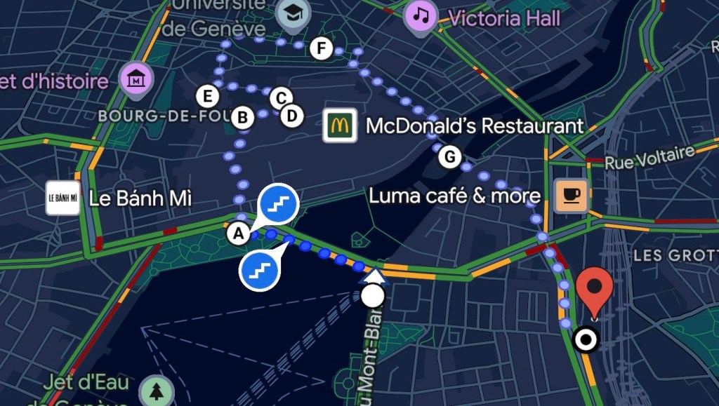
The walking path we used to explore the Alstadt in Geneva
Pont du Mont-Blanc – View of the Iconic Jet d’Eau (or not)
Jet d’Eau is one of the two famous sights in Geneva. It is essentially a fountain that shoots 500 litres of water per second up 140m into the sky. The fountain is especially beautiful at night when illuminated with colourful lights. Jet d’Eau is located on the south-western end of Lake Geneva, near the old town. The water taxi (which is covered in our Geneva Guest card provided by our hotel) that leaves from Mont-Blanc is a great way to view the fountain, as the public transport will pass by the fountain, allowing visitors a close-up view. The other places to get a good view of Jet d’Eau are either from Pont du Mont-Blanc, one of the major bridges that is situated at the mouth of Lake Geneva and the Rhône River that runs into Geneva, or from the waterfront promenade of Jardin Anglais. Since getting from our hotel to Geneva Altstadt requires us to cross the Rhône River, we headed to Pont du Mont-Blanc to see Jet d’Eau. As we were walking to the lake, we did not see any water being propelled into the air. Jet d’Eau was not turned on. Thinking we might be too early and the fountain might not have been turned on, we thought to come back later in the afternoon. Our walk would eventually land us back to one of the nearby bridges, slightly further upstream on the Rhône River.
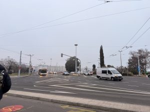
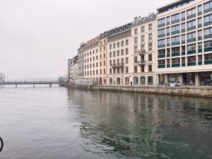
Walking towards Lake Geneva from our hotel
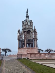
We walked past Brunswick Monument, a neo-Gothic structure honouring a 19th-century duke
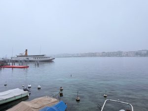
View of Lake Geneva from ground zero
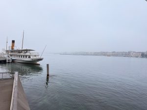
This would be where Jet d’Eau is if it is in operation
Looking out into a hazy Lake Geneva
Jardin Anglais – The Garden by the Lake
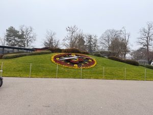
Rather than calling it a destination where we took time to walk around, Jardin Anglais is more of a thoroughfare for us walking towards St. Pierre Cathedral. As we were not great with gardens, plus the plants would have withered for the winter season, we did not plan to stop by Jardin Anglais. Rather, we were here for the Flower Clock, one of the city’s attractions. The Flower Clock is situated by the main road and not too far from Pont du Mont-Blanc, and is on the way to our next sight. The plants on the Flower Clock are being refreshed every time the season changes. During this winter season, the Flower Clock dons maroon and yellow flowers with some black plants in the centre of the clock face. It was interesting to see that the numbers on the clock were also made up of flowers. We saw the clock from a distance as we were waiting for our traffic light to turn green. Before we continued our way to our next stop, we stopped by Starbucks for our caffeine fix.
The Flower Clock in Jardin Anglais
A Monument to commemorate Geneva entering the Swiss Confederation in Jardin Anglais
L’Ancien Arsenal – An Accidental Discovery
After a short coffee break, we headed to the cathedral. When we arrived, we saw some visitors walking away from the main door. This is when we realised that the cathedral only opens at 10 am, giving us 15 mins to loiter around. Since our time was a little tight today, instead of waiting around, we headed to our next stop. Our original next stop was supposed to be the Old Town Management building, thinking it might stand out from the rest of the buildings on the street. However, when we arrived at the Old Town Management building, we couldn’t differentiate it from its neighbouring buildings. The building has the same facade as the rest of the buildings, minus a small plaque that identifies it. Feeling disappointed, we headed back to the cathedral, as it would have opened by the time we arrived.
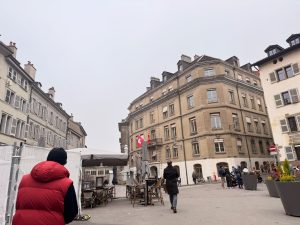
The Old town square opposite Jardin Anglais
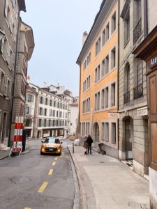
The streets are filled withe old European style buildings
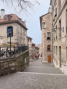
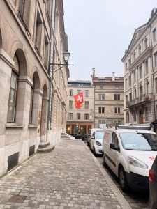
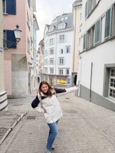
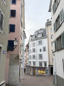
The charming street of altstadt Geneva
On the streets of altstadt Geneva
Looking into the old streets of Geneva
The staircase that we climbed to St. Pierre Cathedral
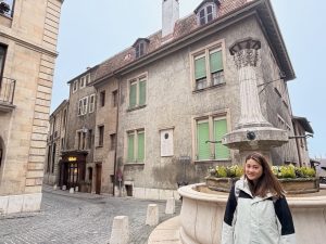
My friend with one of fountain we saw on the way to St.Pierre Cathedral
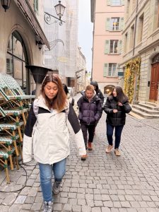
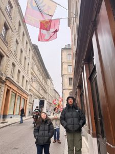
My friends walking on the street of Altstadt Geneva
Weife while walking on the streets of altstadt Geneva
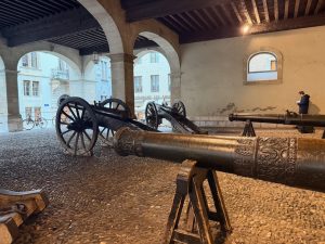
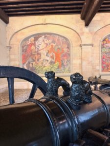
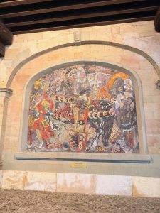
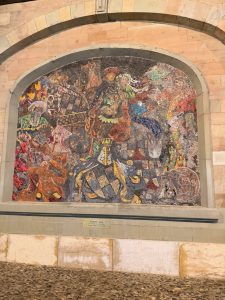
As we were walking back, we stumbled upon a building with an open ground floor. We could see some cannons being displayed on the open ground floor. Little did we know that we had stumbled into the L’Ancien Arsenal. L’Ancien Arsenal is an old armour that dates back to the 15th century and was used to store weapons and artillery needed to defend Geneva during war. In the foyer, we spotted a total of five cannons, three mounted on a wooden wheel cart, and two at the back near the walls. Based on the positioning of these two cannons, they seemed to be the reserve cannons. Behind the cannons, we spotted three mosaic walls that depicted someone riding a horse (later, we found out that these walls depict the key moments from Geneva’s history). We continued our sightseeing and headed back to St. Pierre’s Cathedral after taking some pictures at L’Ancien Arsenal.
We stumbled upon L’Ancien Arsenal while walking back to St. Pierre Cathedral
The cannons at L’Ancien Arsenal
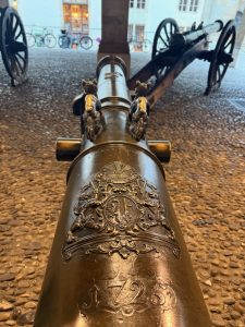
Close-up look of the cannons in L’Ancien Arsenal
We spotted a house emblem on the cannons
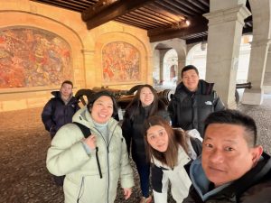
Wefie at L’Ancien Arsenal
There small lion statues on the cannons
One of the mosiac walls at L’Ancien Arsenal
The mosiac walls that tell a story of the battles in L’Ancien Arsenal
St. Pierre Cathedral – Birds’ Eye View of Geneva
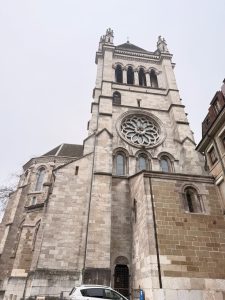
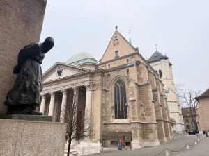
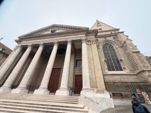
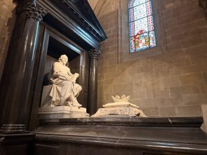
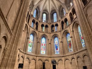
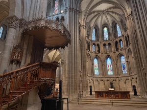
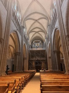
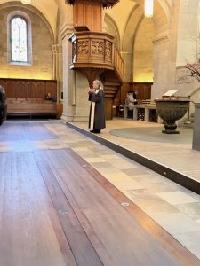
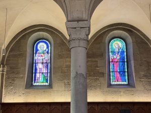
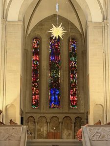
It was slightly after 10 am when we arrived at the cathedral, which was already open for visitors. The interior of St. Pierre Cathedral is plain, and we did not spot any elaborate carvings or paintings in the cathedral. The high ceiling in the cathedral made it look spacious and grand. Like the churches we’ve been to, St. Pierre Cathedral does not have a high altar, but merely a rostrum for the pastors to deliver their sermons. Behind the rostrum, stained window panels vie for visitors’ attention and bring light into the cathedral. The bottom stained window panels were the largest of these stained windows featuring St. James, St. Andrew, St. John and St. Paul, to name a few, that can be clearly seen from the cathedral’s entrance.
The back facade of St. Pierre Cathedral
St. Pierre Cathedral exterior
Facade of St. Pierre Cathedral
Wefie with St. Pierre Cathedral
One of the statues inside St. Pierre Cathedral
The beautiful stained windows in St. Pierre Cathedral
The interior of St. Pierre Cathedral look dark but peaceful
The rostrums where sermons are being delivered
The church organ is perched on the second level above the entrance
My friends resting in the church
The Tower Climb – Viewing Geneva City from Above
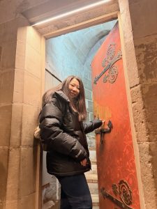
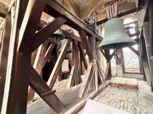
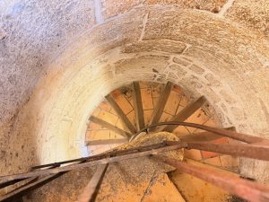
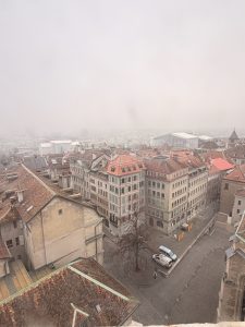
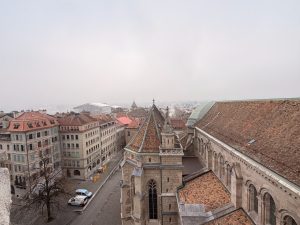
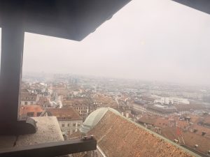
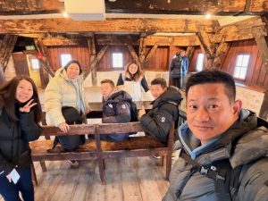
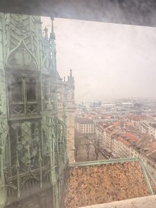
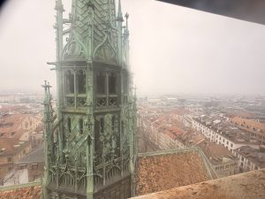
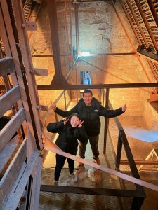
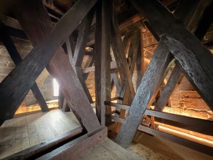
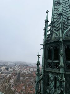
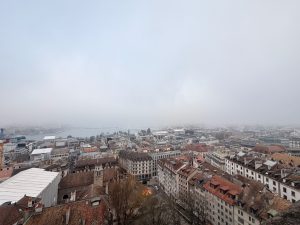
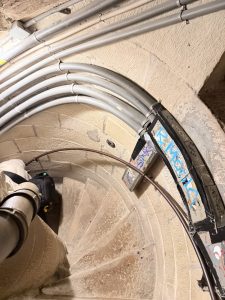
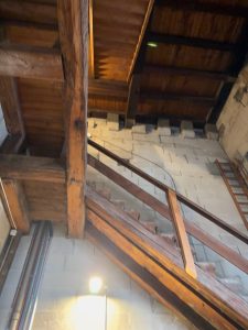
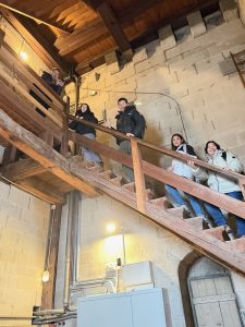
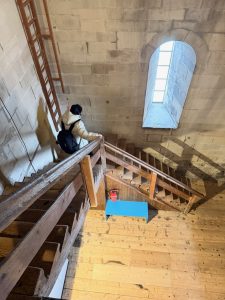
Our main purpose of visiting St. Pierre Cathedral is to climb up to the two towers, which would give us a panoramic view of Geneva. There is a fixed route that we were required to follow when climbing up the towers. The tower visit started with climbing 160 steps via a narrow spiral staircase to the top of the south tower, near the ticketing counter. Halfway through the climb, we came to a wooden open space with signs pointing us to the correct way to the top of the tower. Here is where we spotted an enclosed wooden room with some large bells. These bells, some dated back to 1481, were the bells that are responsible for the chimes we heard at the strike of the hour. There is a small balcony at this level that we can look out of into the city. We continued our climb to the top of the spiral staircase, which led us to a small wooden room. According to the ticketing staff below, this room was a watch tower to look out for fires back in the days. The views up here are great, but were somewhat affected by the stains on the glasses of the window. Despite being able to see the city below and parts of Lake Geneva, we couldn’t see much, partly due to the fog and partly due to the obstruction by the other towers of the cathedral.
My friend entering the door to the south tower from the cathedral
The bells in the south tower of St. Pierre Cathedral
The spiral staircase that we walked up in the south tower
View of the neighbourhood from the top at the watch tower
View of part of the cathedral and its neighbourhood half way up the south tower
View of Geneva from the watch tower
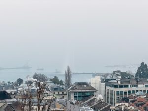
We saw part of Lake Geneva from the watch tower
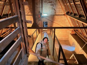
Wefie in the watch tower on top of the south tower in St. Pierre Cathedral
View of Geneva from the south tower
Another view of the city from the watch tower
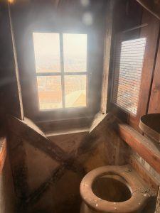
The toilet that the watch guard used on top of the south tower
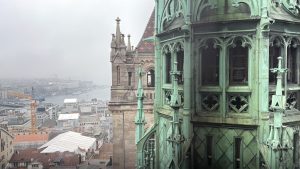
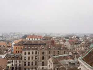
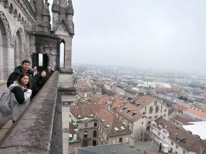
We continued our tower tour by descending the spiral staircase to the halfway point (where the bells were), from here we followed the signs and headed across a bridge linking both towers that is constructed just underneath the roof of the main cathedral building. This bridge brought us to another set of spiral staircases, which led us to the top of the north tower. At the top of the spiral staircase in the north tower is a wrap-around balcony that offered us a 360° panoramic view of the city and Lake Geneva. Seeing the medieval buildings in Geneva like blocks and blocks of LEGO building that span as far as the eye can see was an amazing sight. We could also vaguely see Jet d’Eau spouting out from Lake Geneva from here. On a clear day, we would be able to see Jet d’Eau more clearly and how large the city is. We spent a considerable amount of time up here looking at the city and the places where we will be visiting. Before long, it is time for us to descend the tower to our next destination.
My friend crossing the bridge to the north tower
My friends at the bridge between south and north tower of St. Pierre Cathedral
The bridge between the two towers is built under the roof of the cathedral
Entrance to the north tower
View of Geneva from the north tower
View from the top of north tower
We managed to see Jet d’Eau from the top of the north tower of St. Pierre
My friends posing on the balcony of the north tower
Wefie on the top of north tower
View of Geneva and Lake Geneva
Archaeological Site of St. Pierre – The Treasures Beneath
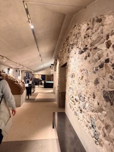
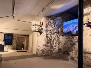
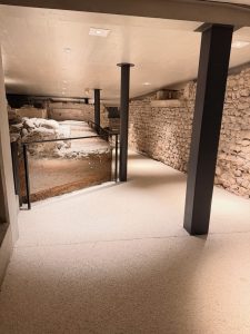
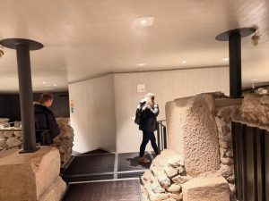
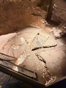
Our next destination was not far from the Towers of St. Pierre Cathedral. In fact, it is just underneath the cathedral. When we were buying the tickets to the tower, we had the option to include entrance to the archaeological site of the cathedral. The entry fee for the combined ticket costs CHF12 (it costs CHF7 to only visit the towers). Visiting the archaeological site is a self-guided tour where we would collect an audio guide from a staff at its entrance. The site sitting under the cathedral gave us a good introduction to the history of the cathedral and Geneva. There are ruins all over the basement that show the original foundation of the cathedral. We even spotted a 2,000-year-old skeleton that belonged to a chieftain of the tribe that was buried in 120 BC. It is fascinating to learnt that after so many reconstructions of the cathedral, some of the original layout of the cathedral still lies beneath it. I thought the audio guide was very informative on the things that we saw with our eyes when visiting the site.
Entrance to the archaeological site of St.Pierre Cathedral
We were introduced on the history of the cathedral and the development of Geneva
The archaeological site showcased the original foundation of the cathedral
The archaeological site of St. Pierre Cathedral
My friends walking through the archaeological site lisitening to the narrations from the audio guide
Wefie while listening to the audio guide in the archaeological site of St. Pierre Cathedral
One of the original foundation in the archaeological site
The 2,000-year-old skeleton of a chieftan
My friend listening to the audio guide while looking through the exhibits in the archaeological site
Place du Bourg-de-Four – The Oldest Square in Geneva
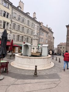
After spending about 30 minutes in the archaeological site under St. Pierre Cathedral, we continued our walk to Place du Bourg-de-Four, about 5 minutes from the cathedral. Place du Bourg-de-Four is a cobblestone square on the site of an old Roman forum and medieval market in the Altstadt of Geneva and is believed to be the oldest square in Geneva. This square, now a popular meeting square with restaurants and cafes, served as a coach stop in the 19th century. In the middle of Place du Bourg-de-Four is an 18th-century fountain that still runs water for visitors to quench their thirst. The surrounding restaurants and cafes offered visitors a great place to relax and people-watch. As we were at Place du Bourg-de-Four early, the cafes were not open for business. We left for our next sight after taking some photos at the square.
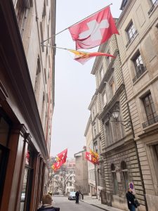
Walking on the old streets of Geneva
Walking towards the Place du Bourg-de-Four
My friends walking on the streets of Geneva
The streets of Geneva is quiet today
My friend with the Fountaine Bourg-de-Four
Place du Bourg-de-Four is full of cafes and restaurants
Fountaine Bourg-de-Four, one of the oldest fountains in Geneva
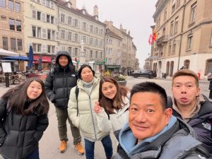
Wefie at the Place du Bourg-de-Four
Parc des Bastions – The Lungs of Geneva
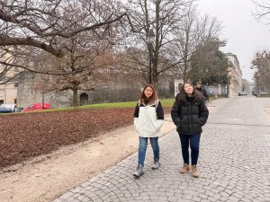
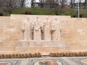
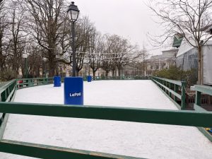
Our next stop is about a 10-minute walk from Place du Bourg-de-Four. Parc des Bastions is one of the many parks in Geneva. It is the oldest, dating back to the 1720s, and the largest park in the city. Often hosting many events, Parc des Bastions is where the locals come to relax and enjoy a stroll amidst the trees in the park. The park is also home to the oldest university in Geneva and the venue of a music festival. We even saw a small ice skating rink in the park. Other than being home to locals for a relaxing walk, and students from the university rushing from class to class, or people using it as a thoroughfare getting from one side of the city to another, Parc des Bastions is also home to the International Monument of the Reformation, also known as the Reformers’ Wall. The 160m wall with statues of the four reformers carved in the centre of the wall, who shaped the Calvinist Reformation, a belief that God’s absolute sovereignty and strict moral life. This reformation was critical for shaping modern Western theology, politics and economics. After taking pictures with the wall, we took a stroll and exited the park from the opposite entrance, heading towards our final destination in Geneva.
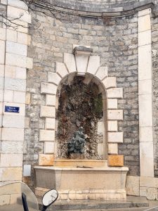
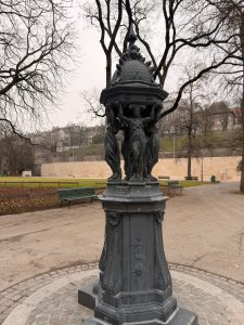
We walked past another fountain on our way to Parc des Bastions
My friends walking in Parc des Bastions
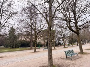
Parc des Bastions is lined with trees along the main thoroughfare in the park
One of the sculpture in Parc des Bastions
The Parc des Bastions is a large park in the middle of Geneva
The Reformers’ Wall in Parc des Bastions
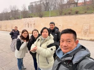
Wefie at the Reformers’ Wall in Parc des Bastions
We spotted a ice skating rink in one corner of Parc des Bastions
Tour De I ’lle – The Clock with Tales to Tell
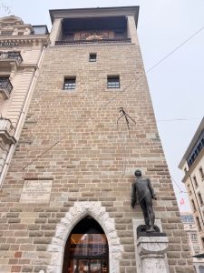
Our last stop is Tour de I’lle, a clock tower that is built on the island of the Rhône River. The clock tower was once part of a castle tower built on the island in 1219. The fortress was demolished in 1849, and only the tower remains. The clock on the tower was first installed in 1538, with its last replacement in 1954. The Tour de I ’lle, attached to another building (Bank of China), looked like a pair of conjoined twins that had witnessed the major historical moments of the city. We weren’t sure if there were any guided tours to the clock tower, and also in the interest of time, we stayed here momentarily until the tram that headed to the train station came by. We need to catch the 12.40 pm train to Annecy.
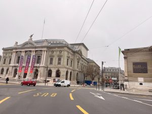
We walked past Geneva Opera house on our way to Tour de I’lle
My friends on the streets of Geneva walking towards Tour de I’lle
My friends on the side walk of Geneva Opera House
Walking towards Tour de I’lle in Geneva
Tour de I’lle in Geneva
Tour de I’lle sits in the middle of the road in Geneva
Rhône River and Tour de I’lle
Rhône River that runs from Lake Geneva through the city
Rhône River and Pont du Mont-Blanc
Wefie with Tour de I’lle
The Tour de I’lle up close
Annecy – The Quint French Village
After our morning tour of Geneva, we hopped onto a train and headed to Annecy, a small French village about 1½ hrs by train from Geneva. We visited this village not only for its famed Venice of the Alps reputation, but also for its cheaper dining (compared to Geneva) and the fact that we will likely not visit this village when we travel to France in the future (as it is situated in the southeastern corner of France). Like most Swiss cities, Annecy is compact and extremely walkable. As we were walking from the Annecy train station to our first sight, we came across Le Thiou River and the buildings sitting on both sides of the riverbank and a lone building sitting in the middle of the river. This is the very sight that gave the town the nickname.
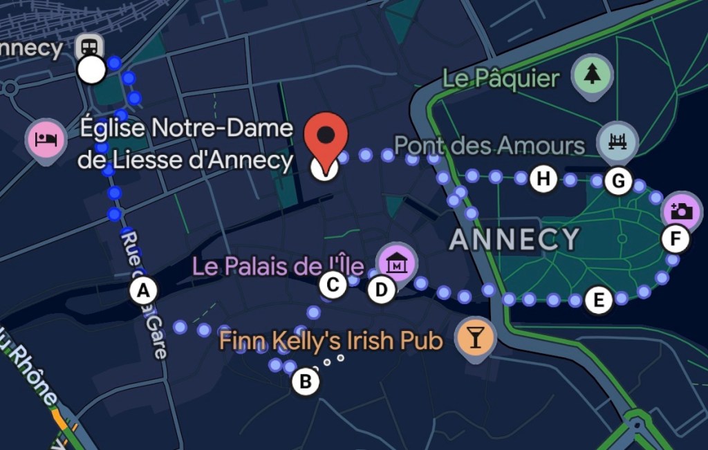
Our Walking Tour of Annecy
My friend buying lunch to be consumed on the train to Annecy
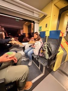
My friends having their lunch on the train to Annecy
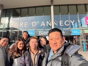
We arrived at Annecy
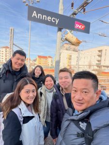
Wefie at Annecy Train Station
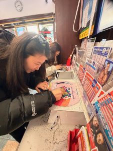
My friends playing scratchy in Annecy
Our first look at the town of Annecy from the train station
Château D’Annecy – Guardian of the Town
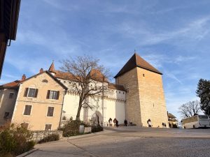
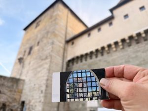
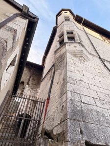
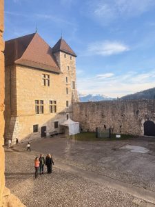
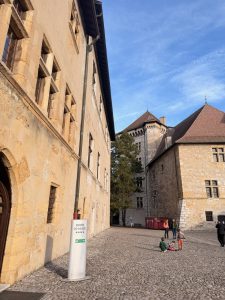
Perched on a hill, the Château D’Annecy dominates the skyline of Annecy. The castle is a key attraction and is what gave the town its fame. The tall castle walls and the thick Queen’s Tower are what we’d imagine a European castle looks like. Château D’Annecy is not large in scale like the Versailles or Schonbrunn Palaces, but its imposing structure is sufficient for the castle to command its presence. Château D’Annecy was initially built in the 8th century to guard the route from Geneva to Italy. In 1219, the Counts of Genevois made the castle their residence after being expelled from Geneva. Over the years, the ownership of the castle changed hands from duke to duke. Today, the castle houses a museum. Single site entry to the castles costs €6.50 per adult, but it costs €8 for a combined ticket with Palais de I ’lle (entry would cost €4). We got the combined ticket as we would visit Palais de I ’lle later. Upon entering Château D’Annecy grounds, we saw a large courtyard with the main castle building on the left side and another building sitting at the end of the courtyard facing Lake Annecy.
Chateua D’Annecy perched on top of a hill overlooking Annecy
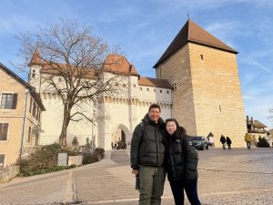
My friends with Chateua D’Annecy at its entrance
Wefie with Chateua D’Annecy
My ticket to the castle
Seeing Chateua D’Annecy from its courtyard
Chateua D’Annecy has a relatively small courtyard
The courtyard of Chateua D’Annecy
View of the forecourt at the entrance of Chateua D’Annecy
The courtyard of Chateua D’Annecy
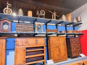
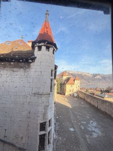
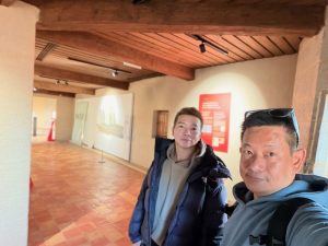
We entered the main castle building, which houses art exhibitions. As we do not have “arty-eyes”, we spent most of our time in the castle walking through the rooms, looking for signs of how the residents of the castle lived out their daily lives. The art museum mainly houses art pieces from sculptures to paintings. Passing through the first room with sculptures, we came into a large room with a sizeable fireplace in the centre. I imagined this would be the great hall where the dukes would entertain their guests and throw parties. The next few rooms that we walked by were spaces for the display of art. There is a room that is filled with furniture, which we assumed was used by the dukes back in the day. As we wandered around the castle, we came to a corridor that gave us a good view of the courtyard and the town of Annecy below. This corridor also linked the main castle building to the Queen’s Tower, the thick tower we saw at the entrance of the castle. The Queen’s Tower got its name in the 18th century, as legend has it that the tower was built to imprison a queen. Access to the top of the tower was closed to the public, but we got a good view of the castle’s surroundings.
My friends entering the interior of Chateua D’Annecy
My friends climbing the stairs to the second level of Chateua D’Annecy
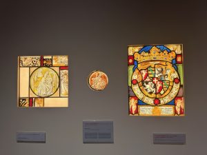
One of the art exhibits in Chateua D’Annecy
The main hall is now a wide space for art exhibition
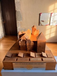
Model of Chateua D’Annecy
Some sculptures on display in Chateua D’Annecy
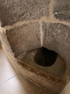
My friend claim this is a toilet in the Chateua D’Annecy
Exhibition in Chateua D’Annecy
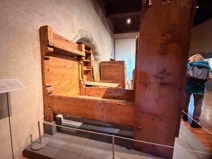
We saw a room with wooden furniture
I wonder if these are the furniture used by the dukes in Chateua D’Annecy
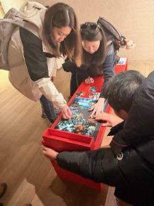
My friends playing with puzzle in Chateua D’Annecy
One of the art display in Chateua D’Annecy
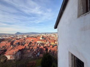
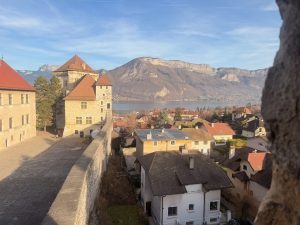
View of Annecy from inside Chateua D’Annecy
View of the courtyard from Chateua D’Annecy
Wefie in Chateua D’Annecy
View of the courtyard and parts of Annecy from the Queen’s Tower
View of the courtyard from the Queen’s Tower
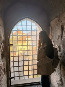
My friend in the Queen’s Tower
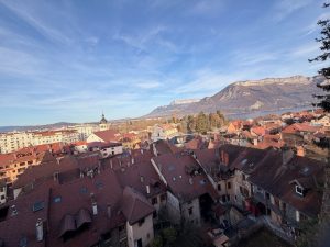
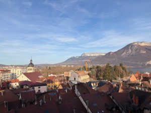
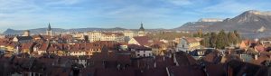
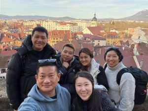
Other than the castle, the biggest reason visitors come to Château D’Annecy is for the view. At the end of the courtyard lies a viewing platform that looks out over the town of Annecy. From here, our sight was filled with red roofs and a few towers rising from the sea of red roofs. The platform also gave us a partial view of Lake Annecy and the mountain ranges across the lake.
View of Annecy from the terrace of Chateau D’Annecy
View of Annecy and Lake Annecy seen from the terrace of Chateau D’Annecy
Panoramic view of old town Annecy from the terrace of Chateau D’Annecy
One of the watch towers in Chateau D’Annecy
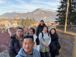
Wefie with Annecy old town from Chateau D’Annecy terrace
Wefie with old town Annecy and Lake Annecy
Palais de I’lle – The Small Château
Exiting the Château D’Annecy, our next stop, Palais de I’lle, is a mere 7 mins walk away. Shaped like a ship, Palais de I ’lle sits on the largest island in the river, and affectionately known to the locals as The Island Palace. Built in the 12th century, Palais de I’lle was first used as a prison, a courthouse and an administrative centre. It even served as a residence to the Monthoux family in the 14th century. Today, the two-storey building houses exhibits on the recent history of Annecy and the development of the town since the 50s. Only the second storey is open to the public. Walking from room to room, we saw a prison cell, a kid’s playroom and a couple of rooms displaying art and history exhibits. As the Palais de I’lle is very small, we only spent 10 minutes in the castle. Due to its small scale and the lack of things to see (unless one is interested in the history of Annecy), I would not have paid to enter Palais de I’lle.
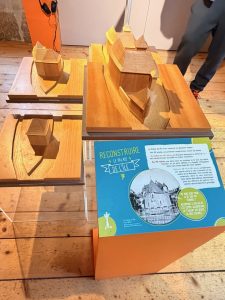
Model of Palais de I’lle displayed in the castle
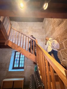
My friends climbing the stairs to the second storey of Palais de I’lle
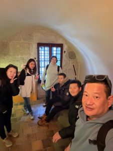
Wefie in one of the prison cells in Palais de I’lle
View of the courtyard from Palais de I’lle
Wefie with Palais de I’lle after our visit
Some of the exhibits in Palais de I’lle
Palais de I’lle sits in the centre of the river
Wefie with Palais de I’lle
Church of St. Francis de Sale – The Italian Church
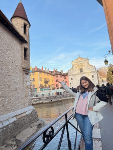
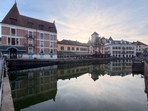
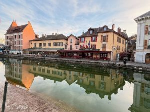
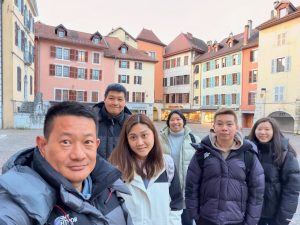
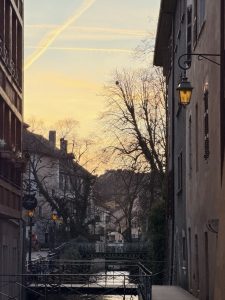
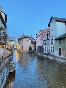
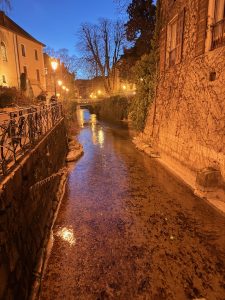
Le Thiou River is the main river that cuts Annecy into two. Lined with medieval houses that are not more than four storeys tall on both sides of the riverbank, and with three islets scattered in the smallish river from the lake to Rue de la Gare, the bridge marked the limits of Old Town Annecy. Coupled with six bridges that link both sides of the river bank within a short span of 650m, where we could see one bridge while standing on the other. It is this image that earned the town the title of Venice of the Alps. Strolling along Le Thiou River, especially on a quiet winter afternoon, was not only relaxing, but it also brought back memories of our trip to Venice several years ago.
My friend posing with the buildings on the banks of Le Thiou River
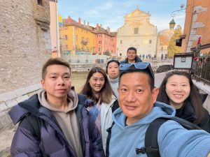
Wefie on the banks of Le Thiou River
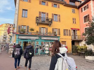
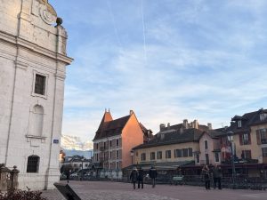
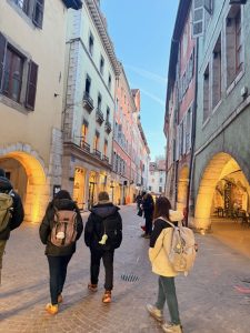
Walking on the streets of old town Annecy
Buildings on the banks of Le Thiou River
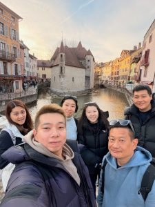
The building by the river gave the town the title of Venice of the Alps
The buildings by the river and the bridges in Annecy gave it the nickname Venice of the Alps
The buildings on the banks of Le Thiou River
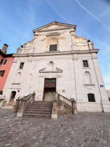
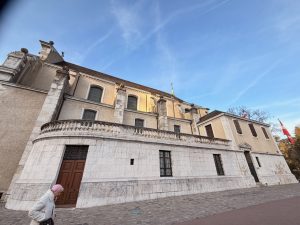
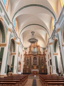
As we were strolling along the river, we came across a small church with a white facade sitting by the river. This is the Church of St. Francis de Sale. The exterior of the church looked plain with niches that seemed to house statues. Built in 1614, the church was transformed into a military barracks during the French Revolution. Today, Church of St. Francis de Sale mainly serve the local Italian community and is affectionately referred to by the locals as the Italian church. The interior of the church has a Roman Baroque decor with white walls and green marble tiles, and the high ceilings with windows above give the church a clean and bright look. The baroque elements were mainly seen in the high altar and the chandeliers.
Facade of Church of St. Francis de Sale
The side of Church of St. Francis de Sale revealed it is a rather compact
The interior of Church of St. Francis de Sale look clean and bright
The high altar in Church of St. Francis de Sale up close
Jardins de l’Europe – Tranquil Views of the Lake
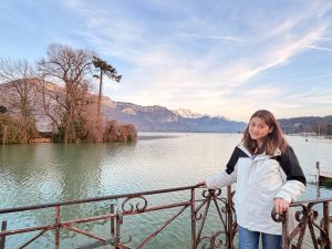
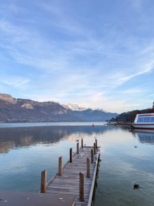
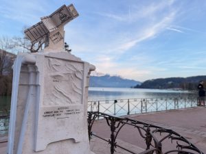
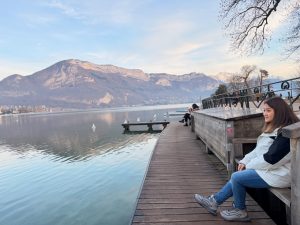
Leaving the church, we walked along the riverbank to arrive at Jardins de L’Europe, the largest park in Annecy. In summer, this is where boat cruises to Lake Annecy depart from, and we saw several boats berthed on the side of the Le Thiou River mouth. The reason why I brought my friends here was for the views of Lake Annecy. At the lake end of the park, sits Panorama du Lac, where we got a stunning view of the lake set alongside the mountain ranges. We even spotted several ducks swimming close to the shore of the lake. Looking out into the lake with the wooden piers stretching out amidst the calm waters felt especially tranquil. I am sure there are other facilities in the park, but we were mainly here for the views of the lake and did not explore the other parts of the park.
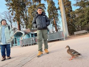
My friends interacting with a local at Jardins de L’Europe
My friend posing for a picture with Lake Annecy at Jardins de L’Europe
View of the lake from Panorama du Lac at Jardins de L’Europe
View of Lake Annecy and the nearby mountain ranges at Panorama du Lac in Jardins de L’Europe
The monumnet at Panorama du Lac
Panorama du Lac at Jardins de L’Europe has the best view of the lake
Wefie with Lake Annecy at Panorama du Lac in Jardins de L’Europe
My friend posing in Panorama du Lac
Pont des Amours – The Lovers’ Bridge
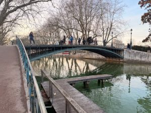
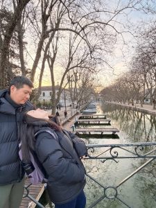
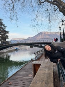
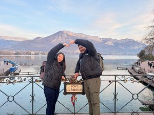
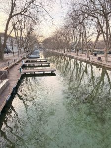
We continued our walk along the shores of the park to the other side of the park and came to a bridge. This is Pont des Amours, or the lovers’ bridge, as the locals call it. The bridge was first built in 1836 using wood. The bridge we saw today was built with iron in 1907. Pont des Amours is a favourite spot for a wedding photo shoot. Legend has it that lovers who kiss in the centre of the bridge will be united for life. Pont des Amours gave us great views no matter where we looked. Looking at the Lake Annecy side, the bridge gave us a vantage point of the lake and the mountains, as well as locals enjoying their day by the lakeside, and on the canal side, we were treated to a peaceful view of a canal lined with trees on both sides, with small piers for paddle boats.
Pont des Amours is a pedestrian bridge made of iron
My friends at Pont des Amours facing the canal
My friend with Pont des Amours in the background
My freinds at Pont des Amours facing Lake Annecy
The canal side seen from Pont des Amours
Me on Pont des Amours facing the canal side
Notre-Dame de Liesse – The Iconic Church of Annecy
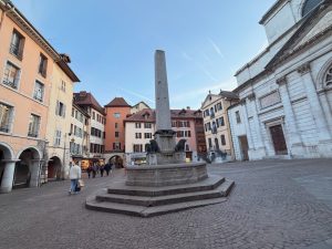
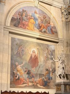
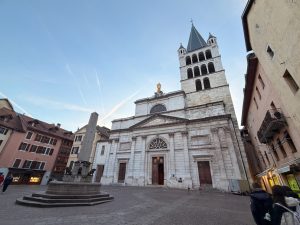
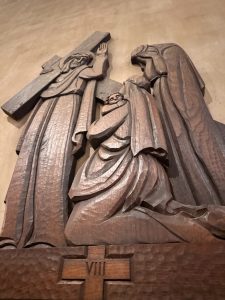
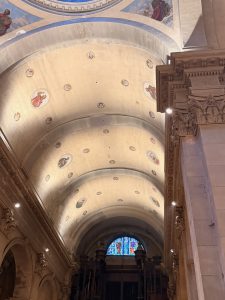
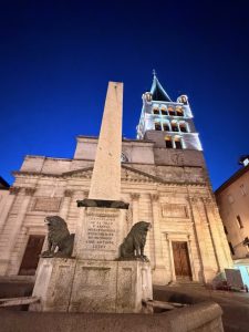
After taking pictures at Pont des Amours, we strolled along the canal and returned to the old town. As we were walking in the old town, we came to a square with a single fountain in the centre. Behind the fountain stands a white church with a six or seven-storey tower. This is the Notre-Dame de Liesse, the biggest and most iconic church in Annecy. Notre-Dame de Liesse was built in the second half of the 14th century by the Counts of Geneva, with the bell tower completed in 1530. The church boasts neoclassical architecture with elements from Roman antiquity. Notre-Dame de Liesse differs from the churches we have seen so far during this trip as it has the most elaborate interiors filled with paintings and frescoes. Right in the centre of the church was a dome topped with glass with frescoes of angels painted in the under dome. Other than the paintings, the interior of the church is adorned with statues and carvings that give the church an artistic flair. These statues, together with the paintings, made the church look colourful and cheerful.
The fountain in front of Notre Dame de Liesse was first built in 1625 to supply inhabitants with water
One of the paintings of Jesus inside Notre Dame de Liesse
Facade of Notre Dame de Liesse and Fountaine de la place Notre-Dame
Wood carving in Notre Dame de Liesse
The high altar in Notre Dame de Liesse
The interior of Notre Dame de Liesse was elaborate and colourful
The under dome in Notre Dame de Liesse was filled with fresco
One of the paintings in Notre Dame de Liesse
The paintings on the ceiling of Notre Dame de Liesse
Notre Dame de Liesse and Fountaine de la place Notre-Dame at night
The back of Notre Dame de Liesse at night
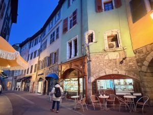
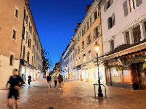
After our short stay at Notre-Dame de Liesse, we continued shopping on the streets of Old Town Annecy. We chanced upon a bakery selling French bread, which looked so delicious that we bought some back to the hotel to enjoy (they were indeed delicious and fresh). With the sky turning dark and our train timing approaching, we headed back in the direction of the train station in the hope of finding some authentic French food.
Wefie on the streets of old town Annecy
Annecy during sunset
One of the canals in 0ld town Annecy that earned it the Venice of the Alps nickname
Buildings built on and at the side of the river earned the the town the titel of Venice of the Alps
The bakery that we visit bought our bread from in old town Annecy
We did a little shopping in Annecy
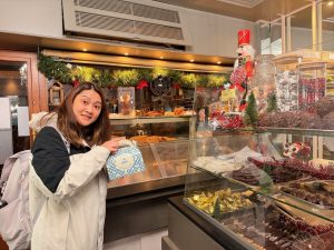
My friend with the bread that she bought from the bakery in Annecy
One of the many canals in Annecy
Shopping in Annecy old town
Our Final Dinner of the Trip
Ironically, the final dinner of our Switzerland trip was not taken in the country but in France. After all, it is cheaper to dine in France than in Switzerland. Our hopes of finding a French restaurant ended at the train station, and as it was getting late, we settled for dinner at an English pub restaurant opposite the train station. The food here was very affordable (by Swiss standards) and came in big portions. The friendly staff welcomed us into the restaurant and patiently introduced the menu to us. We enjoyed the dinner with the delicious food being served. After dinner, we made it in time for our 2-hour train ride back to Geneva. After all, we had to pack our luggage for our departure tomorrow.
Wefie in the restaurant in Annecy where we had our dinner
We initially planned to visit the tower on Uetliberg Mountain for a bird’s eye view of Lake Zurich after our scheduled visit to the Lindt Chocolate Museum. However, based on our experience on the tower on Gurten Kulm in Bern on Day 2 of our Switzerland trip and the strong recommendation by the Malaysian lady we met in Grossmünster yesterday, we switched our final destination in Zurich to Rhine Falls. We checked out of the hotel early and headed to the train station to store our luggage as we had an evening train to Geneva. It only made sense for us to store at the train station in case we were short on time later in the day.
Lindt Chocolate Museum
Getting to the Lindt Chocolate Museum
There are two chocolate museums near Zurich, the Lindt Chocolate Museum is a mere 45-minute train ride, while the Läderach Chocolate factory is a whopping 2-hour train ride. As we did not have much time today and we wanted to take it slow, we opted for the more popular Lindt Chocolate Museum. I would much prefer to visit the Läderach Chocolate Factory as the entrance fee includes a chocolate-making class, while the Lindt Chocolate Museum only allows tasting. Getting to the Lindt Chocolate Museum is very easy from Zurich. We opted for the route with the least walking by taking train S8 from Zurich Hauptbahnhof to Wollishofen and transferred to bus #165 for six stops to the Lindt Chocolate Museum. We booked the earliest time slot, the 10 am time slot, so that we can have sufficient time for an afternoon excursion.
My friends validating our 24-hour ZVV pass for our travels in Zurich
We stored our luggages at Zurich Hauptbahnhof in the morning
Making our way to the platform for our train to Lindt Chocolate Museum
The bus stop that we alighted at the Lindt Chocolate Museum
My friend posing for a photo with the train
The way from the bus stop to the museum is very well marked
We are at Lindt Chocolate Museum
We arrived at the Lindt Chocolate Museum at around 9.30 am, and had to wait a little as the museum would only open at 10 am. Our attention was captivated by the large chocolate fountain in the middle of the foyer as we entered the building. This is the largest chocolate fountain in the world, and naturally, it is where all the visitors would stop to take pictures with. There is a locker room on the left of the chocolate fountain where all visitors store their jackets and bags. While we were not too sure how strict the staff at the museum were regarding bags and coats, we stored them anyway (we did not see anyone being turned away at the entrance, as everyone stored their bags and jackets in the lockers provided). After storing our stuff in the lockers and loitering around a bit, we headed to the spiral staircase next to the chocolate fountain. This is where we picked up the audio guide that would explain the exhibits that we would see along the self-guided tour.
Lindt Chocolate Museum building
My friend posing with the Grand Tour signage in front of Lindt Chocolate Museum building
We were required to store our bags and jackets in one of these lockers
The iconic Lindt Chocolate fountain
There is a cafe at the foyer of the museum
My friend with the chocolate fountain in the foyer
The chocolate fountain in the foyer spans three storeys tall
Me with the chocolate fountain the foyer
The audio guide that we used during the self-guided tour of the museum
Wefie at the museum entrance before our tour
All About Chocolates: From Planting to the Final Product
The Lindt Chocolate Museum generally has five rooms for us to explore. The first room shows the initial phase of chocolate making, how the main ingredient of cocoa was produced for the making of chocolate. The first room has a foresty decor to showcase a typical chocolate plantation, educating us on how the farmers prepare the plantation for cocoa planting and how they harvest. The second room is a huge room that introduces the origins of chocolate and how the Europeans got the recipe from the Mayans, who used the unsweetened and bitter cocoa drink to offer to the gods. This section also told us how the Europeans brought cocoa drink over to Europe and how they refined the chocolate to the present-day sweet version. I thought the third room existed for the purpose of marketing the Lindt Chocolate brand. It showed us how the Lindt Chocolate was discovered by mistake and how it was distributed in Switzerland in the early days. I like the miniature buildings and the painting of the Swiss Alps in this room. By this time, we were already giving up on listening to the audio guide and were ready to jump to the fourth room.
Entrance to the Chocolate museum
My friends listening to the audio guide before entering the museum
The first room educated us on the process of cocoa bean cultivation
The first room is set up to resemble a cocoa plantation
My firends listening to the audio guide on the processes of cocoa bean cultivation
A mock up of a cocoa tree in the first room
Exhibits on cocoa beans
Exhibit of a rake used during cocoa bean cultivation
My friends listening to the audio guide in the first room
My friend listening to the audio guide and viewing the exhibit in the first room
The second room which describes the history of chocolate and how it came to Europe
Exhibits in the second room on the history of chocolates in Europe
Exhibit of an ancient Mayan text on chocolate
My friends playing on the interactive exhibits in the second room
The second room talks about the history and the early days usage of chocolate
My friend taking pictures in the third room
Wefie in the third room which is painted with the Swiss Alps
The third room tells stories on how Lindt was discovered and the logistics of getting the milk from the farms
Houses that told the story of how Lindt chocolate was discovered by mistake
The third room has a mural of the Swiss Alps painted on the wall
Highlight of the Tour: Unlimited Chocolate Tasting
The fourth room was what we were here for – to taste as many chocolates as we could. There were mainly two types of machines which we could get unlimited samples of chocolates: the small chocolate block dispensing machine and the liquid chocolate dispensing machine. Practically all the visitors hopped from station to station back and forth to taste all the chocolates, not once but several times. This room was also where most of us stayed the longest. I liked the liquid types better as they tasted warm, fresh and very smooth. After we had our fair share of chocolate, we headed for the next room, where we could take samples of the various chocolates that Lindt sells. There weren’t any signs around limiting the number of chocolates one could take, but there was a staff member at the counter keeping her eagle eyes on all the visitors. We spotted two girls who managed to bring their jackets into the museum, filling as many of the chocolates as they could into the bucket that they hid underneath their jackets. What sneaky geniuses!
Wall of chocolate before we enter the chocolate tasting room
My friends tasting the chocolate
The fourth room is the chocolate tasting room where most of us stayed the longest
The different chocolates in the tasting room
My friend taking picture of herself taking a small block of chocolate in the tasting room
The dark room after the tasting room
This part of the tasting room educated us on the process of chocolate making
The last part of the tour is the chocolate sample collection
The very last station of the tour was a giant wall where we could get one small chocolate bar after scanning the QR code on our ticket. Initially, we were unsure if the QR code was one-time use and tested it out, and to our surprise, we could do it multiple times. We went on both machines several times in our attempt to get the different flavours (the feature wall was giving out three flavours), and subsequently stopped as more visitors from the 10 am slot ended their tour and started making their way here. There is a gift shop in the museum where we bought some Lindt Chocolates. I did not find the prices here any cheaper than those in the supermarket or in town. We left the museum for the Rhine Falls, which is located in the northernmost part of Zurich. We made our way back to Zurich Hauptbahnhof, where we transferred to another train to the waterfall.
Chocolate making process
The chocolate wall where we collected our small chocolate blocks
Wefie with the chocolate wall at the end of the tour
One final wefie at the chocolate wall before we leave
My friend posing in the Lindt Chocolate gift shop
Wefie at the entrance of Lindt Chocolate Museum before we leave
Rhine Falls – The Largest Waterfall in Europe
In order for us to get back to Zurich Hauptbahnhof in time for our 6 pm train to Geneva, we scrapped our initial plan of taking a cruise on Lake Zurich from the Lindt Chocolate Museum to the Zurich city centre in the interest of time. To get to Rhine Falls from Zurich Hauptbahnhof, we took train S12 to Schloss Laufen am Rheinfall Station. The journey from Zurich to Rhine Falls station took about 30 mins. Upon alighting from the train, there are plentiful signs from the train station pointing us to the waterfalls. Sitting above the staircase where we alighted is the Schloss Laufen, a 1000-year-old medieval castle sitting on the rocks by the Rhine Falls. But our first order of things was to see the waterfall from the various viewpoints across the river.
We boarded the train from the Kilchberg station nearby Lindt Chocolate Museum
My friends on the train back to Zurich
We arrived at Schloss Laufen am Rheinfall station
Wefie at the Schloss Laufen am Rheinfall station
We spotted Schloss Laufen at the top of the stairs
The stairs from the train station to Schloss Laufen
Rhine Falls Viewpoints
During the summer, there will be boats either plying between the Schloss Laufen and Schlössli Wörth opposite, or up to the rocks in the centre of the falls. However, boats are not operational during winter. To get to the opposite bank, we walked on the Rheinbrücke bei Laufen, the closest bridge to Schloss Laufen. Rheinbrücke bei Laufen is a bridge that is mainly used by trains, but has well-protected sidewalks for pedestrians. There are two sides to the bridge; we opted to walk on the side that is facing the waterfalls. Rheinbrücke bei Laufen offered us a calm view of the top of the Rhine Falls, but it does not offer the view of the massive volume of water gushing down the falls. After crossing the bridge, we followed the well-marked path towards Schlössli Wörth. We spotted a couple of viewpoints along the way that offered views from the top of the waterfalls, but we did not find them spectacular either. There are a couple of viewpoints that were somewhat obscured by the wild vegetation. There is one viewpoint, next to the so-called watermill, which we thought gave us a good view of the waterfalls and Schloss Laufen. For those who did not want to walk all the way to Schlössli Wörth, or are short of time like us, the viewpoint at the watermill was a great spot. From this viewpoint, we could see there are more viewpoints at the base of Schloss Laufen opposite that seem to be able to get us close enough to the Rhine Falls. In the interest of time, we made our way back to the Schloss opposite the river.
View of the Rhine Falls from Rheinbrücke bei Laufen
Wefie with a small part of the Rhine Falls
We can still see water flowing from Rheinbrücke bei Laufen
There are signages that point us to the right way near Schloss Laufen
View of Rheinbrücke bei Laufen that we just crossed
Wefie at the first viewpoint
The first viewpoint gave us a good view of Schloss Laufen and Rheinbrücke bei Laufen
A small waterfall before the water gets into a big plunge at Rhine Falls
Wefie at the first viewpoint with Schloss Laufen, Rheinbrücke bei Laufen, and part of the Rhine Falls
Wefie at one of the viewpoints opposite Schloss Laufen
Wefie at the first viewpoint
Schloss Laufen and part of the Rhine Falls seen from the first viewpoint
Schloss Laufen seen from the second viewpoint
My friend walking to the second viewpoint
My friends on the path walking to the viewpoints on the opposite bank from Schloss Laufen
My friends getting to the second viewpoint with Schloss Laufen and Rheinbrücke bei Laufen
Walking on Rheinbrücke bei Laufen
My friends taking picture at the second viewpoint
Schloss Laufen – A Closed-up View of the Rhine Falls
Tracing back where we came from, it took us 15 minutes to make it back to the Schloss. Schloss Laufen has a short three-storey tower that marks its entrance. There are two areas inside the Schloos grounds: the free area, which has a restaurant and part of the castle walls that overlook the train tracks, and the paid area, where the waterfall viewpoints are located. The CHF5 entrance ticket also grants us access inside the main castle building. After getting our tickets, we used the staircase down to the viewpoints after passing through the turnstile. The first flight of stairs brought us to the viewpoint with the Grand Tour signage. Like the viewpoints we saw on the opposite bank, this viewpoint gave us views of the waterfalls from the top. However, I thought the views were better as we could see water rushing down the falls from here. One flight of stairs later, we came to another viewpoint that brought us next to the action, where we could see the waterfall falling down the rocks. After taking more pictures, we continued descending the stairs through a cave to arrive at the bottommost viewpoints. There is a sheltered one, literally next to the waterfall, and an open-air platform. From the sheltered viewpoint, we could feel the might of the water rushing down the falls and the splatter of water. We were so close to the Rhine Falls that we felt we could touch the waterfall by standing here. The open-air viewpoint seemed to be sticking out from the rock it was built on. This viewpoint allowed us to take pictures of the front of the Rhine Falls. I thought the views from these two bottommost viewpoints were worth every step we took coming down here and the CHF5 that we paid.
Entering Schloss Laufen
My friend posing with the entrance to Schloss Laufen
The public area of Schloss Laufen is populated with smaller houses
One of the houses in Schloss Laufen grounds
My friends posting with Rhine River at the begining of our walk down to the viewpoints
Rhine Falls seen from the top of Schloss Laufen
Me at the first viewpoing with the Grand Tour sign at Schloss Laufen
The stairs that we used to access to the lower viewpoints at Schloss Laufen
My friend posing at the second viewpoint
View of Rhine Falls from the first viewpoint
My friend with Rhine Falls at the second viewpoint
Wefie at the second viewpoint with Rhine Falls
Another view of Rhine Falls from the second viewpoint
The majestic Rhine Falls
My friend entering a short tunnel to the lower platforms
There are so much water flowing down the Rhine Falls
Rhine Falls look very close to the third viewpoint
Wefie with Rhine Falls from the open-air bottommost viewpoint
Wefie with Rhine Falls from the open-air bottommost viewpoint
My friend in the sheltered bottommost viewpoint
Wefie with Rhine Falls from the open-air bottommost viewpoint
My friends at the open-air bottommost viewpoint
My friends posing with Rhine Falls at the open-air bottommost viewpoint
Weife with Rhine Falls at the open-air bottommost viewpoint
Another wefie with Rhine Falls at the open-air bottommost viewpoint
My friend posing on the open-air part of the bottommost viewpoint
After taking our fair share of photos from the bottommost viewpoints, the next part is the toughest part. We had to climb the stairs back up. Usually, there will be a lift that we can take to access the viewpoints below. However, the lift and the walkway were under renovation at the time of our visit. Emerging from the stairs some 10 mins later, we checked out the main building of the Schloss since we still had some time before our train arrived. The interior of the Schloss was a museum that showcased the Schloss when it was used as a residence building. Not all the rooms were opened to the public; we were only allowed access to the first and second floors of the building. There were no signs to point us in the direction of viewing the exhibits in the building. For a museum, I thought the number of exhibits and their explanation on display was scarce. The only things that we saw were a room with a dining table (I assumed this was the dining room), one with a fireplace and one with some pictures hanging. There was yet another room that was set up like the interior of the train, showcasing how people travelled to Schloss Laufen back in the days. I was more drawn to the model of the castle in one of the rooms. As there wasn’t much going on in the Schloss, we left after spending about 5 minutes walking through the rooms that were open to the public.
Some art pieces on exhibit inside Schloss Laufen
A 3-D painting of Schloss Laufen over Rhine Falls
Model of Schloss Laufen
View of Rheinbrücke bei Laufen from Schloss Laufen
A dining table set up in Schloss Laufen
Hallways inside Schloss Laufen
Portraits on display in Schloss Laufen
A paper puppet casing in Schloss Laufen
One of the castle walls at Schloss Laufen
Yesteryear train mock up in Schloss Laufen
Last wefie in Schloss Laufen before we leave
My friends having snacks while waiting for our train back to Zurich
Scenes on the train back to Zurich
Scenes on the train back to Zurich
Back to Zurich – Our last view of Zurich from Polyterrasse
It was 4.30 pm when we arrived back at Zurich Hauptbahnhof, and our train to Geneva didn’t depart until 6.15 pm. We used the additional 1 hour plus to ride the Polybahn to Polyterrasse, our last sight in Zurich. Zurich does not offer guest cards like the other cities, which would give us free rides on the local transport. The 24 hr ZZV card that we got also covers the Polybahn; we did not have to pay extra to ride on the funicular (which would otherwise cost CHF1.20). The Polybahn station is a mere 5-minute walk from Zurich Hauptbahnhof, which made it a perfect time filler while waiting for our train to Geneva. The 2 min ride on the Polybahn has been around since 1889, transporting students to the school up at Polyterrasse from the city centre. Built in the 19th century, the Polyterrasse is an open-air terrace located in front of the Federal Institute of Technology University. This terrace offered us a panoramic view of both banks of the Limmat River. The best photospot at Polyterrasse is the leftmost corner, which gave us an unobstructed view of the old town and the city. There was nothing much we could do here other than take pictures of and with the old town, a great way to end our trip in Zurich. During our descent on the Polybahn back to the city, we took the open-air section of the tiny Polybahn, which is large enough for only six passengers, giving us a unique experience riding on the Polybahn.
We rode the Polybahn to Polyterrasse
The peak Polybahn station at Polyterrasse
View of Zurich from the Polybahn
My friends walking in Polyterrasse
View of Zurich from Polyterrasse
Me with Zurich skyline at Polyterrasse
My friends posing with Zurich skyline at Polyterrasse
Panoramic view of Zurich from Polyterrasse
Wefie on Polyterrasse with view of Zurich
Wefie on Polyterrasse with view of Zurich
Wefie on Polyterrasse with Federal Institute of Technology University
Peak Polybahn station at Polyterrasse
Polyterrasse is home to Federal Institute of Technology University
Wefie in the open carriage of the Polybahn
My friends in the open carriage of the Polybahn
Train to Geneva
We made our way back to the train station to collect our luggage, with time to spare for us to buy takeaways for dinner that we would consume on our 3-hour train ride from Zurich to Geneva. The train ride to Geneva was rather uneventful; we couldn’t really see the scenery outside with the darkness outside the train and the reflective lighting inside the train carriage. We arrived at Geneva train station some 3 hours later and headed to our hotel. As we were walking from the train station to our hotel, despite being safe, we somehow felt uneasy. We later got to know from the hotel staff that the area between the train station and the hotel is the red light district, which explains why it felt complicated when we were walking along the street. After checking into our rooms, we settled down and rested for the night. After all, we have a city and a town to explore tomorrow.
We are back in Zurich Hauptbahnhof ready for our train ride to Geneva
Our last look of Zurich
Our last look of Zurich from Zurich Hauptbahnhof
My friends having their dinner on our train to Geneva
We dedicated today to exploring the sights within Zurich City and shopping, since most shops will be closed tomorrow on Sundays. We started the day walking to the Zurich City Hall, wanting to collect the City Keys for the Secret Door walking tour. To our dismay, the City Hall seemed closed when we arrived at around 9 am. We tried walking around the building, thinking there might be another entrance around the corner. After a while, we saw a sign in the main door informing us that the City Hall is closed on weekends. What a pity! We were not able to do the Zurich City Secret Door self-guided walking tour, which is a unique way to see the city. Seeing there was nothing else we could do about the situation, we proceeded on our walking tour around the Old Town of Zurich.
The sights in Zurich that we visited this morning
Zurich Old Town Walk: Walking into History
Zurich city centre is lined with buildings from the medieval period. The Limmat River that runs through the heart of the city creates a picturesque waterfront promenade with medieval buildings on both sides of its bank. Since we were already at the City Hall, we crossed the Limmat River via the Rathausbrücke and headed to our first spot, Lindenhof.
View of Limmat River as we were walking towards the City Hall from our hotel
The City Hall was closed on weekends
The Zurich City Hall
We got a great view of the left bank of Limmat from the City Hall
View of the left bank from the City Hall where we could see Linderhof on the hill
Walking on the streets on the left bank towards Linderhof
Streets of Zurich that are filled with medieval buildings opposite the City Hall
My friend posing for a shot in the streets of Zurich
View of the right bank of the Limmat with the City Hall and Grossmünster
View of the right bank of the Limmat River with the Fraumuster
On the streets of Zurich
This building we saw on the left bank is adorned with beautiful floral patterns
Lindenhof – The Balcony of Zurich
Lindenhof is perched on a small hill across the bridge from City Hall. We passed by some of the medieval buildings that turned into shops as we were walking up the slope to Lindenhof. Despite being a “preview” of the old town building structure, walking in this part of the town felt timeless and tranquil. It took us only 5 minutes to walk to the Lindenhof from the City Hall. Lindenhof, like the Münsterplattform in Bern, is an open space which saw numerous historical events, such as a home for a Roman Fort in the 4th century and a palace where the grandson of Charlemagne built in the 9th century. We came to Lindenhof for the view. Despite the limited views here, due to the shorter elevation, we were still able to see Altstadt Zurich and the Grossmünster church sitting on the banks of the Limmat River from Lindenhof. I thought this place gave us a very good preview of the city.
Linderhof gave us a very good view of the right bank of Zurich
View of Zurich from Linderhof
We got a very good view of the city from Linderhof
My friends posting with the city of Zurich in Linderhof
The fountain on Linderhof
My friend posing on Linderhof
Augustinegrasse – The Shopping Street with Medieval Houses
Augustinegrasse is home to the older medieval buildings where shops call home today. Unlike the medieval times, the buildings on Augustinegrasse are brightly painted, sitting side by side with no gaps between the buildings. It is the irregular building style and roofs that make Augustinegrasse charming to visit. Occasionally, we could see reminiscence of the olden days through the refurbished balconies popping out from the facade of these buildings, or the old signs that still hang on the walls of the buildings facing Augustinegrasse. The street led us to an open piazza, where our next destination awaited us.
Walking on the streets of Augustinegrasse
My friends posing for a picture on Augustinegrasse
The buildings in Augustinegrasse looked bright and colourful
The medieval buildings on Augustinegrasse
Some of the buildings on Augustinegrasse
We spotted Kirche St. Peter on Augustnegrasse
The fountain on Augustinegrasse
Augustinegrasse and the fountain
One of the many medieval buildings on Augustinegrasse
Wefie on Augustinegrasse
Augustinegrasse is lined withe colour medieval buildings
Another medieval buildng on Augustinegrasse
Kirche St. Peter – The Church with Many Functions
One cannot miss Kirche St. Peter in this part of the city. With its commanding clock tower adorned with golden-plated numbers and clock hands and its white church building, Kirche St. Peter sat atop a small hill. Like most of the churches we have seen in Switzerland so far, Kirche St. Peter has a simple facade on the outside. Entrance to the church is located opposite the clock tower, on the other end of the building. The interior of the church is equally plain. There are no outlandish frescoes painted on the walls or the ceiling. Instead, they are plastered with floral patterns, which give the white interior a refined look. The mahogany coloured pillars that supported the second storey of the church and the natural wood coloured panels on the parapet of the second level brought just sufficient colour into the church without sacrificing the pure look of the interior. Unlike most churches we seen, Kirche St. Peter does not have a high altar; in its place is a rostrum on a balcony that faces the main church floor for the pastor to deliver the service. The church felt peaceful, partly due to the white interior and partly due to the lack of crowd at the time of our visit. We stayed in the church momentarily to enjoy the tranquillity it brought.
Kirche St. Peter sits on top of an elevated plain near Ausgustinegrasse
Facade of Kirche St. Peter
The interior of Kirche St Peter is rather simple
Kirche St. Peter interior
Exiting Kirche St. Peter, we walked along the left bank of the Limmat River towards our next destination, the Fraumünster. We felt we needed a caffeine boost this morning, so we settled into a riverfront seating area of a cafe along the bank. We took some time to enjoy sipping our cafe latte in the outdoors while watching the swans and ducks swimming in the Limmat River, going about their daily lives. With the picturesque Altstadt on the right bank of the Limmat River and the twin-towered Grossmünster in front of our eyes, we certainly had a relaxing time enjoying the peace the city exudes.
Coffee by the Limmat River
View of Grossmunster with residents of the Limmat River from the cafe
Wefie with the Limmat River from the riverside seats of the cafe
Residents of Limmat River
City Hall seen from the cafe
We were treated to fanstatic views of Zurich from the cafe
Fraumünster – One of the Big Twos in Zurich
After our caffeine boost on the riverfront, we continued our Zurich city walk along the left bank of the Limmat River towards the Fraumünster. Just when we reached Fraumünster, my friends were attracted to the farmers’ market right by the Münsterbrücke, the bridge that linked both the Fraumünster and Grossmünster. The produce looked fresh, and the friendly stall owners welcomed us to their stalls and patiently introduced their produce to us. Striking up a conversation with the farmers, we were informed that this market only opened on Saturdays from 6 am to noon. Seeing we would have time to return to the market after visiting Fraumünster, we headed to the church before returning to the market to purchase a packet of freshly squeezed apple juice.
My friends checking out the produce from the farmer’s market
The farmer’s market in front of the Fraumunster
My friends shopping at the farmer’s market
Fraumunster seen from the farmer’s market
Fraumünster is one of the four churches in Zurich and is one of the two most recognisable churches in the city. With its massive and stone facade and a lone tall clock tower, the Fraumünster sits on the left bank ofthe Limmat River. Entry to the 99th-centurychurch is located on the Main Street that runs parallel to the Limmat River. As we reached the entrance of the church, we saw a sign stating a CHF5 entry fee for the church. Knowing that we will only stay in the church for less than 5 minutes, we decided to skip visiting the church. As we were walking on Main Street, we spotted an open gate to the side of the church that seemed open to the public without any charges. Locals also used this courtyard as a thoroughfare between the Limmat River and the Main Street. We entered the side courtyard of the church, where we spotted several murals painted on the walls. Like the locals, we also used the courtyard to access the riverbanks. As we were walking to our next stop for a view of Lake Zurich, my friends were drawn to a small crowd in front of the cheese stall in the farmers’ market. Don’t let the modest stall deceive you; the cheese stalls have a wide range of cheeses for my friends to choose from. Despite the little English the stall keeper spoke, she was friendly and welcoming and was generous in the sample portion of the cheese she was selling. My friends sampled some of the cheeses that we saw most locals buy. They eventually bought the truffle cheese.
Facade of Fraumünster
The street where the entrance to the Fraumünster is located
The courtyard of the Fraumünster which is free to enter
Wefie with the Fraumünster (since we will not be entering)
The painted murals on the walls at the courtyard of Fraumünster
The walls of the courtyard are painted with murals
The courtyard of Fraumünster is free to enter
The cheese stall that my friends bought some cheese from
My friends sampling and deciding which cheese to buy from the stall
My friends deciding the cheese to buy from the farmer’s market
My friends in serious discussion on the tastes of the cheese
Wefie with the cheese stall in the farmer’s market
Kopf Hoch Zürichsee – The Lake Lookout
We continued our Zurich city walk after my friends happily had their cheese stock from the farmers’ market. As we were heading towards the Lake Zurich viewpoint, we walked past the outdoor swimming pool. In summer, this would be where the locals come for a cool dip in the lake waters. But in winter, this structure just lies dormant, awaiting the seasons to change to welcome locals to enjoy the lake waters again. Kopf Hoch Zürichsee is an open area at the edge of the city that gives us stunning views of Lake Zurich. At the viewpoint, we could only see part of the lake (due to its massiveness) with the Swiss Alps and the nearby mountains on one side and the southern part of the city adorned by Romanesque buildings occupying the front row to the lake on the other side. We spotted some rowers practising rowing in the winter and how the ferries and water buses ply through Lake Zurich. We did not stay here for too long and crossed the Quaibrücke, the southernmost bridge across the Limmat River to the opera house.
The outdoor swimming pool that we passed by
We spotted a statue as we were walking to Kopf Hoch Zurichsee
View of Lake Zurich from Kopf Hoch Zurichsee
My friend posing on Kopf Hoch Zurichsee
View of south Zurich from Kopf Hoch Zurichsee
Opernhaus Zurich – The City’s Heart of Arts
We walked along the lakefront to the square in front of Opernhaus Zurich. The Sechseläutenplatz is the largest square in Zurich and is traditionally used for spring celebrations in April. Sechseläutenplatz is the best place to view the Opernhaus Zurich (and there is a free public toilet here). The Sechseläutenplatz is a great place to soak up the European vibe with the Neoclassical architecture style of the Opernhaus Zurich and the neighbouring NZZ building, which was the city’s largest newspaper publishing house. Opernhaus Zurich is Zurich’s first permanent theatre, built in 1834, and was on this very spot where the Opernhaus Zurich sits. The former building was burnt down in 1890. Several iterations of the opera house were built between 1890 and 1964, with the current building being the permanent fixture of the City’s main performing space. The facade of Opernhaus Zurich is adorned with the busts of famous artists who performed in this very house. Sitting on the top of the building were sculptures of angels with various musical instruments celebrating music and the arts. We approached the entrance of Opernhaus Zurich to check if we could enter the opera house and view its interior, but the doors to the house were closed, and the signs that pointed us to the entrance of the house ended up nowhere. We gave up and headed to our next stop in Zurich.
Quaibrücke is the sothern most bridge in Zurich
We walked along the banks of Lake Zurick towards the Opera House
Sechseläutenplatz is where the Opera House is located
Zurich Opera House facade
Zurich Opera House seen from Sechseläutenplatz
Zurich Opera House in Sechseläutenplatz
The nearby buildings to the opera house
Zurich Opera House facade
My friend posing with the opera house
Wefie with the Opera House
Grossmünster – The Church with Twin Towers
Leaving Sechseläutenplatz, it took us 7 mins on foot to arrive at the Grossmünster, which is one of the two iconic churches in Zurich with its distinct twin towers. Nestled on the right bank of the Limmat River, Grossmünster sits atop a small hill opposite Fraumünster. The Romanesque structured Grossmünster was first constructed in 1100 and inaugurated in 1220. We were unsure if the church was open, as there were some scaffolds around the church. However, our worries were unfounded as we eventually found the entrance to the church at the back of the church. Unlike the Fraumünster, Grossmünster was free to enter. The interior of the church looks plain and simple. Like most of the churches here in Switzerland, there is no high altar in the church; a rostrum and an elevated platform were used instead, where sermons were delivered. The most striking features of Grossmünster’s interior gotta be the huge stained glass windows behind the rostrum, featuring nine characters (we were unsure who these nine figures were).
Walking to the Grossmünster from Opera House
Along the streets of Zurich
On the streets of Altstadt Zurich
The doors of Grossmünster was intricately carved
View of the colourful neighbourhood next to Grossmünster
The interior of the church was plain and felt peaceful
View of the river from Grossmünster
Grossmünster was covered in scaffoldings when we visited
The pastor giving the hisotry of Grossmünster
One of the many stained glass windows in Grossmünster
We saw a pastor welcoming visitors to Grossmünster
The stained glass windows in Grossmünster
The biggest draw of us coming to Grossmünster was to climb up one of the two towers (entrance costs CHF5 and can be bought at the base of the tower). The 187 steps, 50m tower climb started with a steep and narrow spiral stone staircase that took us halfway up the tower, with the rest of the climb on wooden (and wider) staircases. I was initially deliberating whether the views from the top of the 50m tower were worth it, as the outdoor patio was closed to the public. However, my concerns dissipated when we reached the viewing platform on the tower. Here we were treated with amazing 360° views of the city. At the front, we could clearly see how the Limmat River divides the city into two and how it connects Lake Zurich to the city centre. At the back of the tower, we could see the right bank Altstadt and the surrounding hills. The views here were worth the CHF5 and the 187 steps climb. I personally liked the view of the riverside. After descending the tower, we chatted with the Malaysian female staff member at the ticketing counter, who generously shared with us the history of the church and places she thought were worth visiting around Zurich. Initially, we were torn between visiting Rhine Falls and Uetliberg, where one offers views of a majestic waterfall and the other offers views of the city and Lake Zurich. She convinced us that the Rhine Falls was a better visit. Before leaving the church, she recommended us to lunch at Zeughauskeller, a restaurant nearby famous for its affordable and good local food (she even brought us out of the church and pointed out the directions for us to go). We were originally planning to visit the Hirshen Platz and Predigerkirche, but as we were engrossed with our chat with the staff in Grossmünster, we found that we already missed our lunch and abandoned our last two stops on the list. Instead, we headed to the restaurant that the church staff recommended.
Our climb to the top of the tower started with a narrow spiral staircase
A series of wooden staircase provide us with upper floors access in the tower
My friends on the wooden staircase in Grossmünster tower
My friend descending on the wooden staircase in Grossmünster tower
The midpoint in our tower climb where we changed from the spiral staircase to the series of wooden staircases
View of the other tower of Grossmünster
My friends climbing up the final flight of stairs in the tower
View of Zurich old town from the tower
View of the Limmat river and Lake Zurich from Grossmünster tower
View of Limmat River and left bank of Limmat River from the tower of Grossmünster
View of Zurich from Grossmünster
Wefie on the viewing platform of the tower
Wefie with our new friend from the Grossmünster
Lunch at Zeughauskeller
It only took us 7 mins to walk from Grossmünster to Zeughauskeller. The restaurant, housed in a 15th-century armoury, has been around since 1926 and is a popular spot for locals and tourists for beer and food. As we were at the restaurant during off-peak hours, we only had to wait for 5 minutes before being seated (it can take up to 1 hour during peak period). Despite being off-peak hours, Zeughauskeller is still packed with patrons gathering and feasting. The vibe in the restaurant felt like a medieval tavern, partly thanks to the decor and partly due to the liveliness. Like what the staff at the church mentioned, food was reasonably priced (at CHF30 tops) and came in big portions. The food was good, really good,d and the staff were very friendly.
Zeughauskeller restuarant where we had our lunch
Zeughauskeller has a tavern vibe
Zeughauskeller was still very crowded despite way past lunch time
My friends waiting for their food
Zeughauskeller was formerly an armoury
My friend ordered the Hungarian Parika Schnagg for lunch
Wefie before our food is here
The Zeughauskeller Hacktatschli that my friend ordered
My friend’s pork shank with potato salad
I ordered the Saucisson that comes with boiled potatoes and sauerkraut
One of my friends ordered the Pork Cordon Bleu
Bahnhofstrasse – The Shopping Street in Zurich
Like most European cities, shops in Zurich do not open on Sundays. So we used the rest of the afternoon to shop in the city. Bahnhofstrasse is the main shopping street in Zurich, stretching 1.4km from Zurich Hauptbahnhof to Lake Zurich, where many shops, ranging from luxury boutiques to small cafes, set up business. We saw a peaceful protest ongoing the moment we arrived at the Bahnhofstrasse, where police blocked off the street. As shopping in Switzerland is expensive, we mostly did window shopping on the Bahnhofstrasse. We did buy some Läderach from one of the few outlets on the Bahnhofstrasse. We ended our day at Zurich Hauptbahnhof, where my friend got her final Grand Tour passport stamp from the train station. We also managed to get some tips for our visits tomorrow and our 24-hour local transport ticket (ZVV) from the tourist information, which would cover our trip to the Lindt Chocolate Museum and the Rhine Falls.
We spotted a police car as we were walking along Bahnhofstrasse
Some shops on Bahnhofstrasse
Wefie with the protesters on Bahnhofstrasse
Window shopping on Bahnhofstrasse
Bahnhofstrasse is filled on shops and cafes
Bahnhofstrasse is a busy street filled with shoppers
Shopping for chocolates on Bahnhofstrasse
Wefie on Bahnhofstrasse after our chocolater shopping
Shops on Bahnhofstrasse
Bahnhofstrasse is also filled with old European buildings
We are arriving at Zurich Hauptbahnhof at the end of Bahnhofstrasse
To ride on the Glacier Express, we are required to purchase two things: a seat reservation (only on the Glacier Express website) and train tickets. Seat reservations for the Glacier Express usually go on sale 93 days before the trip. As our trip booking falls within the closure period of the train service (the train service closes every year between Early October and early December), we were not able to make seat reservations 93 days before our trip. When the reservations went on sale, the website was cranky for one week. The original First Class experience we wanted was snapped up before we could book. Worried that we might not get our reservations on the day that we wanted to travel (as our schedule is pretty much inflexible), I had to call the company in Switzerland to purchase seat reservations for Second Class. It would cost more if we were to make the seat reservation and purchase the required tickets together on the Glacier Express website. I chanced upon a YouTube video where the creator shared some very good tips for saving money. The trick is only to make seat reservations on the Glacier Express website (which is mandatory at CHF 54 regardless of First or Second Class), and purchase the train tickets on the SBB website, which offers a saver day pass for CHF 44 for Second Class (compared to the CHF 76 on the Glacier Express website.
The Glacier Express, which we spent 8 hours on
Our Three-Course Meal
We also find the three-course meal (costs CHF49 per pax) on board to be exceptional value (given how expensive food is in Switzerland), but drinks are expensive on board. We pre-booked our meal when booking the train tickets and brought our own drinks. At the start of the journey, shortly after departing from Zermatt, a train staff member came around the train carriage to confirm our booking for the three-course meal. Meals were in a standard set, as I am allergic to mushrooms, the staff was happy to swap out my mains for any of the mains (basically, there were only two, vegetarian and non-vegetarian options) in the menu. Another staff member came around 10.45 am to set up the table for all passengers who ordered food; the setting up of the table rivals those in Business Class flights. The first course, Pumpkin and chestnut soup, was served at 11.15 am. The soup was hearty with a strong hint of pumpkin taste, especially in a cold winter. As I swapped out my mains to the Chicken Tikka Masala, my mains were served earlier than my friends who stuck with the mains from the fixed menu. The chicken was tasty and tender, and the curry was not too spicy. My friends’ mains, Chicken fricassée in morel-mushroom cream sauce, came around noon. A staff first laid the table with a plate, and another went around serving fries, and yet another came around serving the chicken with the sauce. My friends commented that the chicken was tender and the sauce was flavourful. Desserts, mango and passion fruit cake, came around 12.30 pm. Rather than calling it a cake, the dessert felt more like a moose cake. The cake was smooth, and the taste of mango was strong. We enjoyed the three-course meal and thought it was extremely value for money.
Menu for the three-course meal we had on the Glacier Express
My friends having their meal onboard the Glacier Express
Wefie during lunch onboard Glacier Express
We had Pumpkin and chestnut soup as starter
Table was set up by the train staff for lunch
The Chicken Tikka Masala I had from the regular oboard menu for mains
My friends had the Chicken fricassée in morel-mushroom cream sauce from the set menu
The train staff served us Mango and passion fruit cake as dessert
We were given a biscuit after meal
The Journey
Our 7.5hr train ride on the slowest express train in the world
The highlights of our train journey
Section 1: Zermatt to Brig
Our train ride started from the alpine village of Zermatt, with this train station as either the start or the end of the Glacier Express ride. There are staff at the platform checking our seat reservation and pointing out where our train car is. Despite our train leaving at 8.52 am, we arrived at Zermatt Bahnhof at 8.15 am so that we could find places for our luggage. The Glacier Express has a small compartment behind each carriage for passengers to stow their luggage. The luggage compartment wasn’t large, and we were glad we arrived early, so we managed to find spaces for our luggage. So it pays to get early to the train station for those of us who brought our big luggage along for the ride.
We got to Zermatt Bahnhof early this morning to catch our 8-hour Glacier Express to St. Moritz
Wefie at Zermatt Bahnhof before we leave the town on the Glacier Express
Settling into our seat on the Glacier Express
The Glacier Express train that we will be spending 8 hours from Zermatt to St. Moritz
Wefie at the train station before we board the Glacier Express
My friends settling into their seat onboard the Glacier Express
Wefie on the Glacier Express before departure
The first section of the ride was relatively flat as we pulled out from Zermatt Bahnhof, but little did we realise that we were actually descending the mountain as Zermatt sits on a higher plain. Along the way, the scenery felt familiar. The scene of an occasional river that flows alongside the snowy mountainscape, decorated by trees that grew beside the railway track with snowcapped mountains as the backdrop, reminded me of the scenes that we had seen for the past few days in Switzerland.
We saw mountains after mountains alongside the railway track as we were pulling out of Zermatt
The snowy scenary that unfolded before our eyes from Zermatt to Brig
Scenes from the train from Zermatt to Brig
We were surrounded by mountains from Zermatt to Brig
A bridge over the river seen on the first leg of Zermatt to Brig
Section 2: Brig to Andermatt
The second section of the ride is where the scenery shifted to mountainous. The train slowly climbed up the mountains after Brig, and the train stations seemed further apart, with built-up areas giving way to mountains and ski slopes. Accompanying us at the side of the tracks were more pine trees and highways, with the occasional appearance of rivers alongside the tracks. Relatively large towns became small villages that are spread further from each other. This is the section where the train started climbing up the mountains, starting from 670m in Brig to 1,350m in Andermatt. Out of the windows, we can see the entire village resting at the foot of the mountains. Occasionally, villages with a handful of houses appear beside the train either at a distance or next to the track. 3 hours into the ride, we arrived at Andermatt. This is where the Glacier Express make a brief stop with most passengers in the other second-class carriage alighted (we got to know from the train staff that they were part of the tour group).
Our view turned more mountainous as we travelled from Brig to Andermatt
Rivers are more frequently seen on this leg of the journey
Wefie onboard the Glacier Express
Winter wonderland seen on this leg of the journey
More river set against the backdrop of villages and mountains
Another village we saw on the way to Andermatt
My friend posing for a picture against the mountains on the Glacier Express
More wilderness on this leg of the ride
We are starting to see villages after some time
Our Glacier Express traveling along the mountainous track
We see more wilderness on this leg of the journey
Everything covered in snow is beautiful
Climbing up the mountain on the Glacier Express
We have arrived at Andermatt, marking the end of the second leg of our Glacier Express ride
We are seeing villages sitting between mountain valleys
Mountain villages seen along the way from Brig to Andermatt
Section 3: Andermatt to Chur
After the brief stop at Andermatt for the tour group to alight, we continued our journey towards St. Moritz. At this point, the train will continue to climb to the highest elevation at 2,033m. As we continue to climb up the mountains, we can see the entire city of Andermatt sitting between two mountains, donning white apparel made of snow. The scenery was beautiful, and it was what we had imagined we would see. We could see cable car stations afar, sitting on top of the mountain, catering for skiers to hit the slopes. Andermatt was the last city we saw on the leg as we climbed up the mountains. Our sight was filled with snowy mountains that seemed to get shorter as we ascended the mountains. It was a surreal experience, sitting in the train looking out the large windows of the Glacier Express, witnessing how the train travels to be on the same level as the mountain peaks afar. Other than an occasional hut sitting on the side of the mountain, it was white snow all around us.
We are leaving Andermatt for our next leg of the journey
Andermatt became small as we rode up the mountain
We could see the entire Andermatt and the nearby mountains as we rode up the mountain
We spotted a ski cableway on the opposite mountain
We are almost on the same altitude as the opposite mountain ranges
The land is filled with snow and mountain ranges that seem short
We spotted a lone hut up in the mountain ranges
We arrived at the peak station with a cableway situated right next to the train station. This is the highest point in our entire 8-hour Glacier Express ride. At first, I thought the train would stop here for us to get off and take pictures (at least this was what I saw on YouTube), but I was disappointed that the train merely passed through the station. The mountainscape continued to entertain us as the train started its descent. Other than the pine trees that lined the side of the railway track, occasionally we would ride past a town that was perched at the foot of the mountains. The train made a 15-minute stop at Disentis, where we got off the carriage to stretch our legs and enjoy the winter climate. After leaving Disentis, we saw more wintery scenery along the ride, with civilisations appearing more frequently. The mountain ranges that were so close to us earlier on now took a back seat, and rivers came to the foreground. Just before we enter Chur, our next stop since Disentis, we saw mountain cliffs presiding over the river as the train snakes next to the river on the side of the mountains. We have entered the Rhine gorge, where a dramatic landscape dominated our sight. This region is also known as the “Swiss Grand Canyon” due to the stone cliffs sitting at the side of the river. We rode beside the river until we arrived at Chur.
It is amazing to see the peak cable car station next to the train station in Oberalppass
There is a ski resort next to the train station
View of the mountain village on Glacier Express
The cogwheel railway track we have been riding on
View of the village set against the mountain ranges
Part of the mountain village next to the railway track
Winter wonderland seen from the Glacier Express
River running next to the railway track on the mountain
Riding along the Rhine Gorge
We had a brief 15 mins stop at Disentis
A church in the mountain village
My friend posing for a picture with the Rhine Gorge
The river that we rode pass on our way to Chur
The beautiful Rhine Gorge is also nicknamed the “Grand Canyon of Switzerland”
The beautful Rhine Gorge seen from the Glacier Express
We rode along the river since descending from the mountains towards Chur
View of the river from the Glacier Express
We started to see more greeneries as we were nearing Chur
We arrived at Chur where the train was connected to another locomotive and head out the opposite direction to St. Moritz
We will arrive in Chur after crossing the river
Section 4: Chur to St. Moritz
The train made a brief 10-minute stop at Chur, mainly to connect the locomotive. This is where we started to travel in the opposite direction towards St. Moritz. The Chur to St. Moritz leg would be our final leg, where we will be passing over the valley on the iconic Landwasser Viaduct. I was looking forward to this leg of the ride. As the train pulled out of Chur, we were once again treated to the views of the city slowly giving way to the gorgeous Rhine Gorge. At this point, I was busy taking pictures that I had missed out on earlier on our way into Chur. Due to the reflection on the windows of the Glacier Express, I spent most of the time in the train exit area, where the windows can be lowered for me to take non-reflective pictures. When not taking pictures, I was back at my seat staring at Google Maps to track where we were, ensuring I was ready at the train exit area to take pictures of the Landwasser Viaduct. It was about 1 hour after leaving Chur, and we were about to arrive at the bridge. I hurried to the train exit area to take pictures of the train making its way onto the bridge. However, my excitement was soon diminished. The actual journey on the viaduct was only 1 minute. From the train, it is difficult for us to appreciate the beauty of the bridge. To make things worse, the views on the bridge weren’t spectacular, and the absence of snow made it feel like an ordinary bridge. After passing the Landwasser Viaduct, the train went through a series of tunnels, where at the end of the tunnel, we were once again seeing similar mountain and village scenes that we had seen earlier in the ride. The Glacier Express ended the journey some 1½ hours later at St. Moritz.
We rode in the same way as we came after departing Chur
Crossing the river after departing Chur
The famous Landwasser Viaduct that was the poster child of the Glacier Express
The Landwasser Viaduct is a very short bridge
Coming out of the tunnel after Landwasser Viaduct, we were once again in the highlands
Village that we saw from the Glacier Express as we were nearing St. Moritz
Wefie onboard the Glacier Express as our ride is coming to an end
The snow seem to have melted in the valley
The beautiful mountain near St. Moritz
View of the mountains near St. Moritz
There is a ski slope near St. Moritz
We are arriving St. Moritz
Our last few beautiful view of the snowy mountainscape from Glacier Express
St. Moritz to Zurich
The whole purpose of coming all the way to St. Moritz was to see the Glacier Express steaming past the Landwasser Viaduct. However, this part was so short that it zoomed past before we knew it. While the views along sections of the train ride were scenic, they weren’t particularly eye-catching. Most of the other passengers were either busy chatting or eating. To a certain extent, I find it a little underwhelming. Would I do the Glacier Express again? Probably not. As we did not plan to stay in St. Moritz, we got onto the next train with the shortest time to Zurich, where we will stay for the next two nights. The train ride to Zurich was rather uneventful; due to the darkness outside, we couldn’t really appreciate the scenery. We arrived at Zurich some 2 hours later and checked into our hotel, where we retired and rested for the night. After all, we would need the energy to explore the city of Zurich tomorrow.
We had a brief stop at St. Moritz, where we could see the frozen lake
View of St. Moritz from the train station
View of St. Moritz at dusk
My friend happily stamping her Switzerland Grand Tour pass book in St. Moritz
We finally arrived in Zurich after a whole day of train rides
We visited the fifth and last mountain of our trip today. Originally, today was planned for Gorergrat and Rothorn, the last two mountains of our trip. After discussing with my friends, we decided to skip Rothorn since the views would be similar and slowed down our pace a little today, starting later, since we only have Gornergrat on our list today.
We were waiting for the golden cap on Matterhorn during sunrist from our apartment balcony
My friends preparing breakfast
My morning cuppa date with Matterhorn
My freinds having breakfast in our apartment
Getting to Gornergrat was easy; there is a regular train service from the Gornergrat Bahn terminal in Zermatt, just across from Zermatt Bahnhof, linking visitors from Zermatt to Gornergrat in just under 30 minutes. The scenic cogwheel railway journey offered panoramic views of the Matterhorn and surrounding glaciers, and the seat on the right side of the train (during ascent) offered these breathtaking views. The Gornergrat Bahn started its climb up the mountain the moment it pulled out of the station, and within minutes, we were already outside the town riding amongst the forest on the hills behind Zermatt. The scenery gets wilder as the train climbs higher towards Gornergrat, until a point where the pine tree forest gives way to large snow plains. It is fascinating that the train brought us from a temperate climate zone through the subarctic to the arctic zones within minutes, where forests gave way to deserts of glaciers and snow. The Gornergrat Bahn stops at five stations along its climb to end at its final station at 3,089m.
Taking a wefie in Zermatt as we were walking towards the Gornergrat Bahnhof
My friend posing with Matterhorn on my way to the train station
The Gornergrat train station is a separate building next to the Zermatt Bahnhof
Zermatt as we pull off from the train station
Zermatt still look pretty large at this point
Zermatt getting smaller as we got further up the mountains
The train brought us through the pine tree forest
View of the mountain ranges from Gornergrat Bahn
We are still at the temperate transiting to subarctic climate zone
Riffelberg station where we were supposed to rent a sledge and bring with us into the train if it was operational
We saw machines preparing the ski slopes on our way up
We are in the arctic climate zone where no plants grow
View of the montain ranes from the train
We finally reached Gornergrat station
The train brought us up tot eh arctic climate zone with exceptional views of the pyramid shaped Matterhorn in full view
Gornergrat – Europe’s Highest Open-Air Railway
Gornergrat is a 3,135m high ridge in the Swiss Pennine Alps. The top of Gornergrat offers visitors a great panoramic view of the surrounding mountain ranges and the Matterhorn. Other than being Europe’s highest open-air railway, Gornergrat also houses the highest hotel in the Swiss Alps. open to non-staying guests, the hotel houses a souvenir shop, a cafe and a restaurant. In terms of activities, there are rather limited things we can do at the top of Gornergrat. We spent our time visiting the many viewing platforms and the Zoom Experience. We first visited the souvenir shop at the hotel to check if there were any unique souvenirs we could buy back. As it was still rather early, we got our caffeine fix from the cafe one floor above the souvenir shop.
The Gornergrat Bahn pulls up into Gornergrat station with the hotel in the background.
Gornergrat Observation Platform
The Gornergrat observation platform is located behind the hotel building and is the only other thing to do up here. Getting to the platform requires us to walk up a small slope, which is not too tedious. At the top of the slope is a large flat area with benches set up that are partially buried under the snow. This would make a great spot to relax and look out into the surrounding 29 peaks, and for an unobstructed view of the Matterhorn. There are some telescopes placed at the four corners of the platform, which are free for us to use. When looking through these telescopes, we saw information about the mountains (such as their names and heights) being projected inside the lens of the scope as we swivel it around to see the different mountains. As I was doing that, my friend suddenly popped into my view, which gave me a good idea to take some unique pictures of my friend through the telescope with the mountain name imprinted. We spent some time taking such pictures while we were up here. As we were walking around, we spotted some visitors seemingly climbing up a pile of rocks. This would be the highest point (other than the hotel) at Gornergrat. There wasn’t really much to do around here other than relaxing, taking pictures with the mountains and building snowmen.
The way up to the Gornergrat observation platform
My friends at the Gornergrat observation platform with the hotel and the mountain ranges
My friend with the mountain ranges and the hotel in the back
We were able to see Matterhorn and Gornergrat train station from the Gornergrat observation platform
My friends with the mountain ranges seen from the Gornergrat observation platform
Gornergrat observation platform offers a great view of the mountain ranges
Me taking picture with the mountain ranges seen from Gornergrat observation platform
Panoramic view of the hotel and the mountain ranges seen from Gornergrat observation platform
My friends figuring out the telescope on Gornergrat observation platform
View of the mountain ranges from Gornergrat observation platform
We were treated to view of the nearby glacier from Gornergrat observation platform
My friend posing for a picture in the telescope
My friends playing with the telescope at Gornergrat observation platform
Me taking picture in the telescope
My friend posing for a picture in the telescope which told us the mountain we saw and their height
My friend posing for a picture in the telescope
My friends posing for a picture in the telescope with the Matterhorn
My friends took a picture of us taking picture on the mountain peak
Me on the mountain peak, this is the easiest mountain peak to reach
The telescope on Gornergrat observation platform shows the names of the mountain and their height
My friend posing for a picture on the peak of Gornergrat
View of the mountain ranges and glacier on Gornergrat observation platform
Wefie with the mountain ranges
Zoom Experience
After the viewing platform behind the hotel, we headed back to the souvenir shop to buy the souvenir glass with the shape of the Matterhorn at its base. We headed to the Zoom Experience next, which is an interactive exhibition that is included in our train tickets to Gornergrat. The experience started with a film about the Matterhorn. Compared to the film we saw in the 360° cinema on Jungfraujoch or the Cinema Lounge on Matterhorn Glacier Paradise, I thought this film was more interesting. It fully captures how the surroundings at Mattechangehanges with the seasons, and some parts I felt like I was flying up the surface of the mountain. The other experience that was interesting was the VR goggles. Sitting on the hanging chairs, the VR goggles play a film from a paraglider’s perspective, gliding past the Matterhorn. The hanging chair and the VR goggles gave us the feeling of flying.
Entrance to the Zoom experience is part of the ticket we paid for the ride up Gornergrat
The movie about the changing seasons at Matterhorn
Matterhorn and Riffelsee
Periscope to see the Matterhorn up close
The immersive 3D show of the Matterhorn
Displays of the plants and rocks found on Matterhorn
The paragliding VR stations
My friends trying the VR paragliding experience
Golden Spot
The Golden Spot, a short walk from the Zoom Experience, is essentially a place where a Golden Gornergrat Bahn was on display for visitors to take pictures with the Matterhorn as the backdrop. Getting to the Golden Spot during winter was a tad challenging. We had to tread each step very carefully on the path, as it is sloping downwards and covered with the remnants of ice. Other than taking a picture with the Golden train head, there was nothing much we could do here. We backtracked the slope we came down and made our way to the train station, just in time to catch the next train to Rotenboden.
View of the Gornergrat Bahn cogwheel tracks from Golden Spot
The path to Golden Spot
My friends walking to the Golden Spot
Me with the 3003 locomotive on the Golden Spot
The historic locomotive 3003, one of the three locomotives of the first generation of the Gornergrat Bhan
My friend with the 3003 locomotive
My friends posing with the 3003 locomotive on the Golden Spot
My friend posing with the Grand Tour frame on Gornergrat
My friend posing with the Grand Tour frame on Gornergrat with Matterhorn behind
Rotenboden – Our failed Attempt to hunt for the Lake
We originally planned to sledge on Gornergrat, as I read that the sledging here is one of the longest in Switzerland. We would basically rent a sledge at Riffelbergleberg and ride the train one stop up to Rotenboden and sledge downhill beside the railway track. However, we were disappointed that the facility was closed today. The next best thing to do is to proceed with our other original plan of taking a short 10-minute hike from Rotennoden station to Riffelsee, where the famous Matterhorn reflection is in the lake. However, the way to Riffelsee wasn’t exactly well-marked, and as we exited the train station, we eventually gave up the idea of going to Riffelsee. We saw some igloos on the way up and attempted visit the igloos. The way to the igloos was well marked by signs, and we could see the igloos after we crossed under the railway, but once we crossed under the railway track and they seemed far, we estimated it would take us at least 30 minutes to reach them. Moreover, it is situated in the lower plains, meaning we would be tired of climbing back up. We also gave up the idea of visiting (luckily, we did not visit; we heard from one of the visitors that the igloos are closed). As the Gornergratbahn calls into the stations every 30 mins, we spend the rest of our time relaxing and enjoying the tranquillity the mountains brought us while waiting for the train.
Our train to Rotenboden
There signs around pointing the directions to the igloos
My friends walking to the igloos
The igloos are too far down the slope and would be challenging for us to climb back up
Close up shot of the igloos
My friend posting with the sunsetting over the mountains
My friends resting on the bench at Rotenboden
Return to Zermatt
After the foiled attempts on the stuff we were planning to do, there wasn’t much else to do at Gornergrat, so we headed back down to Zermatt via the next train that arrived. Despite seeing the same scenery when we came up, I was still captivated by the majestic mountain ranges and the Matterhorn. This could be our last time seeing Matterhorn at such a close range. Like our upward journey, the descent also took around 30 min. We popped by one of the two supermarkets in town to buy additional food that we will be cooking for dinner tonight. Tonight will be our last night in Zermatt, and we will leave the town on the World’s slowest express train, the Glacier Express, tomorrow.
Bahnhofstrasse in Zermatt at night
Zermatt is especially beautiful in this winter night
Zermatt at night
View of Matterhorn from one of the viewpoints in Zermatt at night
Matterhorn is perhaps most famed for its presence on Toblerone chocolate bars and was often used as a poster child for Switzerland. A visit to the country is not complete without a visit to the mountain. However, Matterhorn is not accessible unless we are experienced climbers (which we were not); the closest we can get is Matterhorn Glacier Paradise, located on Klein Matterhorn. Klein Matterhorn is separated from the Matterhorn by the Theodul Glacier and offers the closest, most direct, and spectacular views of the Matterhorn.
We woke up early to watch the sunrise over the Matterhorn from the balcony of our apartment.
Ascending to the top of Matterhorn Glacier Paradise at 3,883m
Getting to Matterhorn Glacier Paradise was a breeze, thanks to the engineering prowess of the Swiss in their cable car construction. We headed to the Glacier Paradise base station and got our tickets, which we were able to get half price using our Half Fare card. The base station was packed with skiers going up the mountain this morning. Despite the long line, the queue actually moved very fast. We found ourselves on the cable car going up to the mountain in under 5 minutes of queue time. The way up to the mountain was easy, with only one change of cable car in between. As we ascended up to the mountains, we were treated with views of the Zermatt Village and the Swiss Alps. And all these while, the pyramid-shaped Matterhorn never left our sight, as though the mountain was protecting us on our way up. The first cable car brought us up to 2,939m to Trockener Steg, passing by three cable car stops at Furi, Schwarzsee, and Furgg along the way. When we were riding past Schwarzsee, we spotted the huge “Zermatt” sign. This was the sign that I wanted to bring my friends to take pictures with, but I found it difficult to access when I was planning this trip. I was elated when I saw that this sign was so close to the cable car station. I told my friends about this sign and would return on our way down, as it would be difficult for us to get to the top with the amount of skiers going up the mountain. After another 15 minutes, we reached Trockener Steg, where we changed onto another cable car up to Matterhorn Glacier Paradise.
Walking towards the Matterhorn Paradise valley station with the view of Matterhorn constantly in our sight
Zermatt in winter morning
There was a long queue at the cable car station
We saw the village below as we ascend up the mountain
The cable car that took us up to 3,883m to the top of Matterhorn Glacier Paradise
View of Zermatt as we ascend the mountain
Zermatt got smaller the higher we travel up the cableway
Zermatt is reduced dots as we ascend the mountain
We “flew” over forests of pine trees and the ski slope below
The scenery changed to mountain ranges
The view of the mountain ranges from the cable car
View of Matterhorn as we ascend up the mountain
View of the mountain ranges from the cable car
Wefie as we transitted to another cable car up the mountain
The view of the mountain ranges from the cable car
Glacier Paradise Top Station
When arriving at the top station of Matterhorn Glacier Paradise, we originally wanted to visit the viewing platform, which promised us a spectacular view of the mountains. However, the viewing platform was under renovation during our time of arrival, and would only be opened at the end of January 2026. Since we couldn’t visit the viewing platform, the next best alternative was the skier’s start point next to the restaurant. It was chilly and very windy the moment we stepped out of the building. The chilly winter alpine wind kept blowing our way, making standing outside the building a torture. Despite the chilly winter wind, stepping outside the Glacier Paradise top station building treated to a view of the winter wonderland of the Swiss Alps. The viewing was spectacular. We shuttled in and out of the building to take in the views and a quick wefie before we gave up and headed to the Glacier Palace.
Wefie at Matterhorn Glacier Paradise
Matterhorn Glacier Paradise is the start point for advanced skiers
View of the ski slope from the warmth of the restaurant
Attractions in Matterhorn Glacier Paradise
Panoramic view of the ski slope and the mountain ranges
The mountain ranges view is stunning up here
Wefie with the mountain ranges at 3,883m
Wefie with the mountain ranges at 3,883m
Wefie with the ski slope on Matterhorn Glacier Paradise at 3,883m
Wefie out in the cold on top of Matterhorn Glacier Paradise
Wefie with the sign stating the altitude we were at
Glacier Palace
The other activity to do up here at the top station of Matterhorn Glacier Paradise for non-skiers was to visit the Glacier Palace (other than visiting the viewing platform). Perched 15m below the surface on top of the 3,883m Matterhorn Glacier Paradise, the centuries-old ice formations sit on the broad glacier between the Kleine Matterhorn and Breithorn, which is the highest Glacier Palace in the world. Our visit to the Glacier Palace started with a lift ride 15m below the surface to a tunnel of ice where we saw numerous ice sculptures ranging from bears to eagles to wolves and even ice sculptures of humans. There is even an ice bar and an ice slide. The ice slide was carved into a tunnel, which looked dark and claustrophobic. However, once we had a go, it was not as dark as it seemed, and it was quite fun. The only issue we found was that the slide was not slippery, especially with the mat that was provided. We thought it was better without the slide. After playing with the slide, we explored the rest of the ice cave and saw more ice sculptures. We spent a total of 30 minutes in the Glacier Palace.
Entrance to the Glacier Palace at Matterhorn Glacier Paradise
We saw Matterhorn and the nearby mountain ranges engraved onto the walls of the Glacier Palace
Selfie with the wolves ice sculpture
Wefie in the ice tunnels of the Glacier Palace
Ice sculpture of bulls fighting
Ice sculpture in the Glacier Palace
The glacier formation in the Glacier Palace
There is a chapel inside the Glacier Palace
The tunnels in the Glacier Palace is actually quite spacious
My friend in the Glacier Palace
Wefie in the Glacier Palace at Matterhorn Glacier Paradise
Ice sculpture of birds in the Glacier Palace
We spotted a Swiss flag carved into the walls of the Glacier tunnel
Waiting for our turn at the ice slide
My friends in the Glacier Palace at Matterhorn Glacier Paradise
Wefie in the ice bar while waiting for our turn at the ice slide
The ice slide at Glacier Palace at Matterhorn Glacier Paradise is located next on the the ice bar
Group photo with the “Zermatt” engraving
My friends with the Zermatt engraving on the wall
My friend posing with the Zermatt carving
Cinema Lounge
Our last stop at Matterhorn Glacier Paradise was the Cinema Lounge, which was situated at the entrance from the cable car station. Since we were here, we figured to take a look at what the Cinema Lounge offers. To our disappointment, we thought the film shown in the lounge was boring. There is a limited number of hanging chairs for visitors to sit and watch the replay run videos of people climbing to the top of the Matterhorn. I thought it was not worth the time coming to the Cinema Lounge, unless one has time to kill. Seeing there was nothing else to do up here (no snow fun park for us to sledge), we took the next cable car and descended the mountain.
The Cinema Lounge plays vidoes of poeple climbing up Matterhorn
We set in the hanging pots to watch the show
The Lower Stations of Trockener Steg and Schwarzsee
Before heading back to Zermatt, we had lunch at the Trockener Steg. There are two types of dining available at Trockener Steg – the sit-down full-service and the canteen-style self-service restaurants. We opted for the canteen style and found the food to be reasonably priced and delicious. Other than dining, Trockener Steg offers visitors a great spot for pictures with the iconic Matterhorn.
Trockener Steg offered us great views of the Matterhorn and its neighbouring mountain ranges
My friends with her funny pose in Trockener Steg
My friend with the Matterhorn at Trockener Steg
Another panoramic shot of the mountain ranges
Schwarzsee is our last stop before we return to Zermatt. It is the second last station on the mountain before we reach Zermatt. We did a brief stop here to take pictures with the “Zermatt” sign. As the sign sits at the side of a ski slope, we had to walk down the slope to get to it. The “Zermatt” sign at Schwarzsee was a great spot as the letters were set against the Matterhorn.
Wefie with the Zermatt sign in Schwarzsee
I saw a wooden statue of Virgin Mary and baby Jesus
Me at the Zermatt sign
Another wefie with the Zermatt sign with Matterhorn at the background
My friend at the Zermatt sign with Matterhorn in the background
Exploring Zermatt
It was already 2 pm when we arrived back at Zermatt. We originally planned to visit the Rothorn, but seeing that the last descent from Rothorn was at 3.30 pm, we figured it was not worth going up since we would not be spending much time on the mountain. We changed our plan to spend the rest of the afternoon visiting the sights in Zermatt.
Municipal Administration Office Viewpoint
There are a handful of sights in the village of Zermatt which can be seen in one afternoon, due to the compact size of the town. We stopped by a viewpoint of the Matterhorn outside the Zermatt Municipal administration office. This viewpoint gave us a good view of the Matterhorn against the traditional Swiss alpine cottage. As it was situated on an elevated platform, we were not worried about blocking the human traffic on the main street. There are some benches placed here for people to rest and admire the beauty of the Matterhorn. With the wooden alpenhorn strategically placed on the stairs to the platform, I thought this was a good place for people to take pictures of the Matterhorn and the traditional long Swiss horn.
The wintery scene in Zermatt
The streets of Zermatt are filled with many traditional Swiss house
View of Zermatt in winter
Walking towards the Municipal Administration Office viewpoint through the streets of Zermatt
Wefie on the streets of Zermatt
Zermatt is characterised by the wooden Swiss houses and the viewpoint is located outside the Municipal Administration Office, the white building on the right
View of Zermatt from the viewpoint
The Alpenhorn at the viewpoint with Matterhorn in the background makes a great photo spot
My friends taking picture at the viewpoint
We could see the traditional wooden Swiss houses on top of the Matterhorn at the viewpoint
Wefie at the viewpoint
Me at the viewpoint
My friend taking picture with the Matterhorn at the viewpoint
Pfarrkirche St. Mauritius
Our next destination is the Pfarrkirche St. Mauritius, situated in the centre of the village, just next to the Municipal administration office viewpoint. One cannot miss this church due to its location and its distinctive stone structure, bell tower, and green roof. The church, dating back to 1285, is the tallest structure in Zermatt. Unlike the churches we saw in Italy or Paris, the exterior of Pfarrkirche St. Mauritius is rather plain, with the exposed stone feature on the tower. As with its exterior, the interior of Pfarrkirche St. Mauritius looked equally clean, without elaborate carvings and frescoes. The only fresco is painted in the centre of its ceiling, depicting Noah and his ark. The main altar features a baroque style with elaborate carvings, with the statue of St. Maurice installed in the centre of the altar.
Pfarrkirche St. Mauritius in Zermatt has a distinct architectural style
The baroque high altar in Pfarrkirche St. Mauritius is perhaps the most elaborate item in the church
The interior of the Pfarrkirche St. Mauritius is simple with simple patterns and a fresco of Noah and his ark
The Matterhorn Museum is another sight in the centre of Zermatt, next to Pfarrkirche St. Mauritius. The distinctive glass-domed building was a stark contrast to the traditional architectural style of the church. The museum archives how Zermatt changed from a sleepy farming village to a world-renowned alpine village. It also displayed wooden cottages and the effects of the first climbers of the Matterhorn. We did not enter the museum as it costs CHF 12 to visit. There is a cemetery behind the church (which we discover in the evening when walking past it), with graves of the mountaineers who scaled the Matterhorn.
A beaver sculpture in front of Matterhorn Museum
The Matterhorn Museum is next to the Pfarrkirche St. Mauritius
Hinterdorfstrasse
The main street of Zermatt, Bahnhofstrasse, ends at the train station, which is filled with shops selling from souvenirs to luxury items. Most of the restaurants and supermarkets are found on the Bahnhofstrasse. We made a detour off the Bahnhofstrasse into Hinterdorfstrasse. Often missed by visitors to Zermatt, the Hinterdorfstrasse is a small street with traditional Swiss wooden houses built on both sides of the street. These houses used to be barns and stores for the residents to store their harvests. The distinctive stone stabs these houses sat on were designed to keep mice out. Today, the facades of these houses have not changed, but their function changed. Most of these houses were converted to chalets and cafes. I even saw a plaque on one of these houses that dates the house back to the 17th century for the storage of sugarcane and bread. I thought Hinterdorfstrasse is a great spot to take in the historic vibe of the town and makes a great photograph spot, especially in winter when the houses are blanketed with snow.
Walking through the streets of Zermatt
Bahnhofstrasse is the main street in Zermatt and is filled with hotels, shops and restaurants
Bahnhofstrasse is always very busy with human traffic
The church and the iconic Zermatthof hotel sits at the end of Bahnhofstrasse
Hinterdorfstrasse is where the traditional Swiss wooden houses are mainly located
Walking amidst the traditional Swiss alpine cottages in Hinterdorfstrasse
Houses in Hinterdorfstrasse are mainly made of wood and has been around since 17th century
These wooden houses in Hinterdorfstrasse gave the street a rustic vibe
Some of the houses in Hinterdorfstrasse are built on slabs of stone
Houses in Hinterdorfstrasse have been converted to places of business
Walking through Hinterdorfstrasse
A typical house in Hinterdorfstrasse sitting on stone slab to prevent rats
A fountain at the mouth of Hinterdorfstrasse
Murini Hill – Sunset in Zermatt
As it was approaching sunset, one of the things that we planned to do was to view the sunset and see the village of Zermatt light up from Murini Hill. Murini Hill is situated in northern Zermatt, past the Zermatt train station and Rothorn cable car station. The walk up the hill started with a climb up a gentle slope, and the walk up the hill ended with a 300-step staircase. There was a small crowd by the time we reached the viewpoint on Murini Hills, all waiting for the sunset and the village light up. This is the viewpoint from which the iconic photo of Zermatt glowing at night with the Matterhorn Mountain standing solemnly behind was taken. We watched the sky turn from light blue and eventually be taken over by darkness, and Zermatt slowly be taken over by warm orange light. The view was spectacular. We were glad that our patience paid off as we waited for sunset. We did not wait for the sky to turn completely dark; we headed to the supermarket to buy dinner and breakfast before heading back to our apartment to rest for the night.
Begining of our climb up 300 steps to Murini Hill viewpoint
My friends climbing the stairs to Murini Hill viewpoint
The stairs that brought us to Murini Hill viewpoint
View of Zermatt and Matterhorn on Murini Hill viewpoint near sunset
Wefie at Murini Hill viewpoint before the sun sets
View of Matterhorn and Zermatt as the sun was setting
Wefie at Murini Hill viewpoint after the sun set with Zermatt glowing with warm lights