On Day 3 of our trip to South Korea, we had another first experience – hiking up Hallasan, the tallest mountain in South Korea. The drive around Jeju would be relatively shorter compared to yesterday, as a bulk of today is spent trekking up Hallasan.
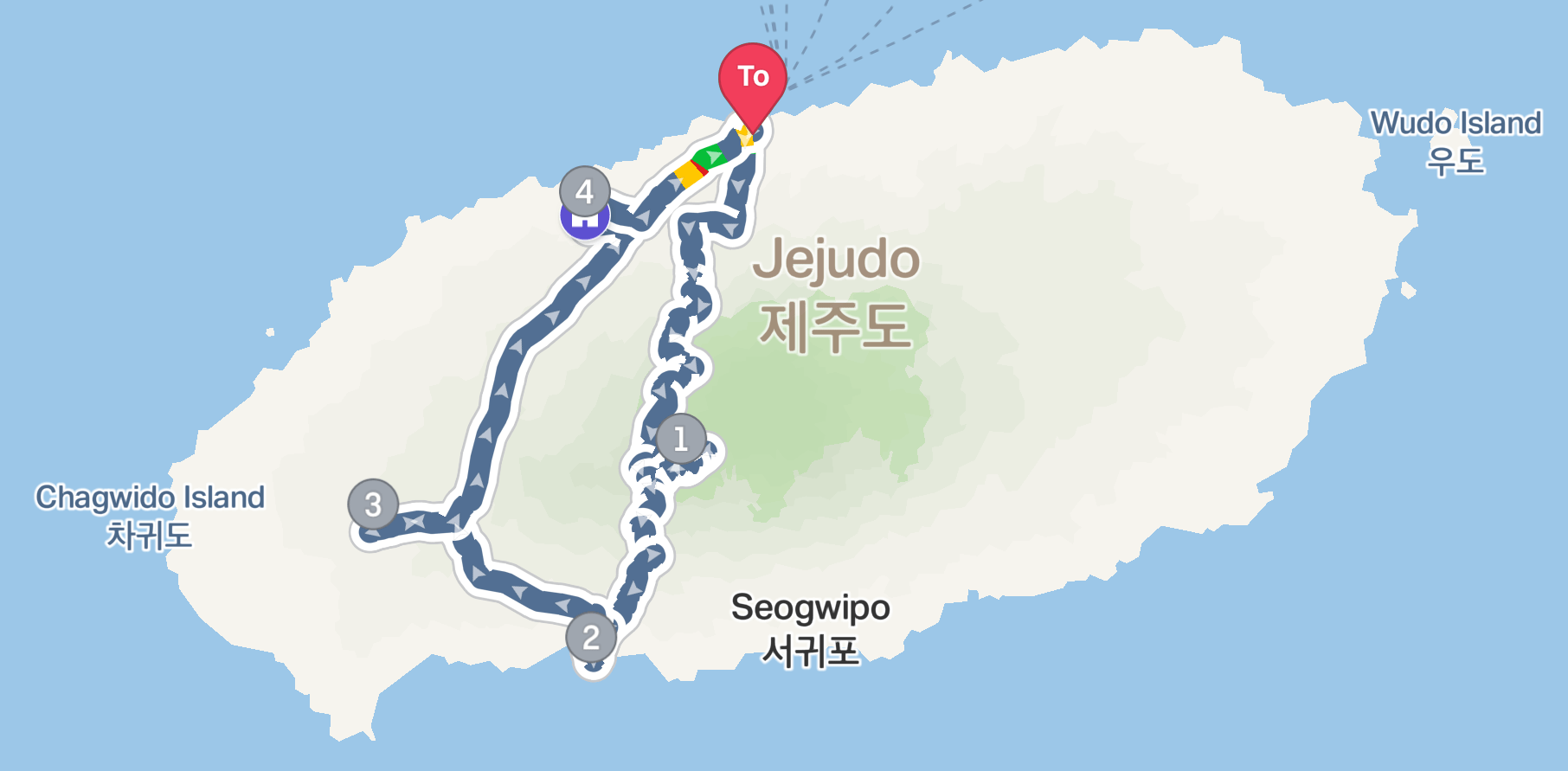
Our journey today focuses on the central and southwestern part of Jeju-do
The not-so Mysterious Road
The first destination today is to stop by at the Mysterious Road, whilst driving towards Hallasan. The road got its name for the fact that visitors can see water flowing upslope. I was here 10 years ago and witness how the water flows up to the slope and was excited to show my friends this phenomenon. Before heading out from our Airbnb accommodation, we prepared a bottle of water for that purpose. The drive to Mysterious Road from our accommodation took a mere 15 mins. After parking our car, we spotted a sign that says “Start of Mysterious Road”. We quickly whipped out our water bottle and start pouring a small amount of water. We observed. The water did not flow upslope, instead, it flowed downslope. Thinking maybe we might have the wrong section of the road and walked up further. We tried again, the water still flows downslope. Again we walked further up and tried. Same results. Eventually, we reached another road sign that says “End of Mysterious Road”, this is the point where we gave up and thought the Mysterious Road is no longer mysterious. We ended up the 7-Eleven next to the road and got ourselves some coffee and Onigiri for our hike up Hallsan and left for Yeongsil Trial on Hallasan.
-

- The not-so Mysterious Road
-
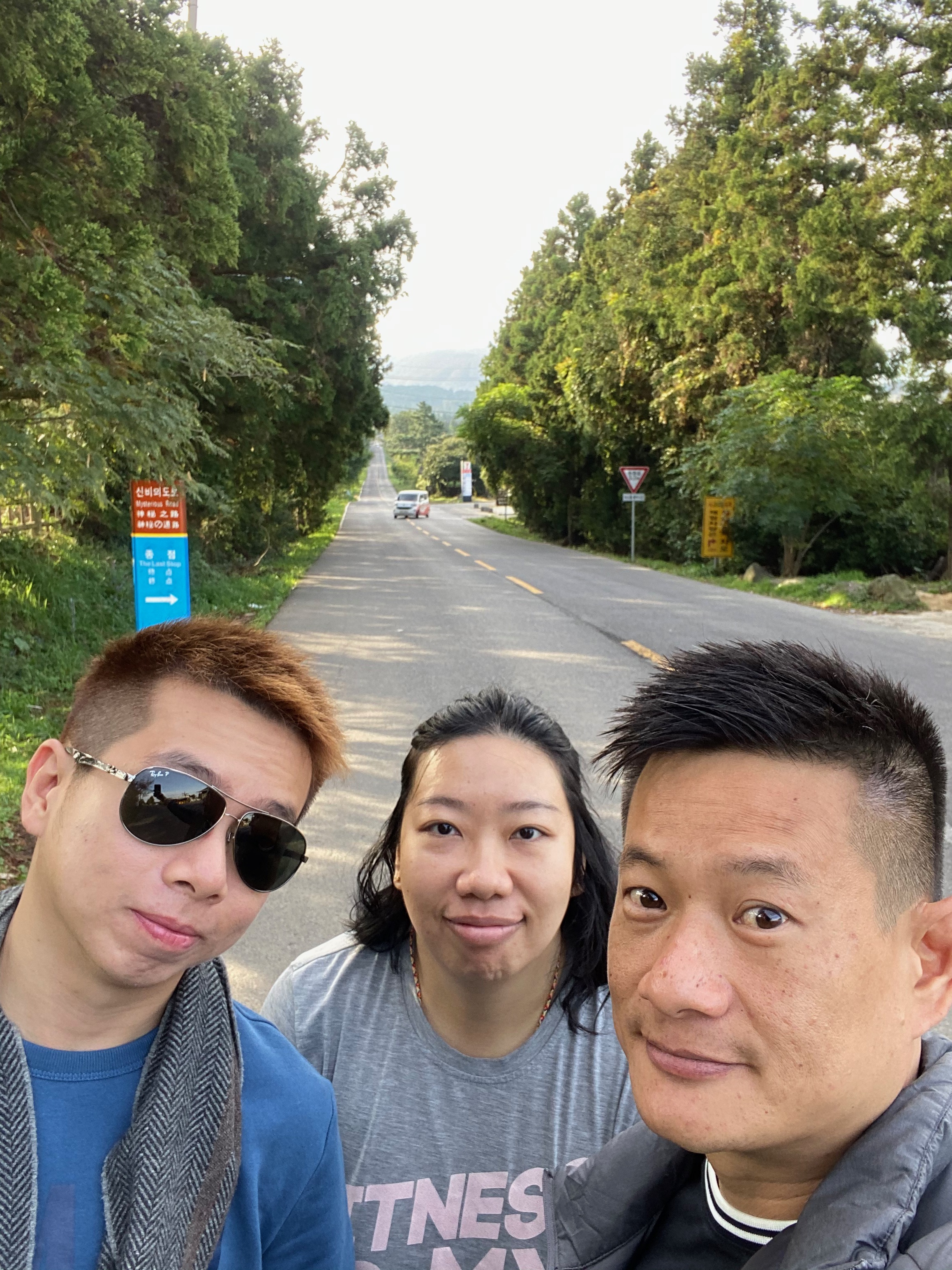
- Wefie at Mysterious Road
Hallasan – Hiking on the Back of The Sleeping Giant
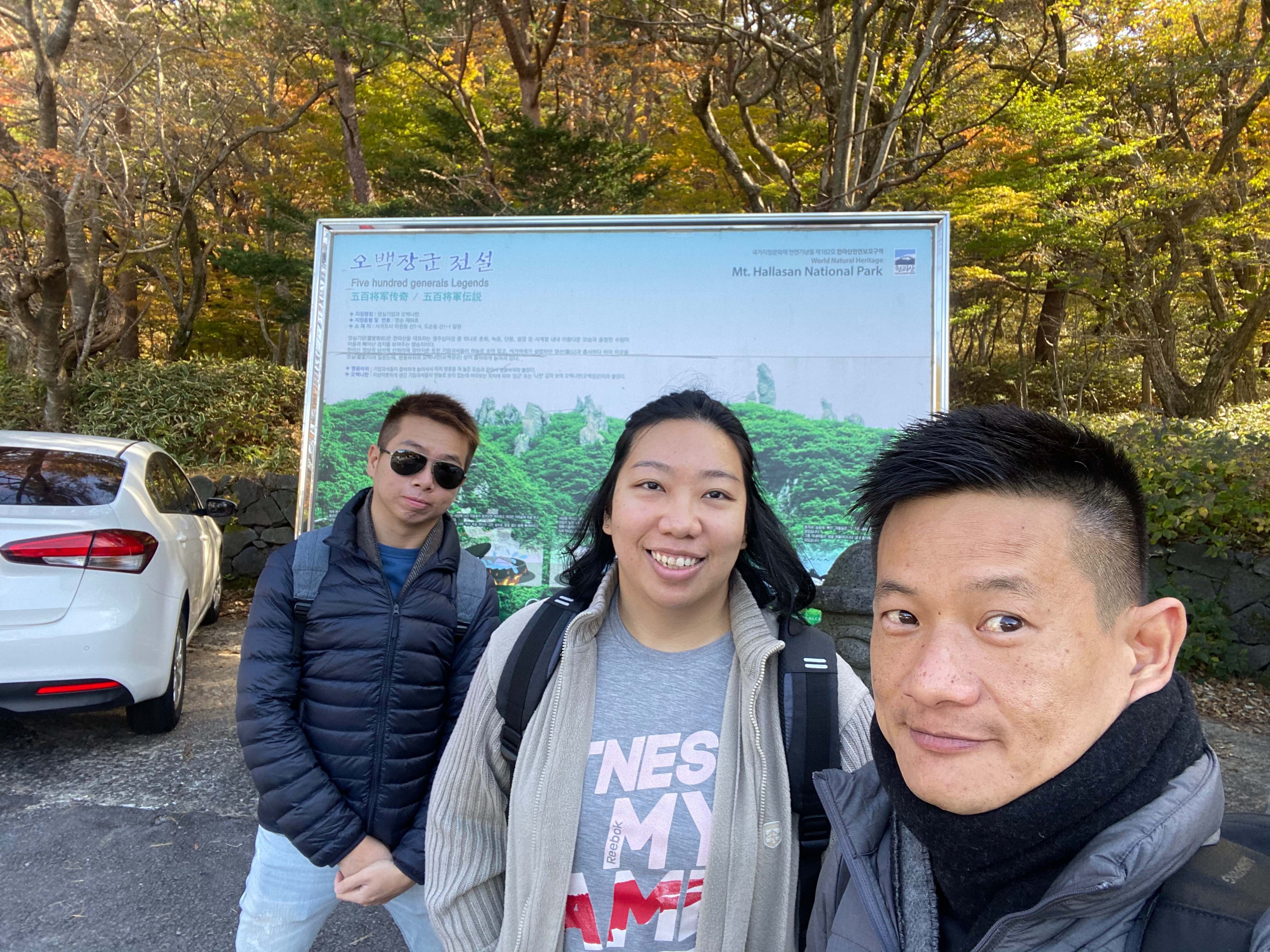
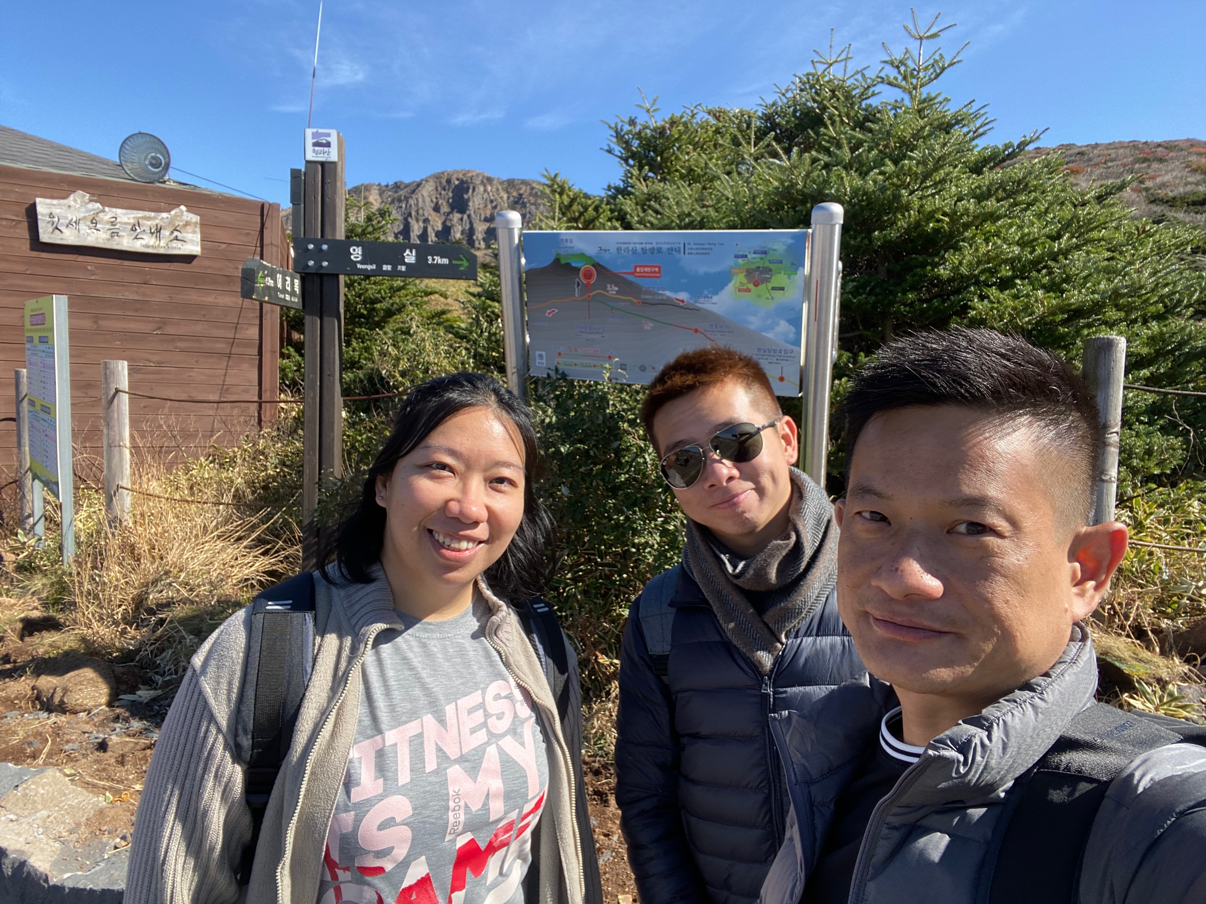
When I was planning for this trip to South Korea, standing at 1,950m tall, Hallasan is an extinct volcano and the tallest mountain in South Korea. It towers over Jeju Island like a guardian angel watching over Jejuans and its visitors. It would be a pity not to scale it since we are already in Jeju. There are seven hiking trails in Hallasan with some taking hikers to the peak of the mountain, ranging from as short as 1.5km (about 30 mins hike) to as long as 9.6km (about 5 hours one way). I wanted to hike a trail that does not take too much time and yet allowing us to get scenic views of the mountain. Yeongsil Trail fits the bill perfectly. The estimated hike up Yeongsil Trail takes around 4 hours in total, which will leave us with some time to explore the other parts of Jeju.

The hiking trails on Hallasan
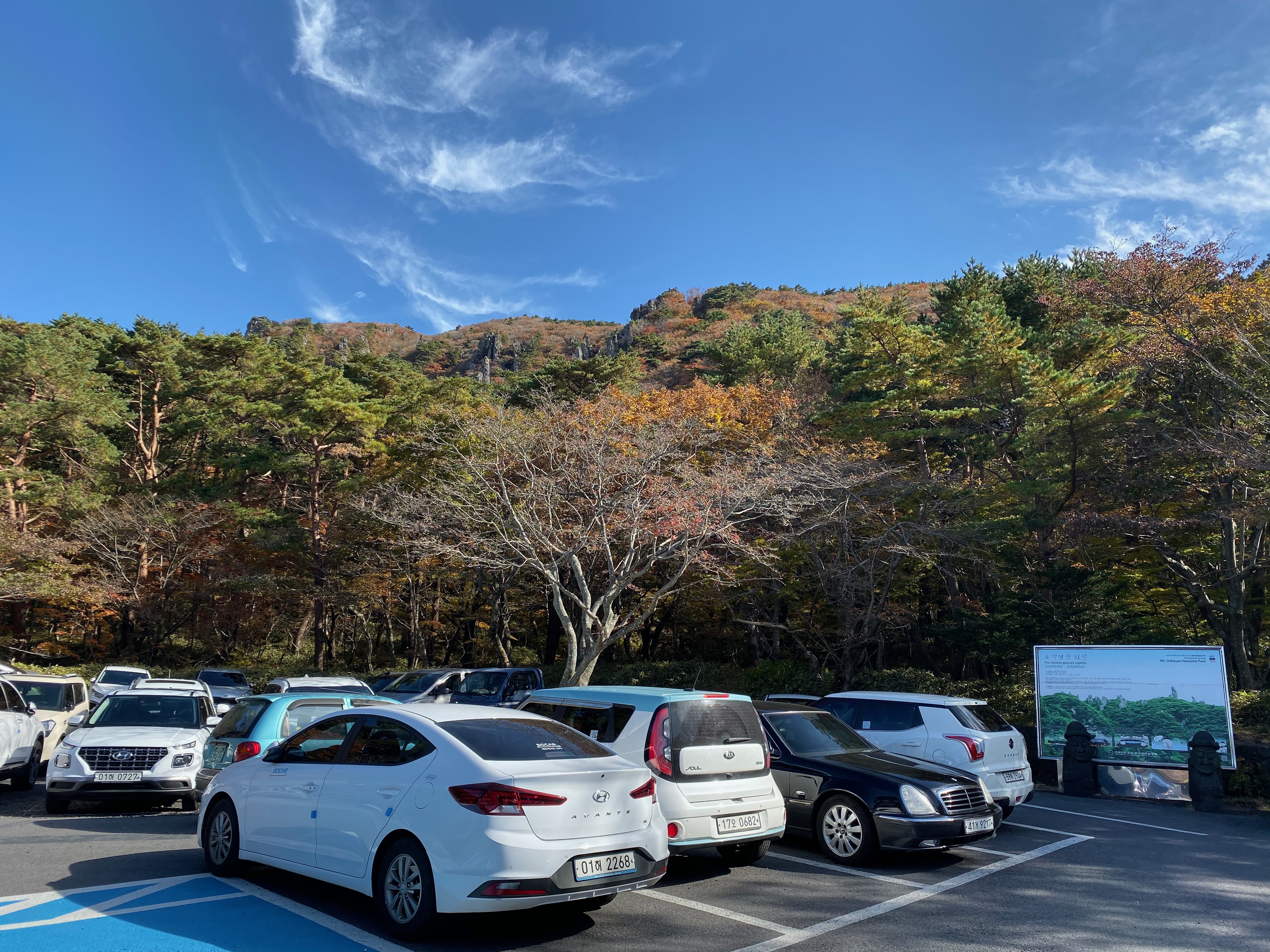
It takes us around 1hour to drive up to Yeongsil Trail entrance from Mysterious Road. As we were driving up to Yeongsil Trail, the winding road took us past rows and rows of forest trees that were starting to show their autumn foliage, some decked in red and other in yellow, the drive was both soothing and therapeutic. Soon we reached the first car park at Yeongsil Trail. There are two car parks at Yeongsil Trail, the first car park has more parking lots, but requires one to walk another 2.5km to reach the entrance of the trail. There is a second car park right in front of Yeongsil Trail entrance. There was already a queue forming up for the second car park at the time we arrived at the first car park. We were stuck in the queue for around 30 mins. My friends and I were discussing our options while we wait for our turn to drive to the second car park. There are limited parking lots at the second car park and traffic to the second car park is controlled. Soon we were moving as some cars ahead of us left the queue. With no signs of any vehicles coming out, and just when we were about to give up waiting and leave the queue to park our car in the first car park, the staff opens up the boom gate and let us in. The drive to the second car park took another 5 mins through some windy mountain roads. Entrance to Hallasan is free, but parking is chargeable at KRW1,800 per car.
-

- Driving to Yeongsil Trail in Hallasan
-

- First car park at Yeongsil Trail
-

- Driving towards the second car park
-
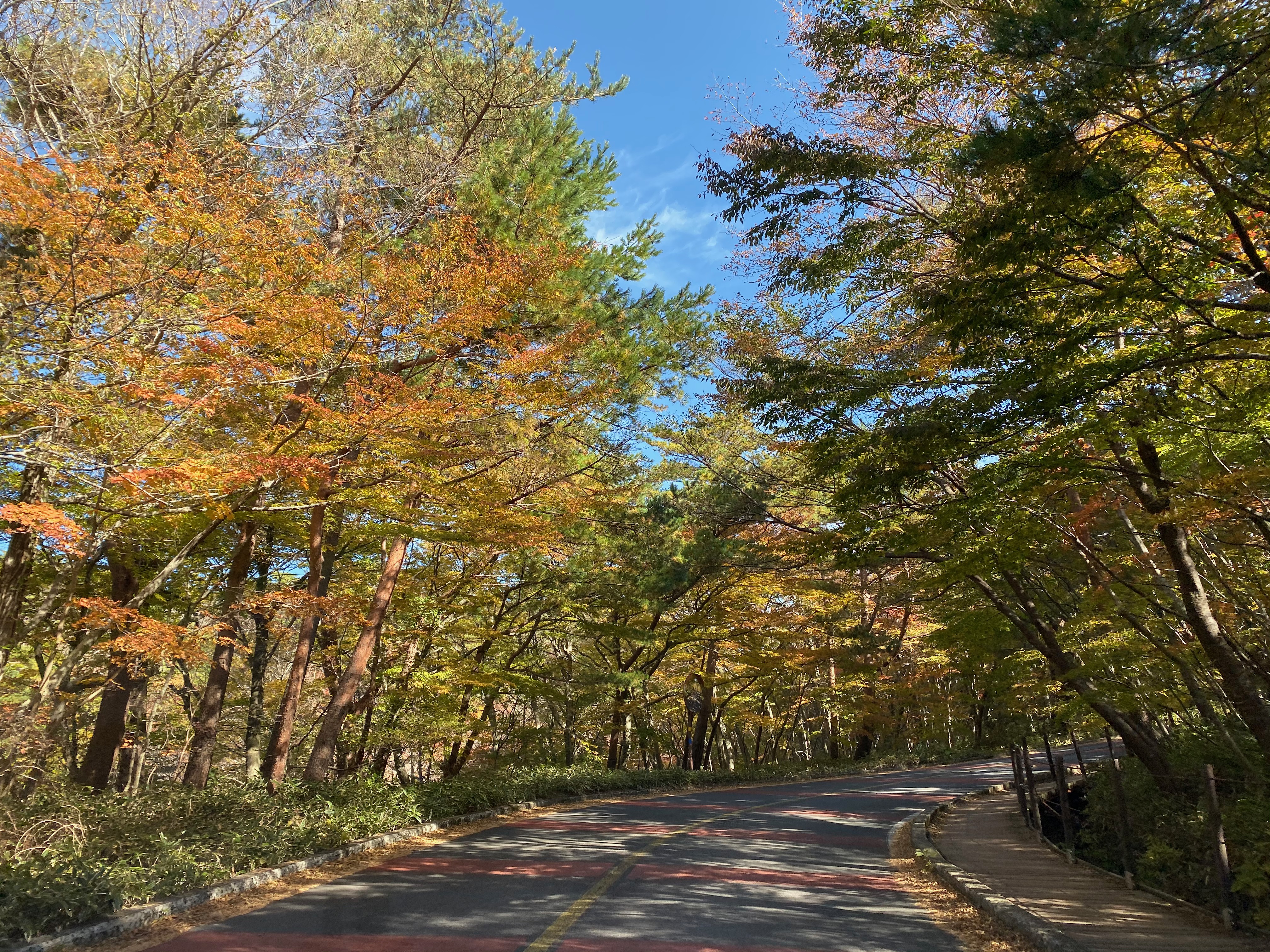
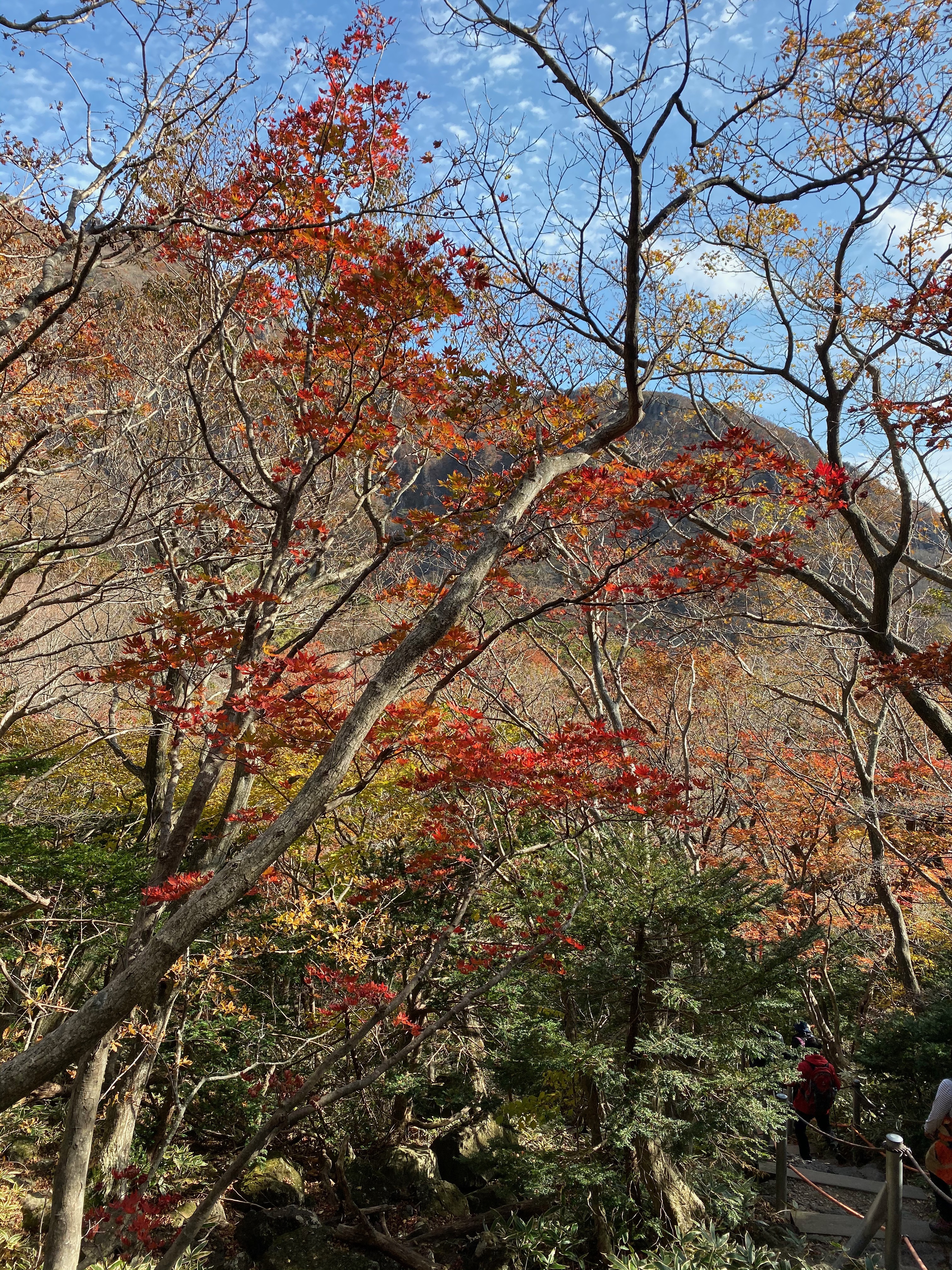
- The autumn foliage along the road
-
- The second car park is right at the entrance to Yeongsil Trail
The First Leg – Hiking Through the Forest
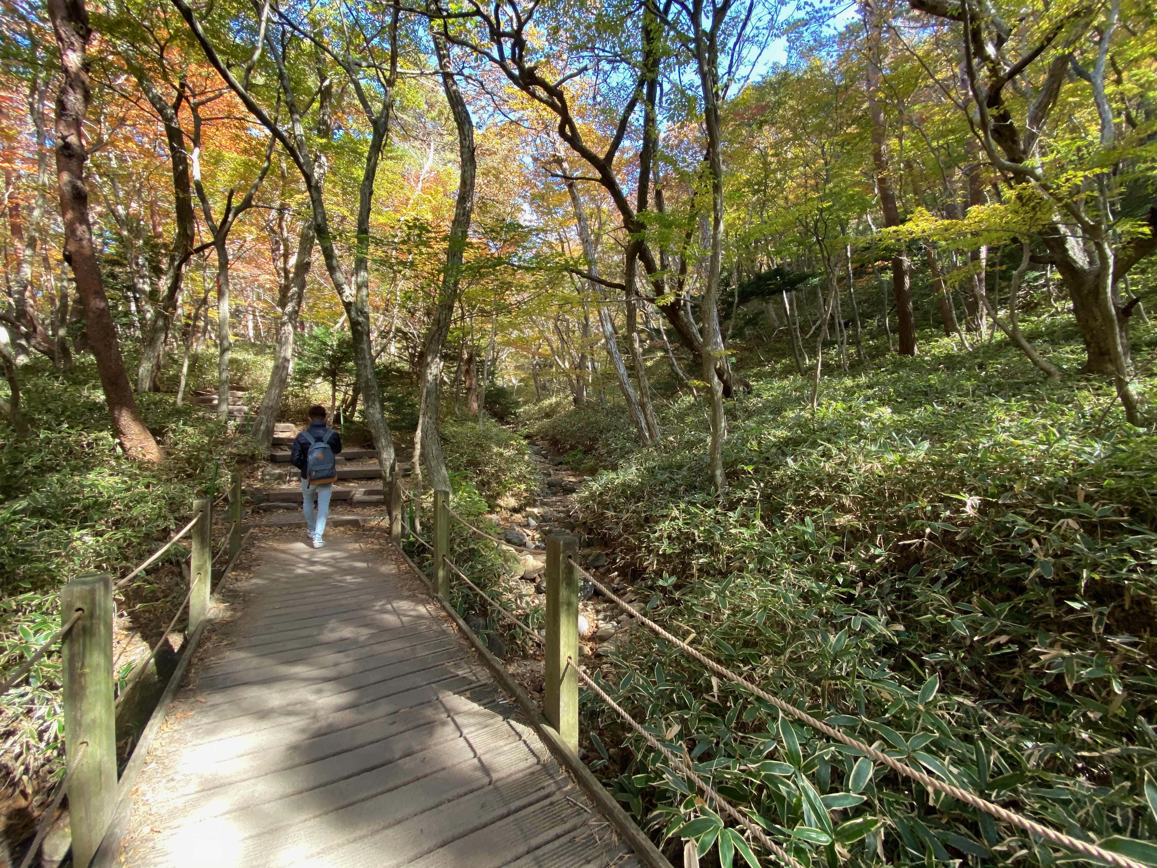
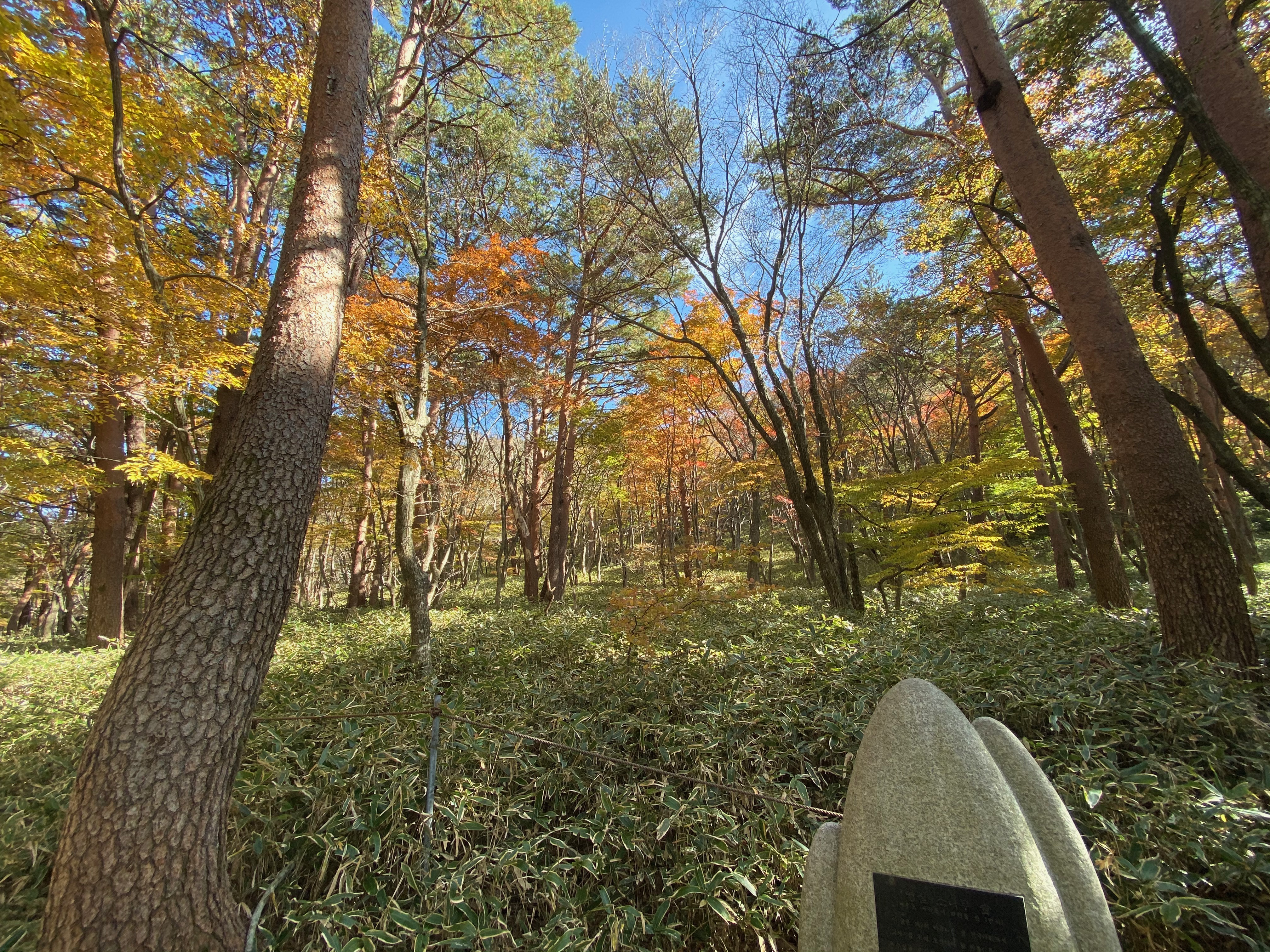
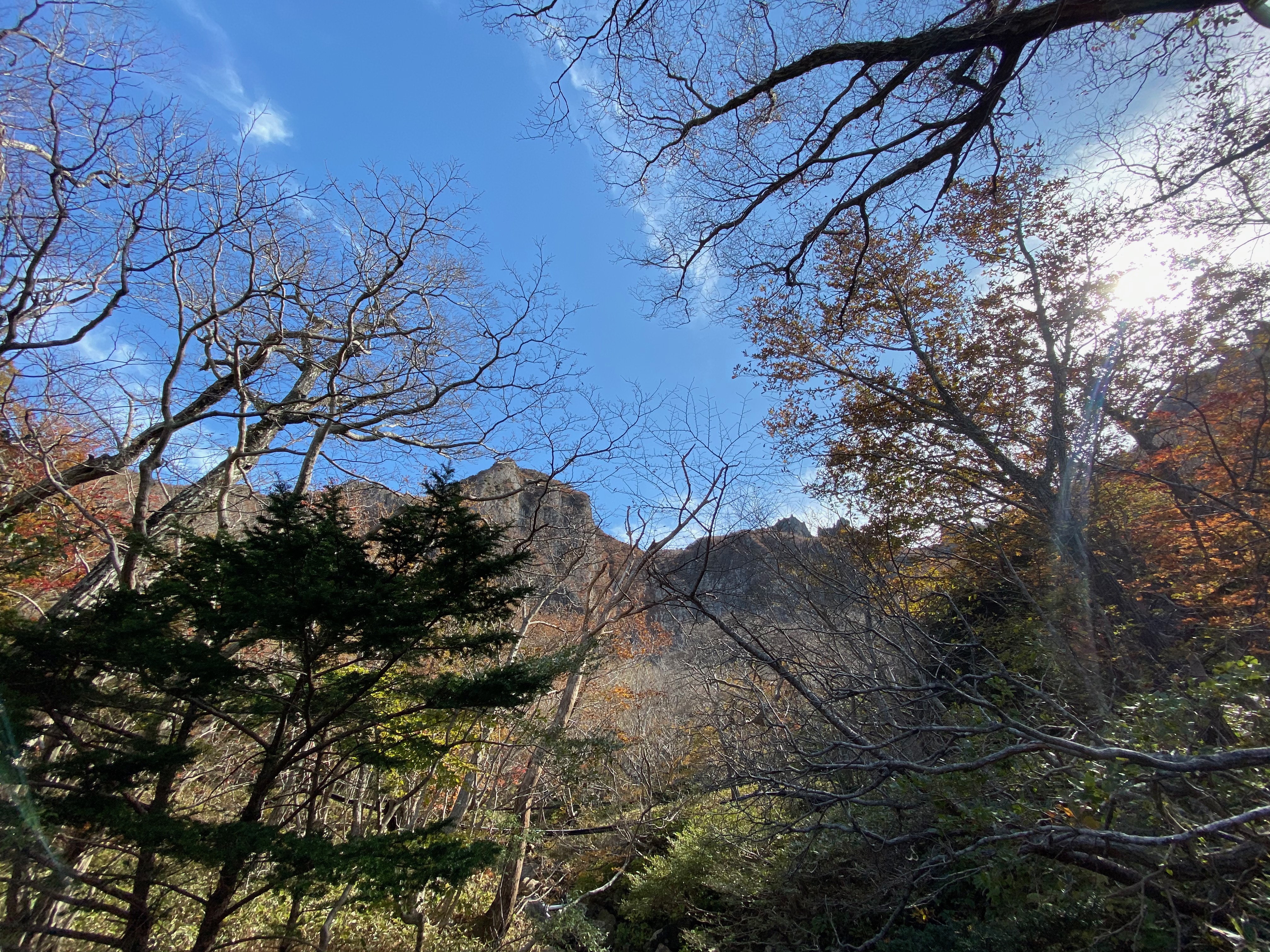
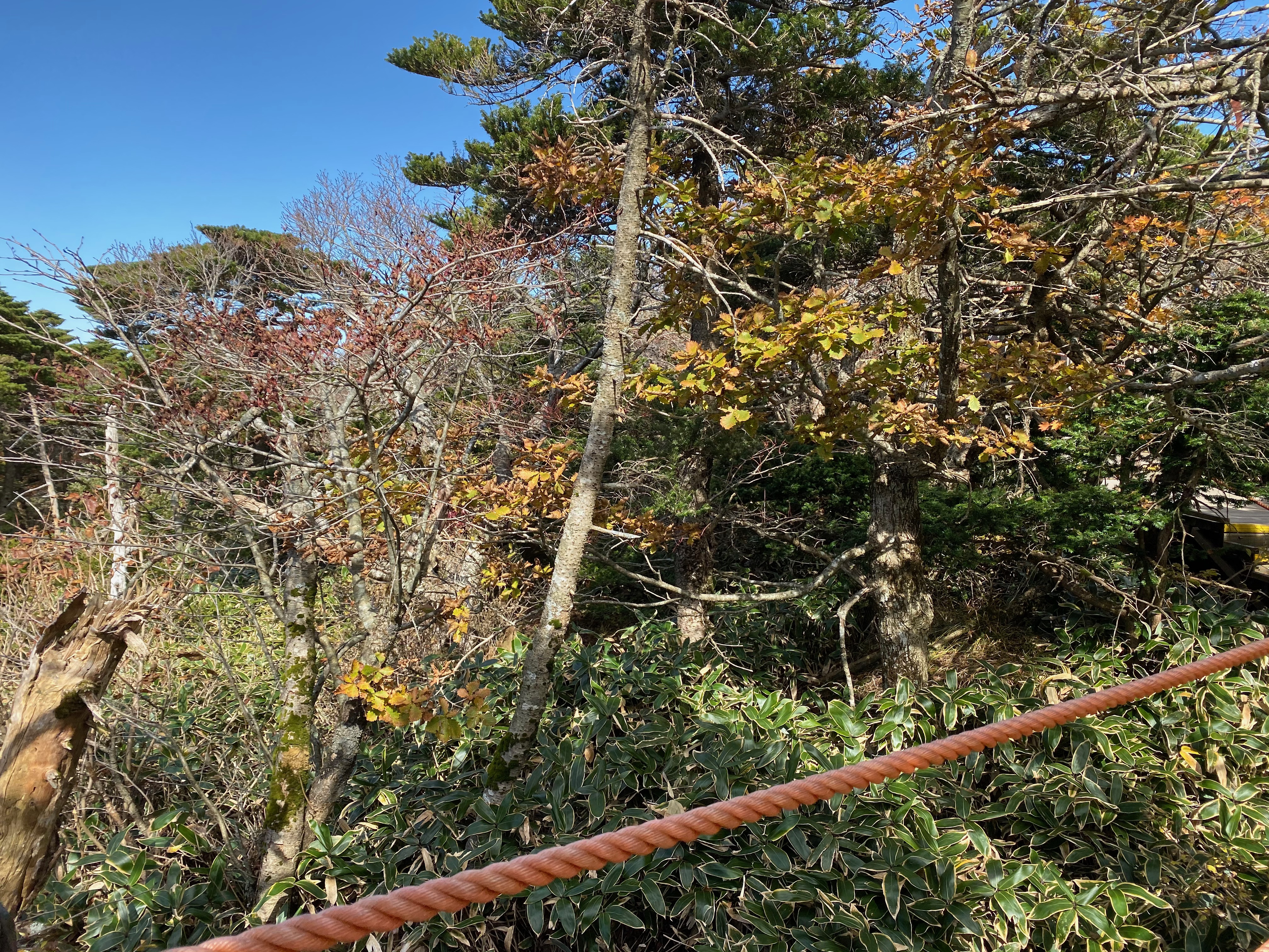
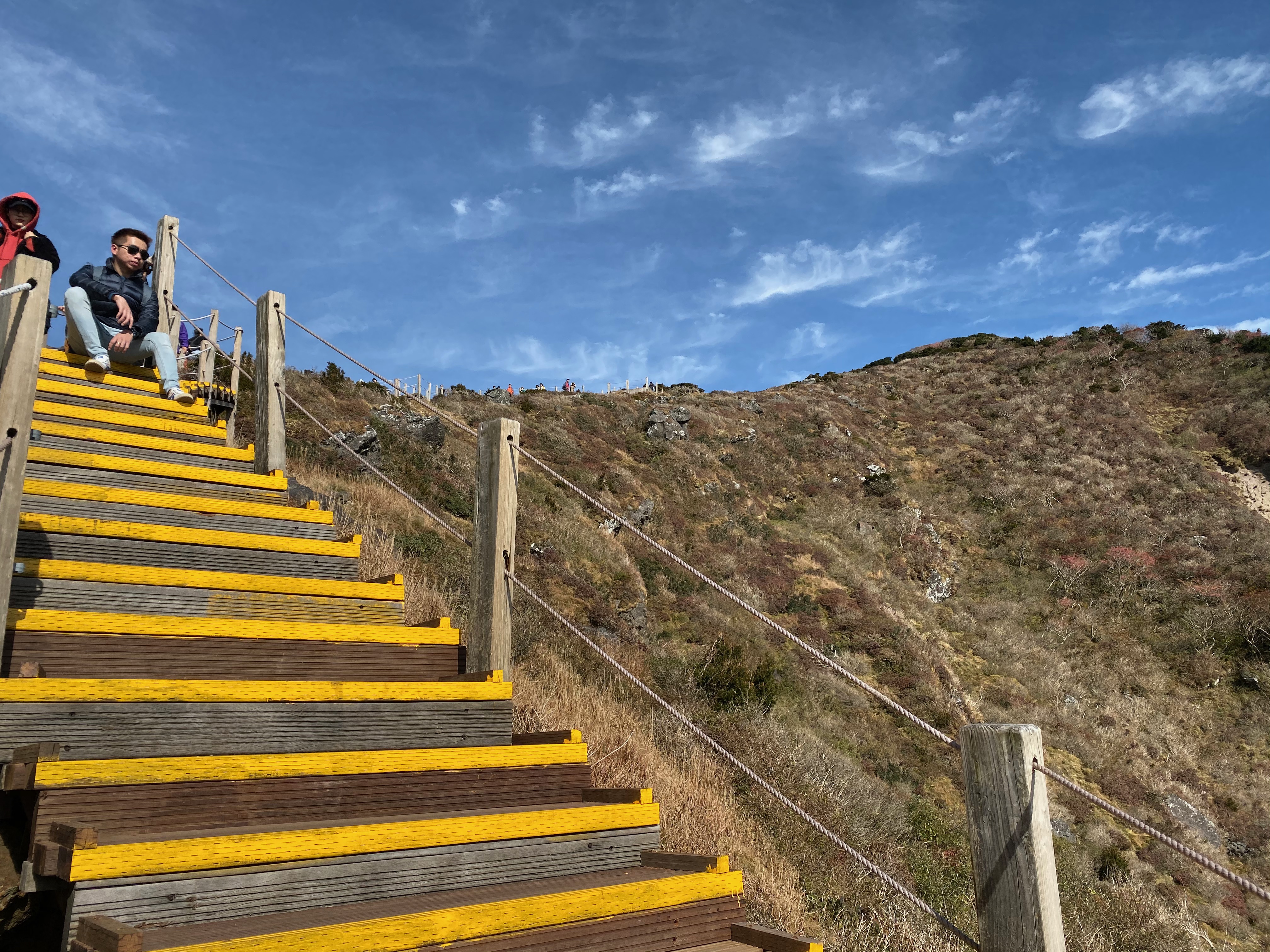
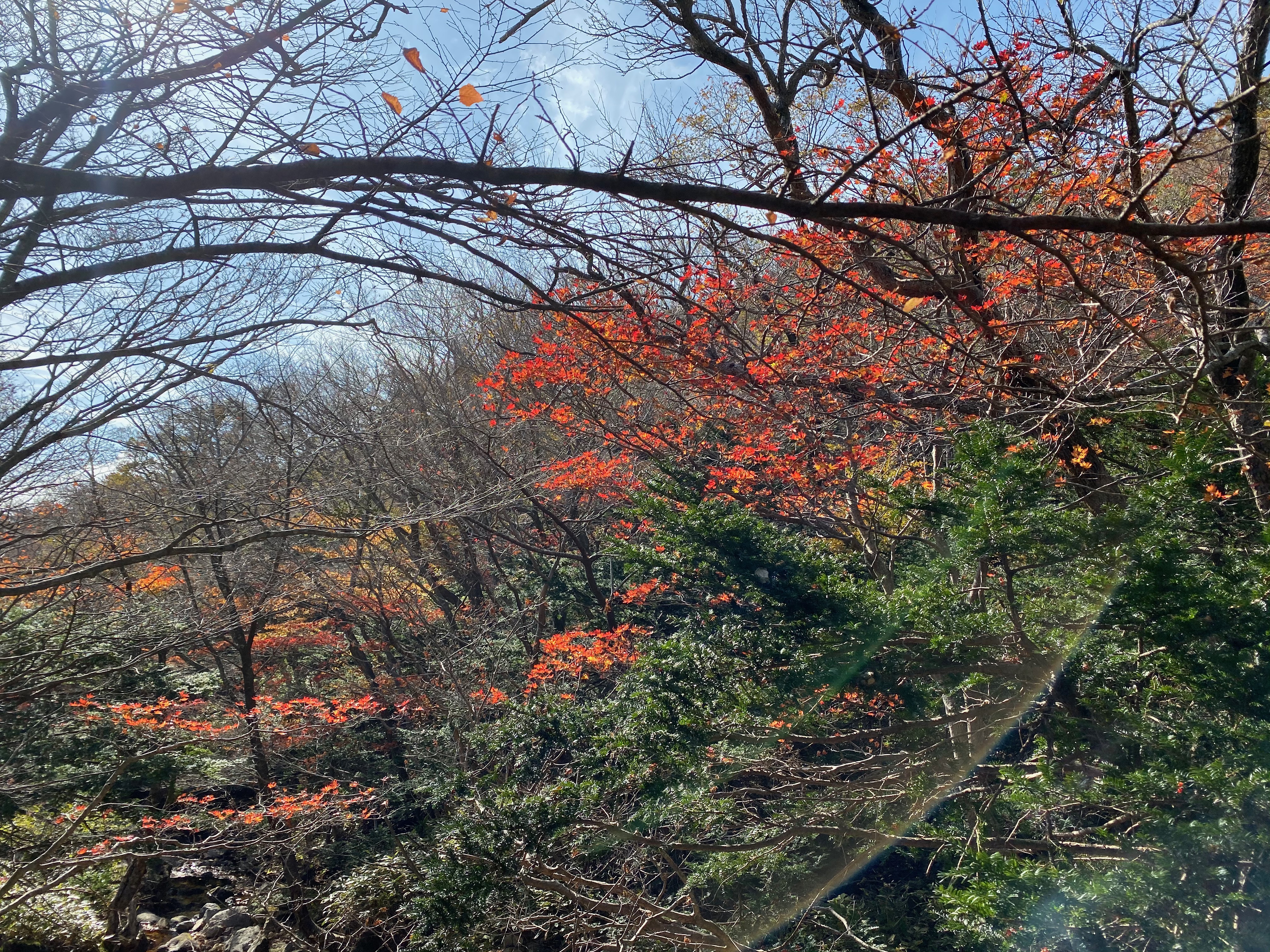
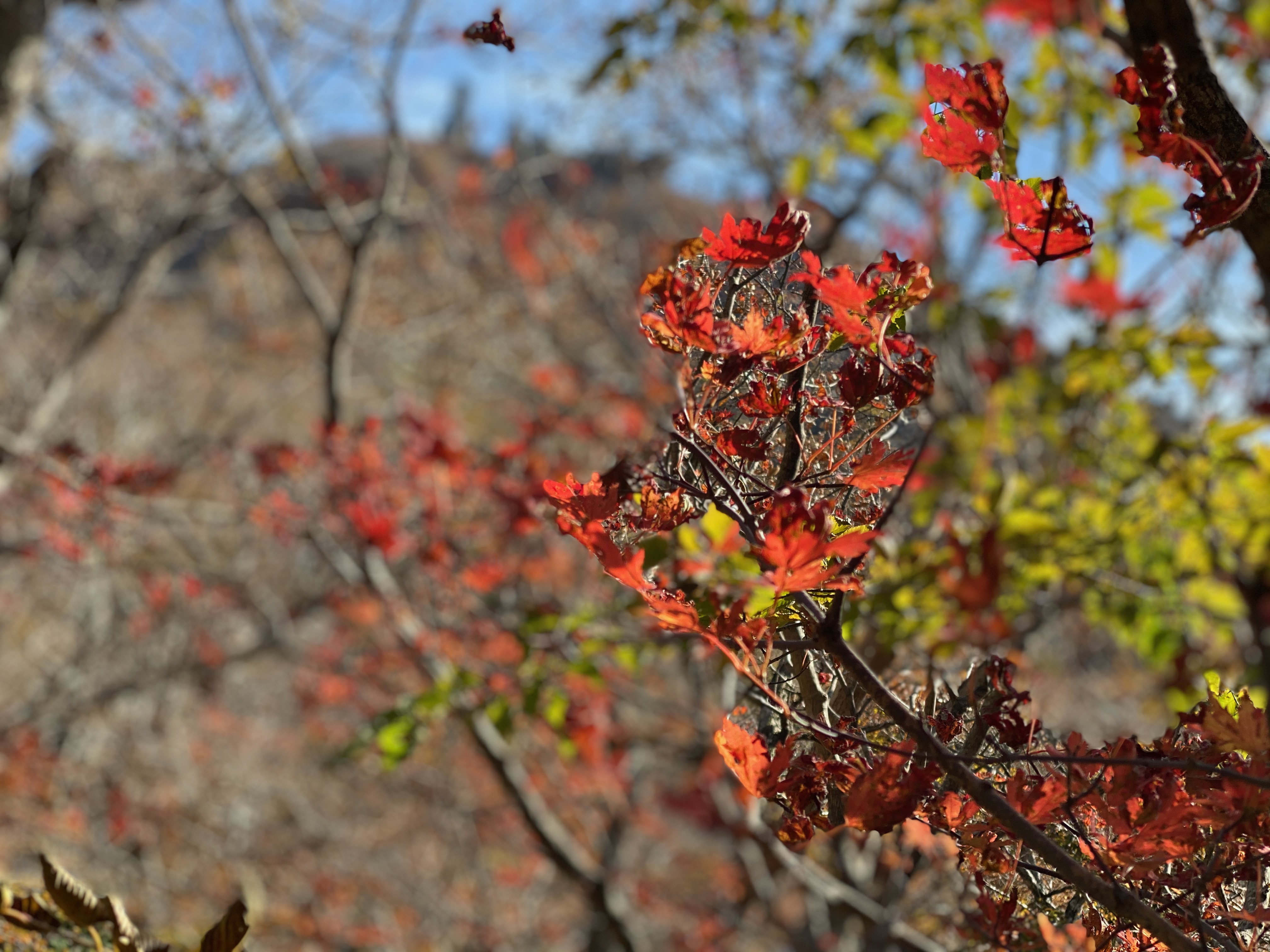
Yeongsil Trail entrance starts at 1200m above sea level. There are some eateries and souvenir shops next to the car park at Yeongsil Trail entrance. There is a booth at the start of the trail apprising hikers of the route and the time required. Here is where they distribute maps in various languages for hikers. The entrance of Yeongsil Trail took us into a forest. his part of the trail is an easy walk, with roads well marked out. The fresh and crisp morning forest air coupled with birds chirping to the morning air, and absence of flying insects make hiking here a pleasant experience. TAs we were walking on the trail, we spotted some leaves on the trees starting to don on their autumn clothing. A good portion of the trees have turned yellow and some even in red. We hear water flowing from a distance, seemingly playing the symphony of mother nature, but can’t seem to point out where the stream flows along. We can even seem part of Hallasan peeking out at us through the canopy of the forest the further we walked in Yeongsil Trail. At this point, we were totally clueless on exactly which part of the trail we are at and how long more to go. We kept on hiking along the trail, following the general flow of human traffic. Occasionally we spot a map telling us where we are, but that does not give us a good enough indication of our exact location. About 30 mins into Yeongsil Trail from the entrance, we came to a steep staircase made out of the rocks. This is where we know we arrived at the second leg of the trail.
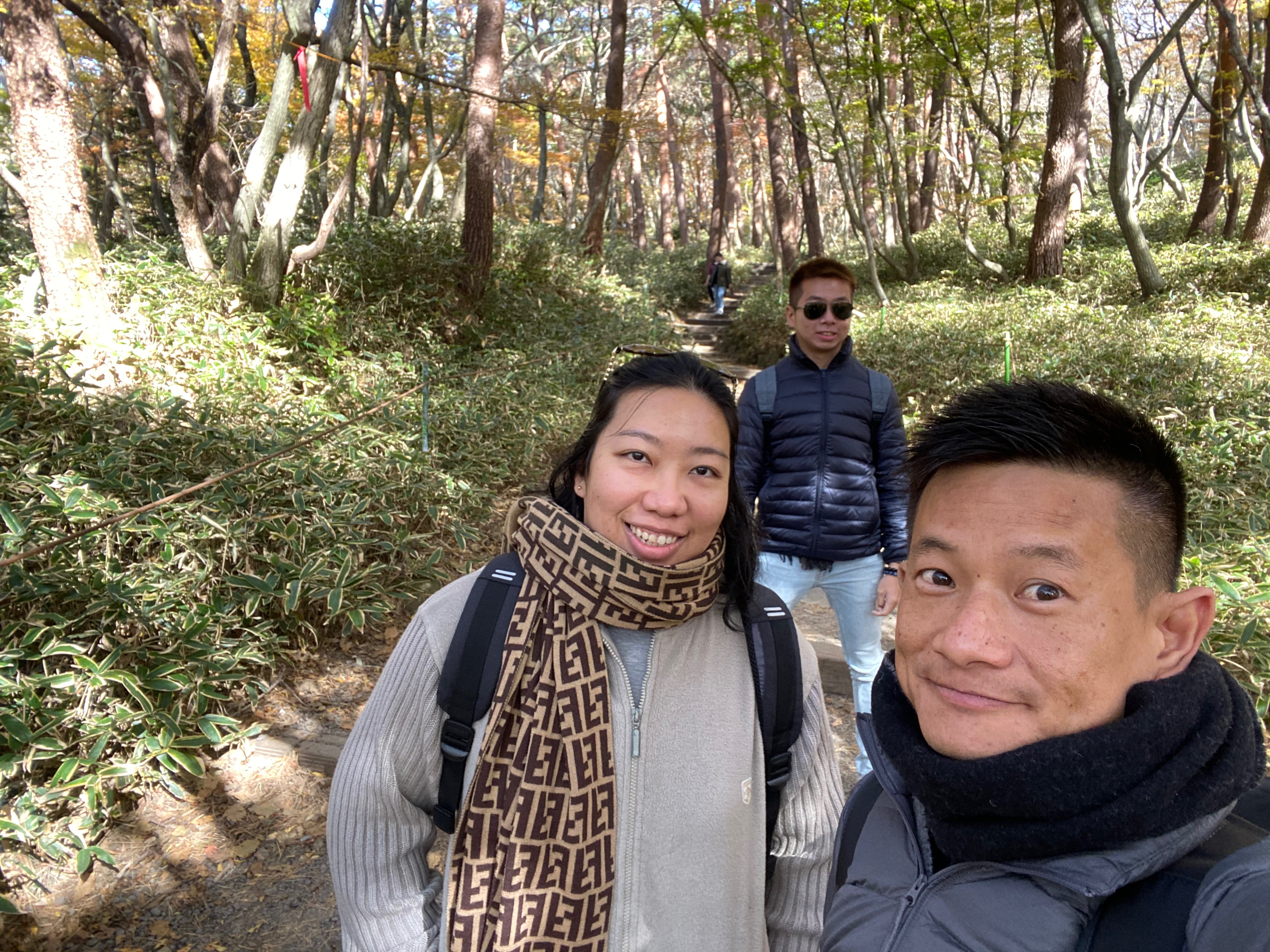
Taking a wefie before our hike up South Korea’s tallest mountain – Hallasan
-

- Tablet showing us the elevation at the start of Yeongsil Trail
-

- Yeongsil Trail, here we come
-
- Taking a wefie at the tablet
-

- There is a booth at the start of the trail distributing maps
-

- The start of Yeongsil Trail is an easy walk through the forest
-
- Very well paved roads on this leg of the trail
-
- The trees in the forest showing signs of autumn
-
- Wefie in the forested section of Yeongsil Trail
-
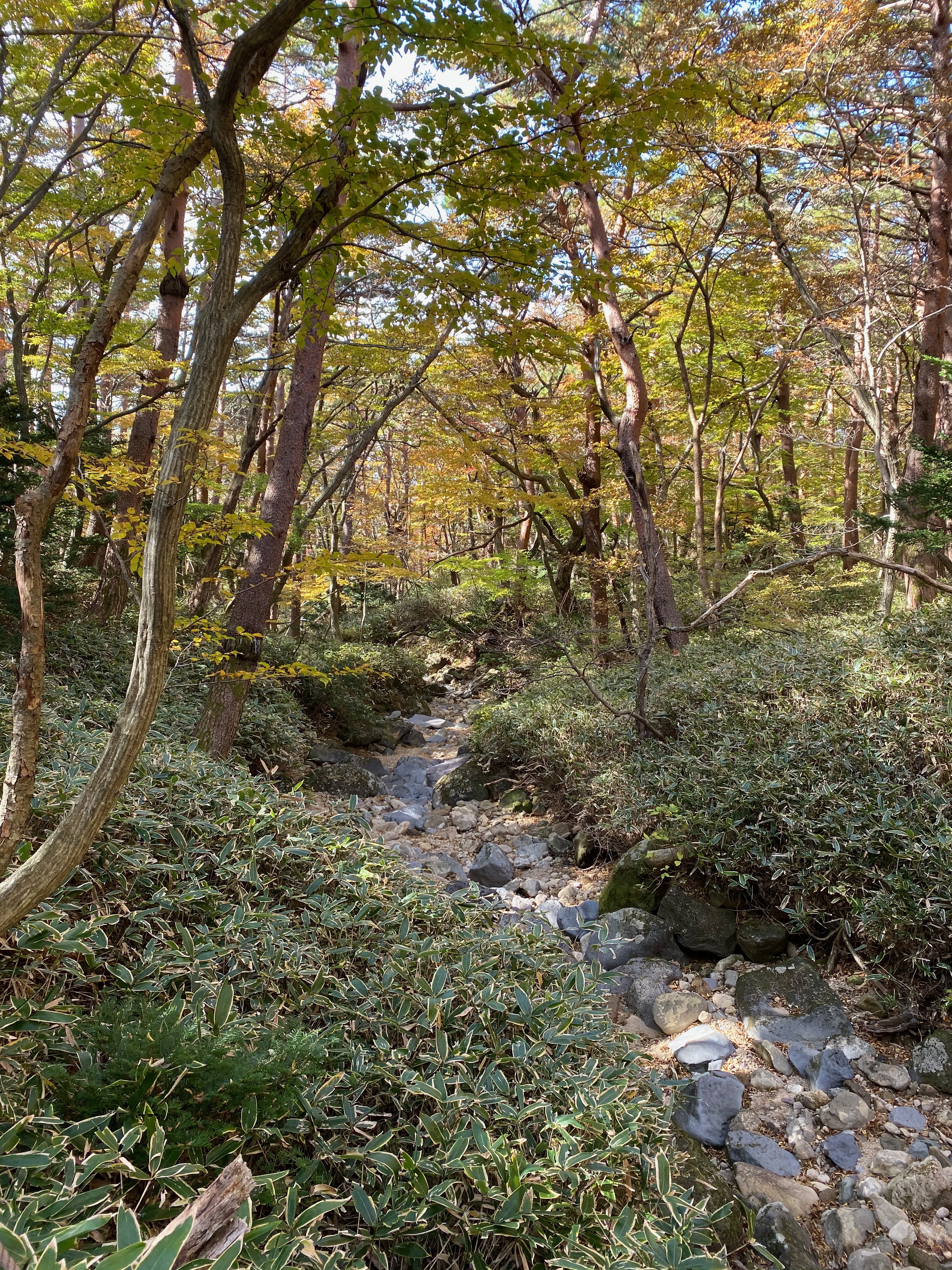
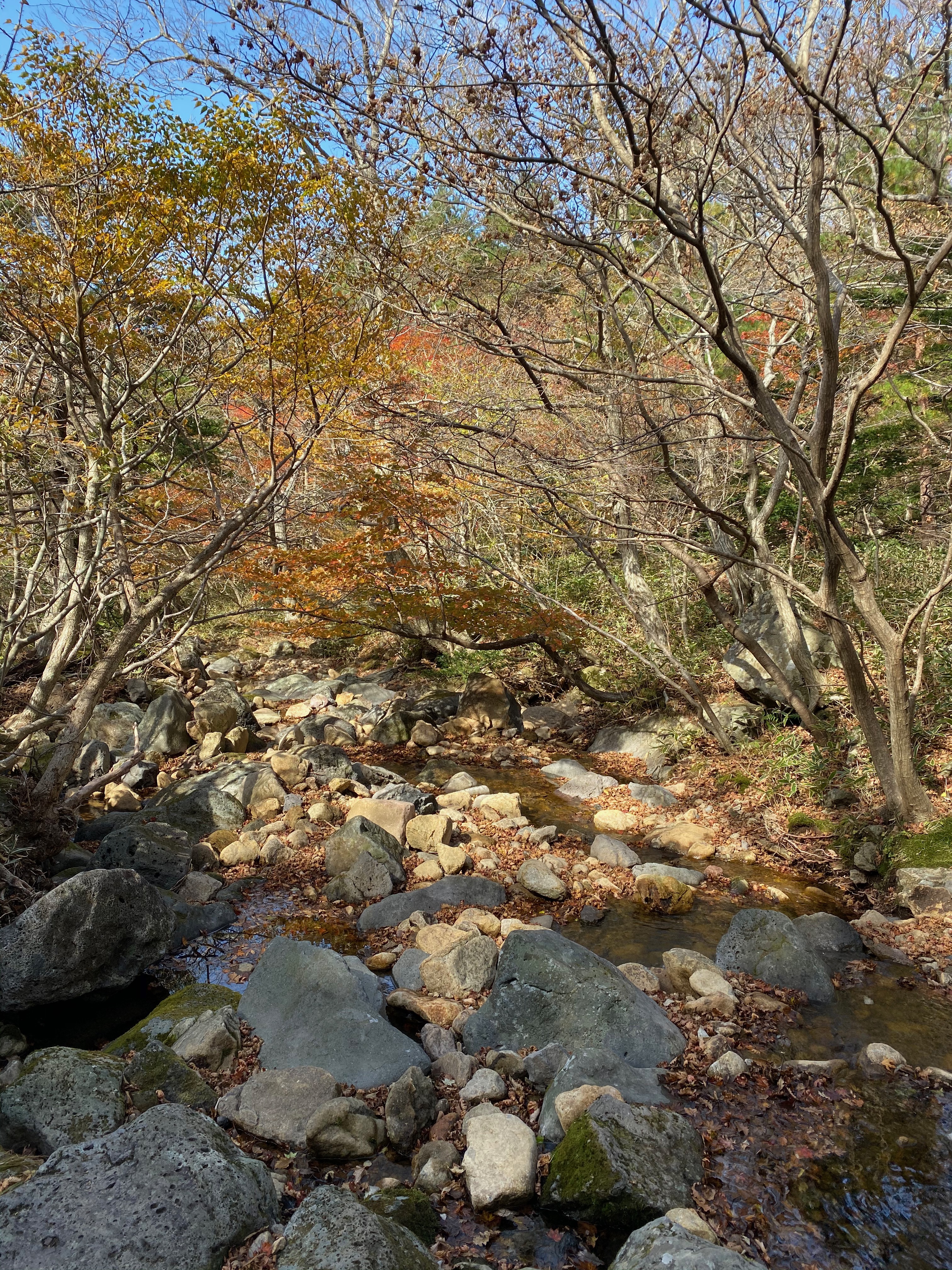
- We walked past a stream int he forest
-

- Pleasant walk through the forest
-
- More autumn foliage in the forest
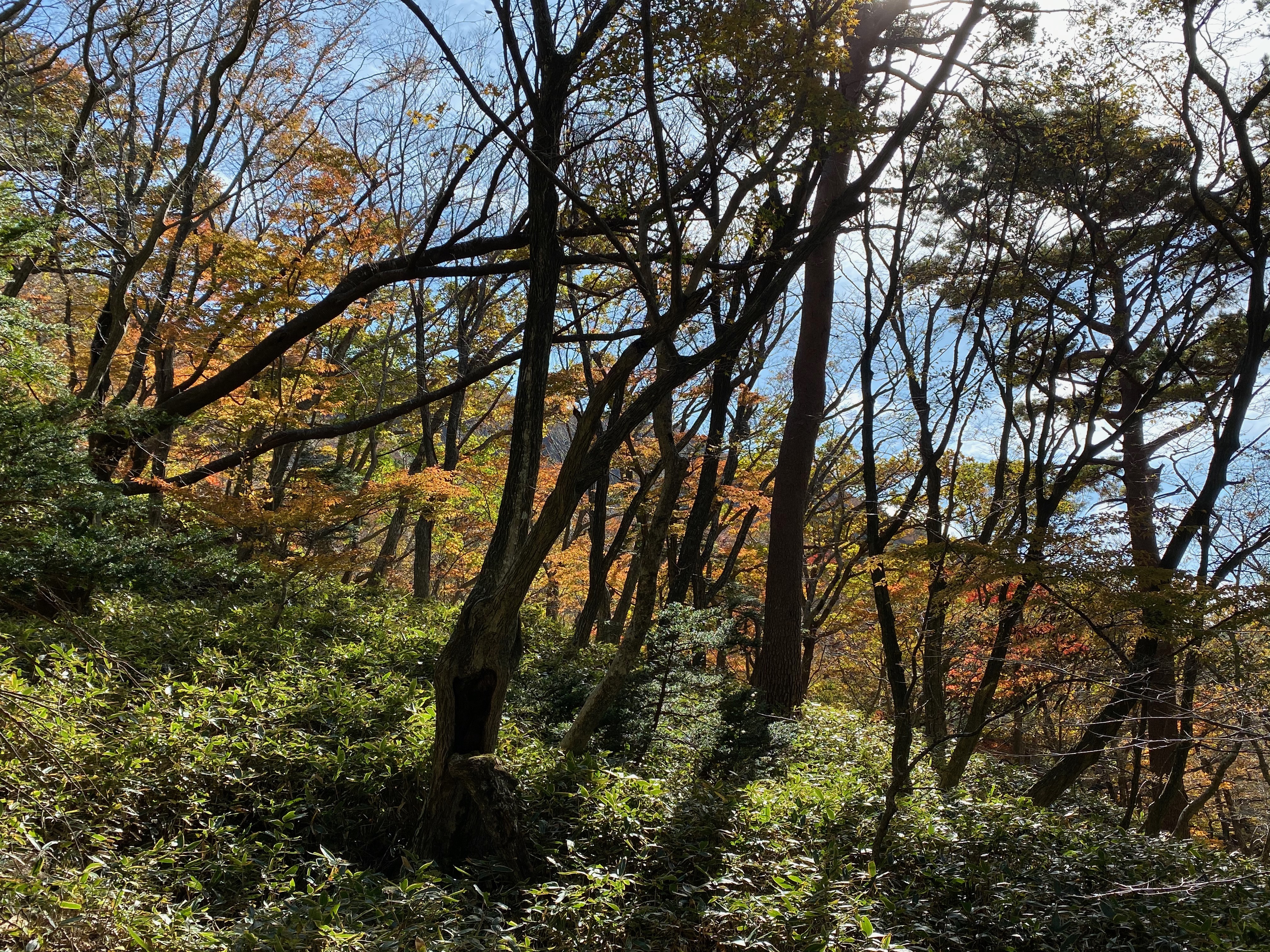
More views of the forested area along Yeongsil Trail

We see Hallasan peeking out from the forest canopy occasionally
-
- The vegetation started to thin out
-

- Climbing the staircase on Yeongsil Trail
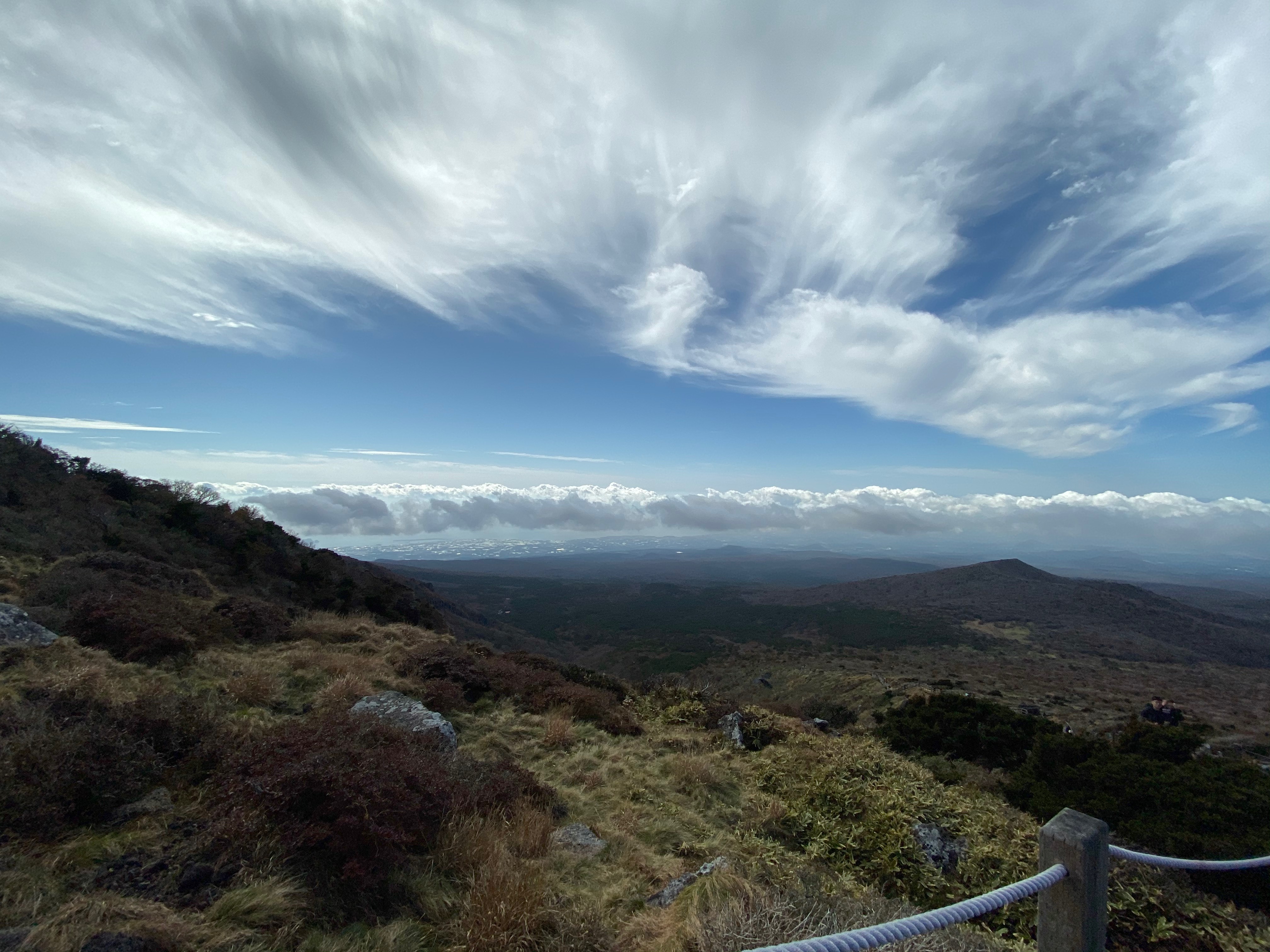
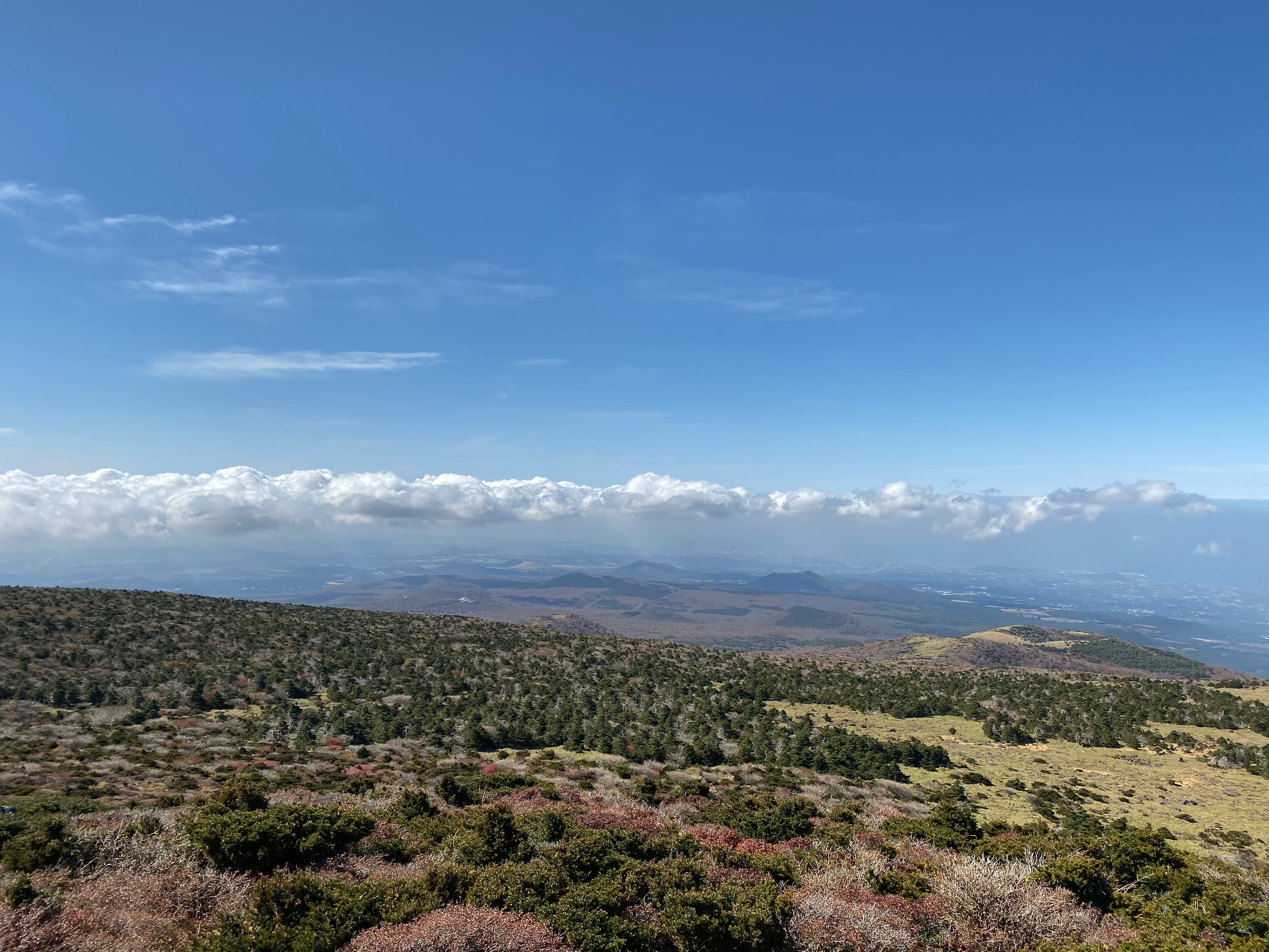
The Second Leg – Dramatic View of the Land Below
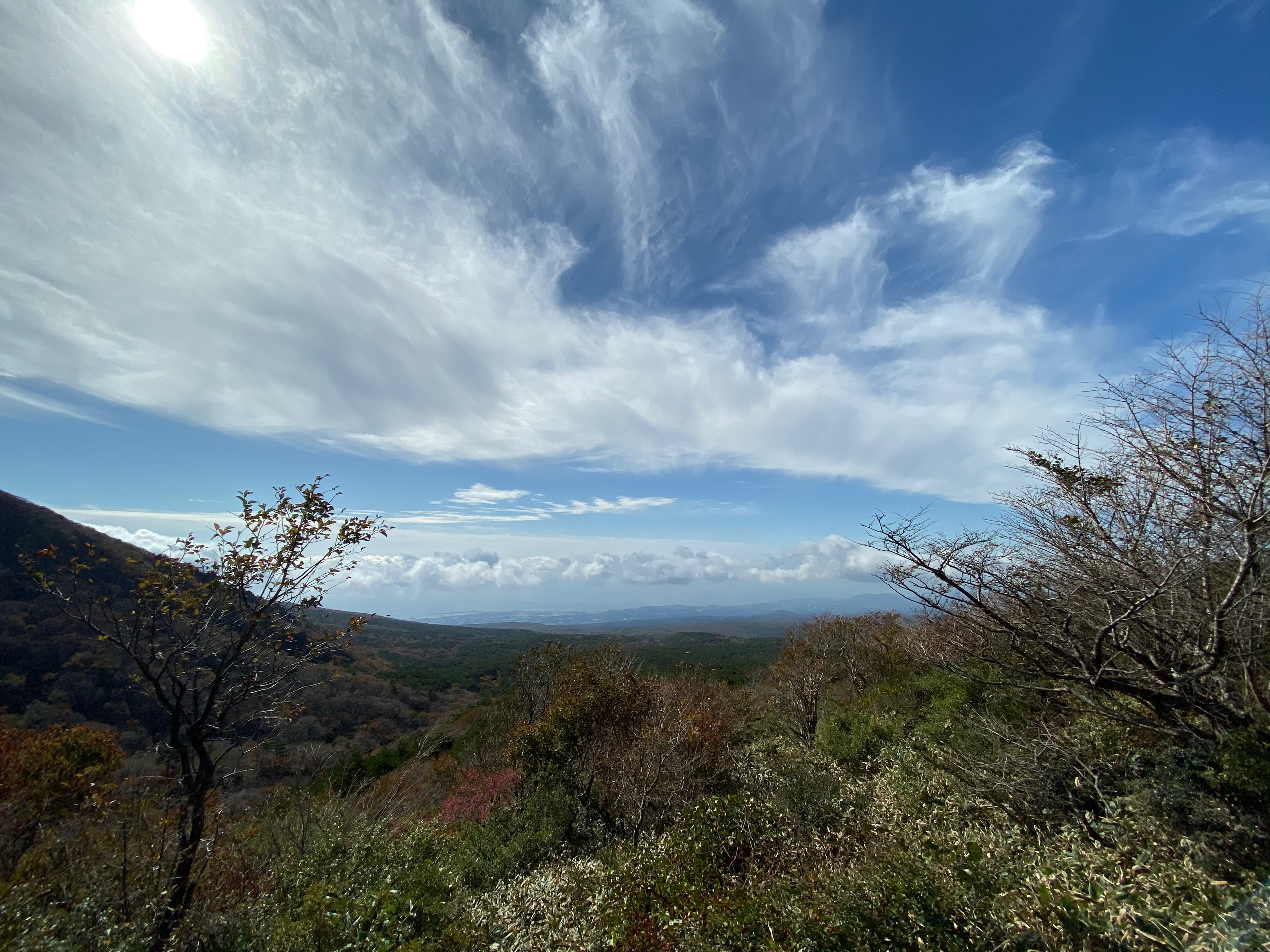
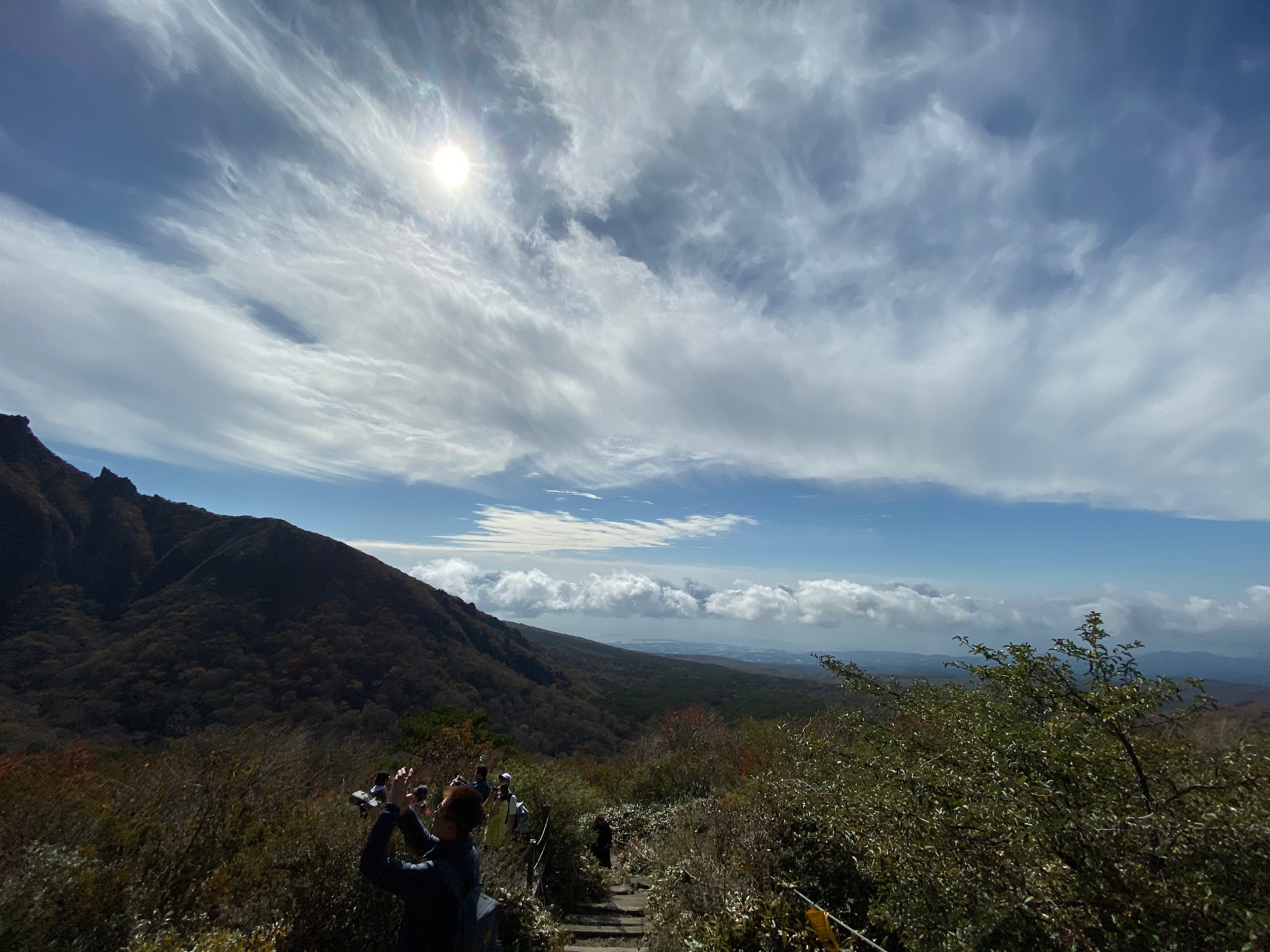
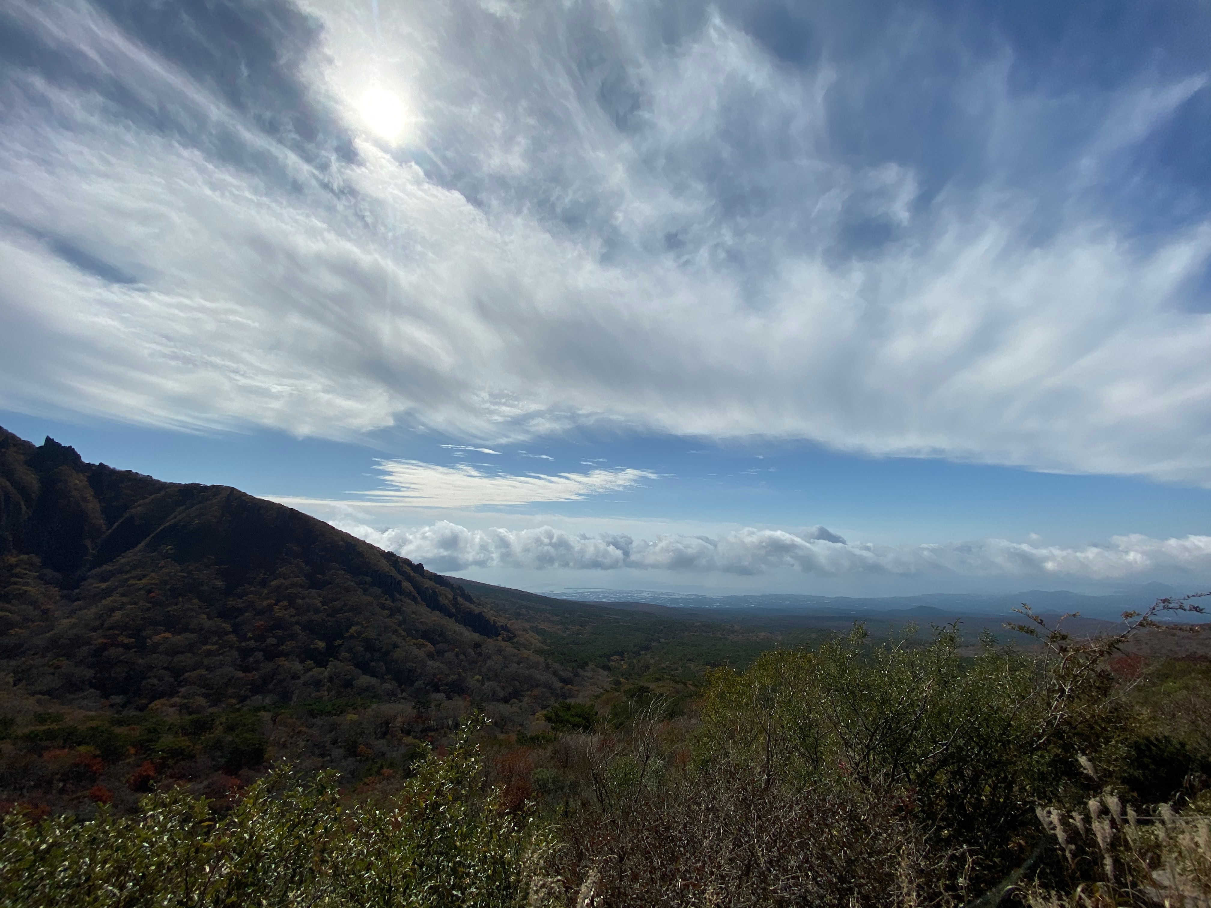
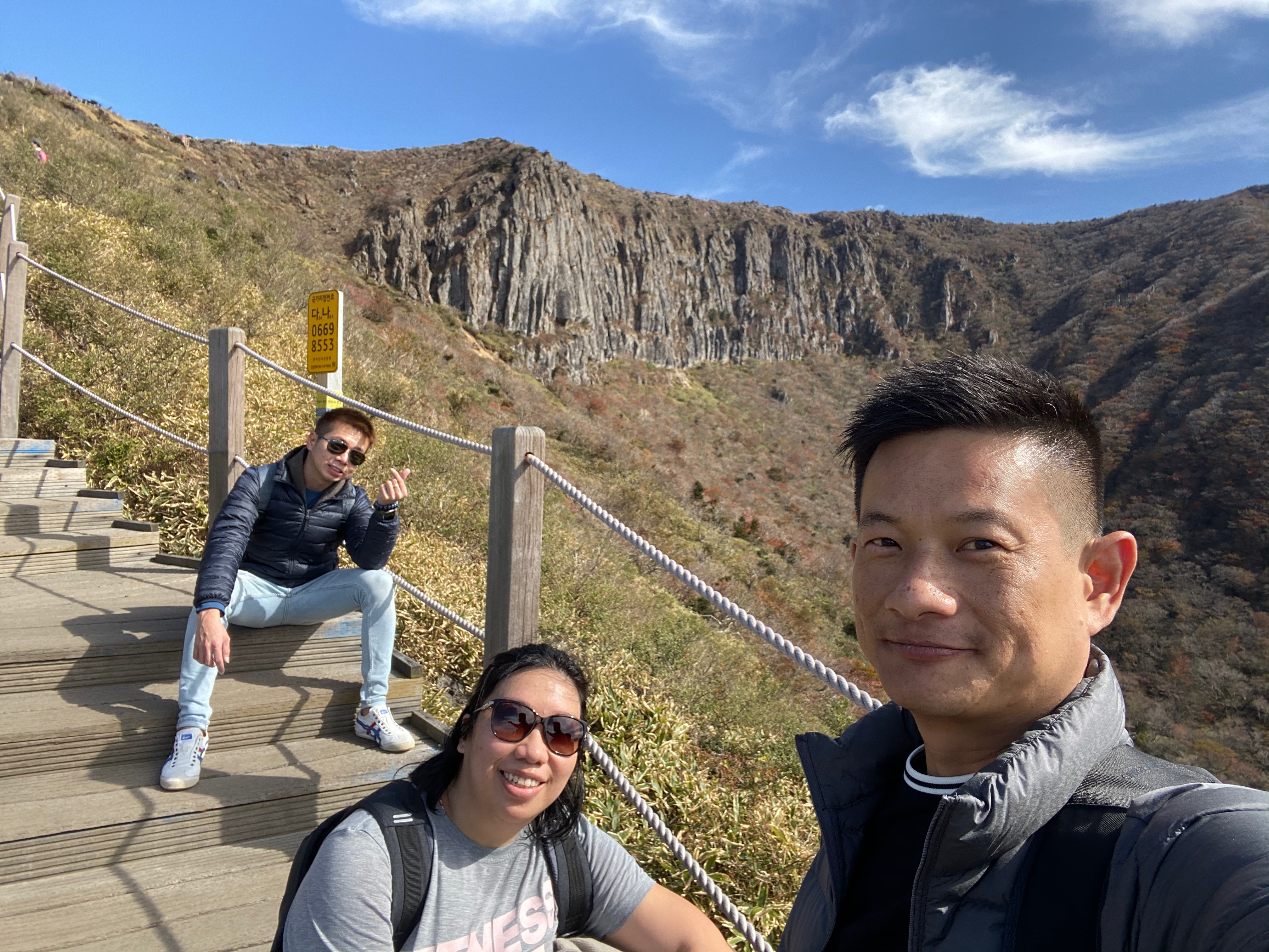
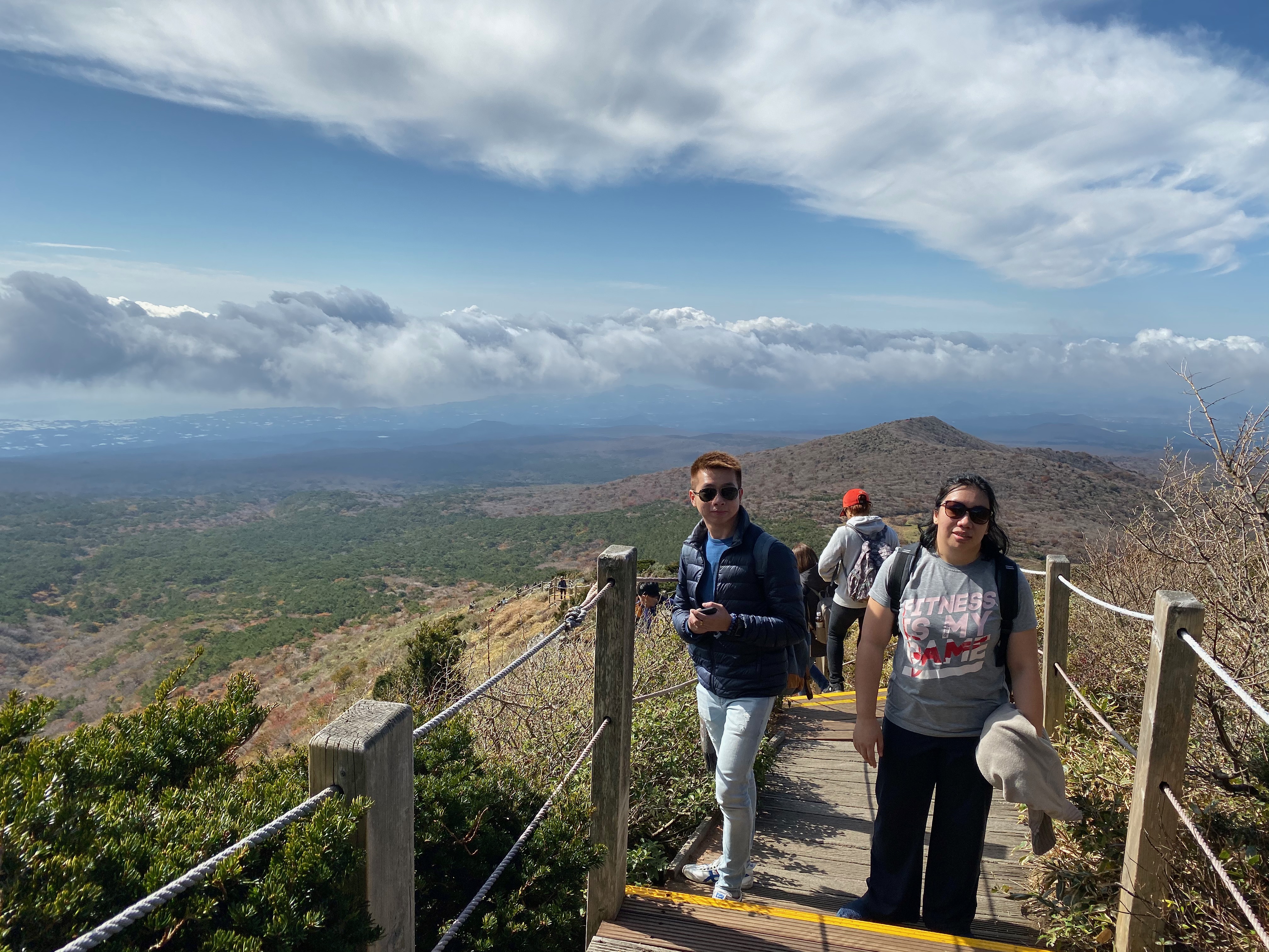
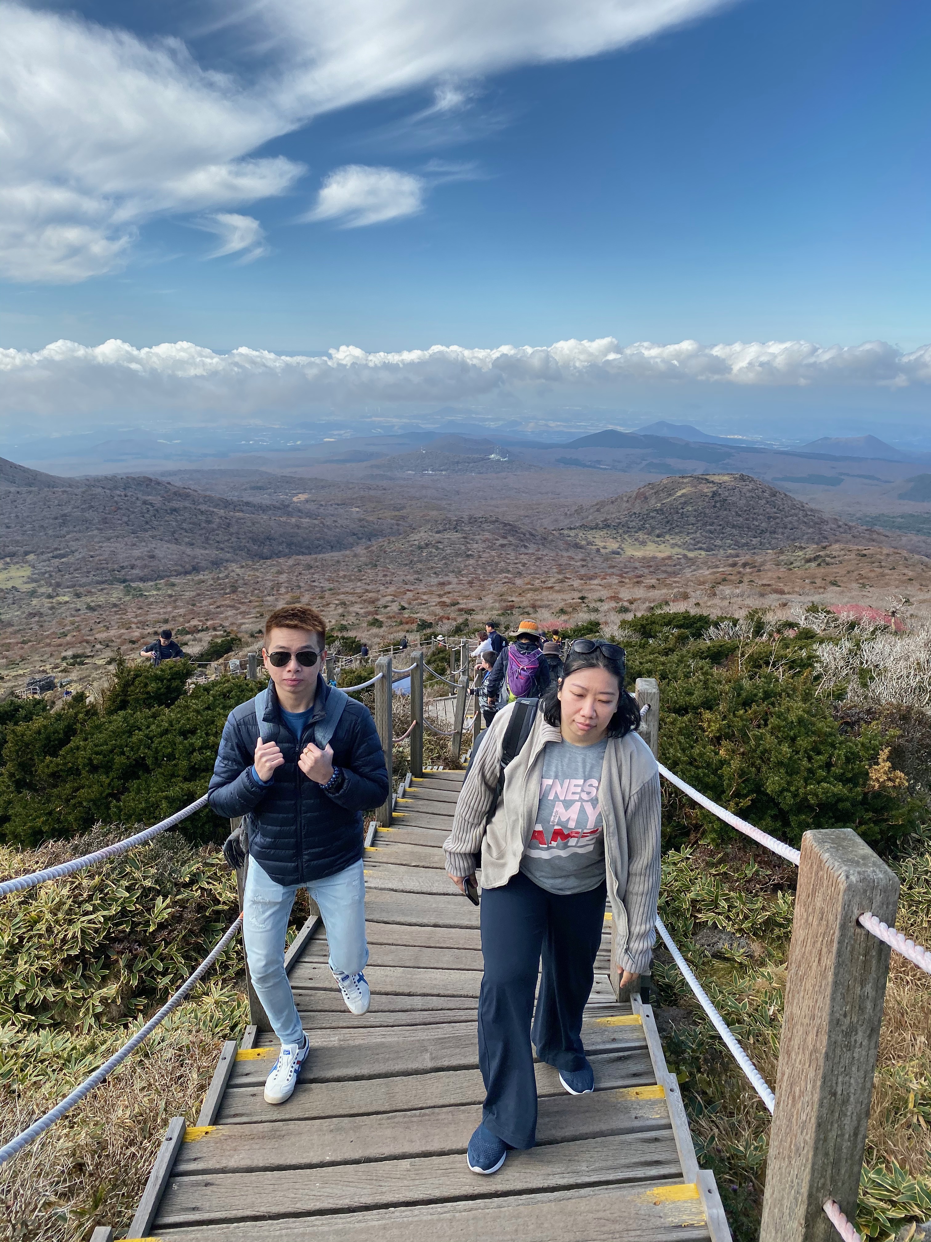
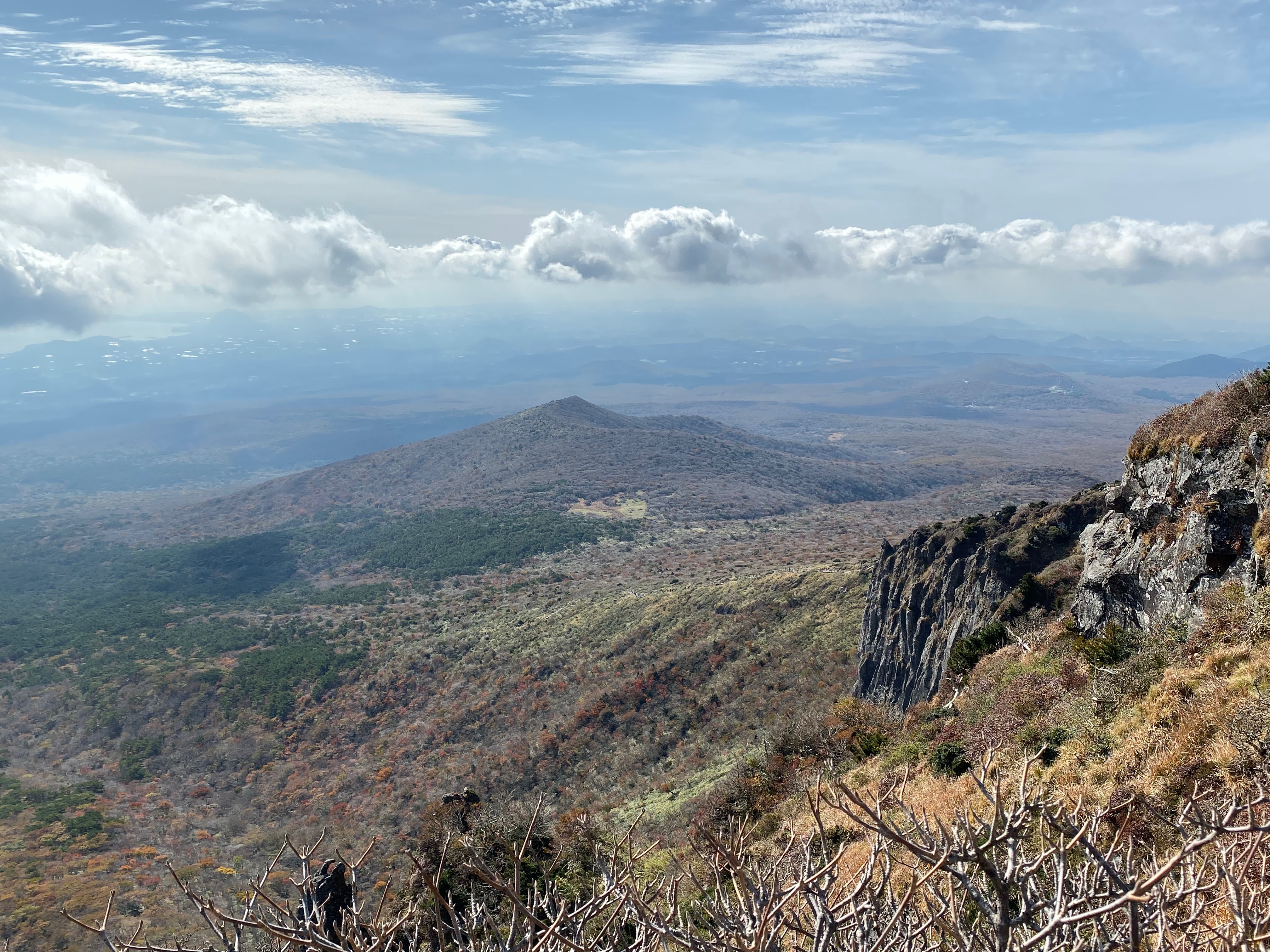
After the climb over the steep staircase, the forest canopy starts to thin out and eventually gave way to reveal the clear blue sky and the majestic Hallasan. From here, it is a series of stairs climbing to our final destination on Hallasan. It is here that we started to realise the hike up to Hallasan seems long and daunting. Along the way, we kept wondering where would our final destination is on the mountain. We half suspect we were only at the beginning of the hike. The higher we climb up Hallasan, the thinner the vegetation is, and the more we can see over the land below us. Yeongsil Trail is at the southern part of Hallasan, we got a good view of southern Jeju Island. The view was magnificent and makes one feels so small in this world. There are several viewing platforms along the Yeongsil Trail for hikers to rest or to take pictures of the vast land below. We stopped occasionally both on these platforms as well as along the stairs to take photos and admire the vastness of the land. Looking down below from this leg of Yeongsil Trail makes one forget all the troubles. The other highlight of this leg is the views of the Byeongpung Bawi Rocks or the Folding Screen Rocks, which got its name as the appearance of this part Hallasan resembles folding screens. Our hike was slightly delayed as we stopped numerous times to take pictures, we couldn’t get enough of the views offered on this leg of the trail. Some parts of this trail were so close to the edge of the cliff that it felt like one can fall off anytime. However, hiking on this trail is absolutely safe as the trail is well paved with handle ropes to aid visitors when climbing up Hallasan. The parts that are close to the edge of the mountain are erected with high fences to ensure hikers have a safe journey up and down Hallasan.
-
- We are on the second leg of the trail
-

- Taking a wefie
-

- Hallasan in full view here
-
- At this point, we couldn’t see the land below us yet

Panoramic view of Hallasan
Hallasan on Yeongsil Trail

At this point, we are able to see the vast lands below
-
- Stopping for a wefie with Hallasan
-

- Another wefie time
-

- We were able to see the vast land below
-

- On Yeongsil Trail with Hallasan
-
- We were pretty high up on Hallasan
-
- Continuing our hike on Hallasan
-

- Another wefie on Hallasan
-

- Another wefie with Byeongpung Bawi Rock behind us
-
- This is one of the resting platform that offers great views on Hallasan
-
- Stunning view of Jeju Island on Hallasan

My friend on the platform looking out into the vast lands below

Byeongpung Bawi Rock on Hallasan
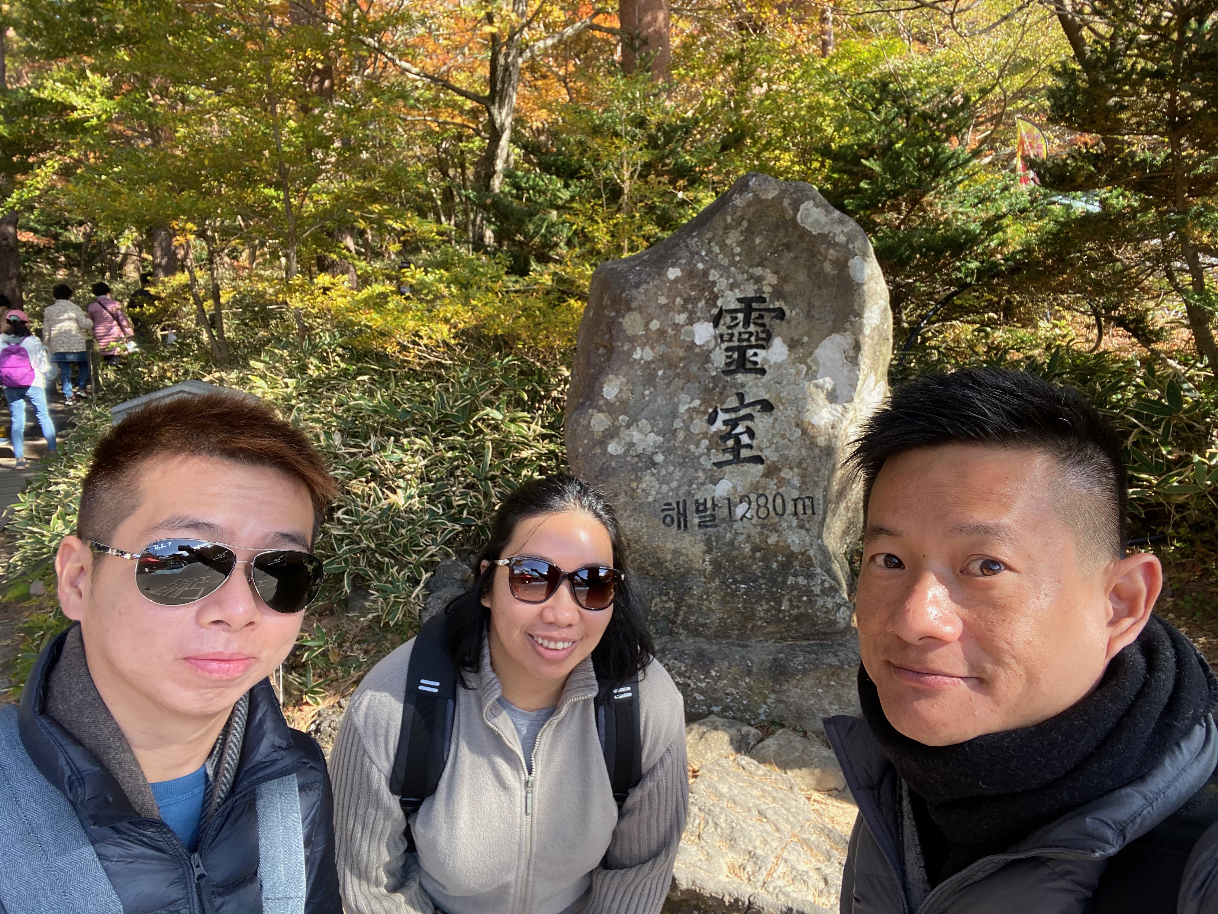
The Final Leg – The Alpine Flatland and End Point Witseoreum Shelter
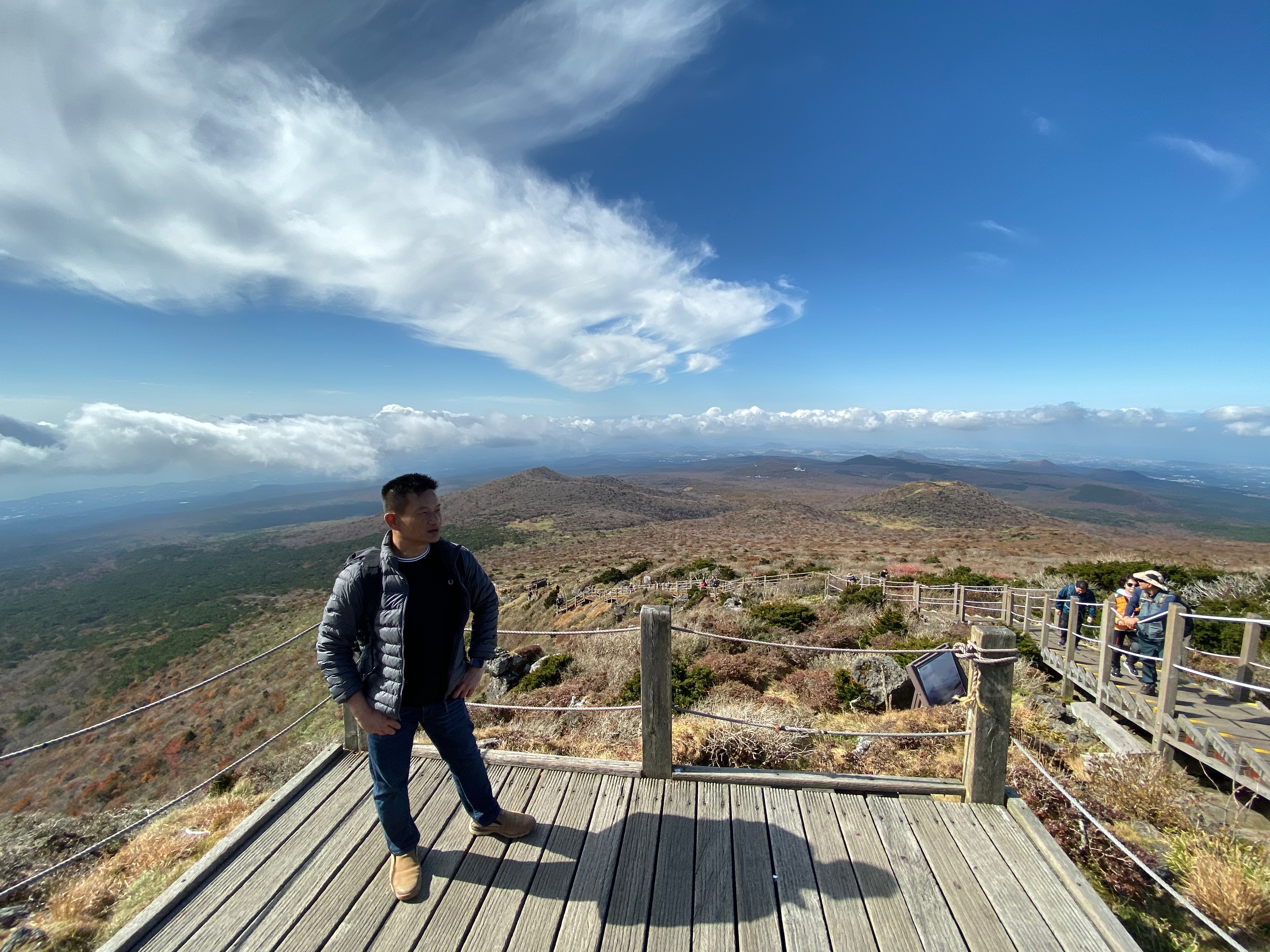
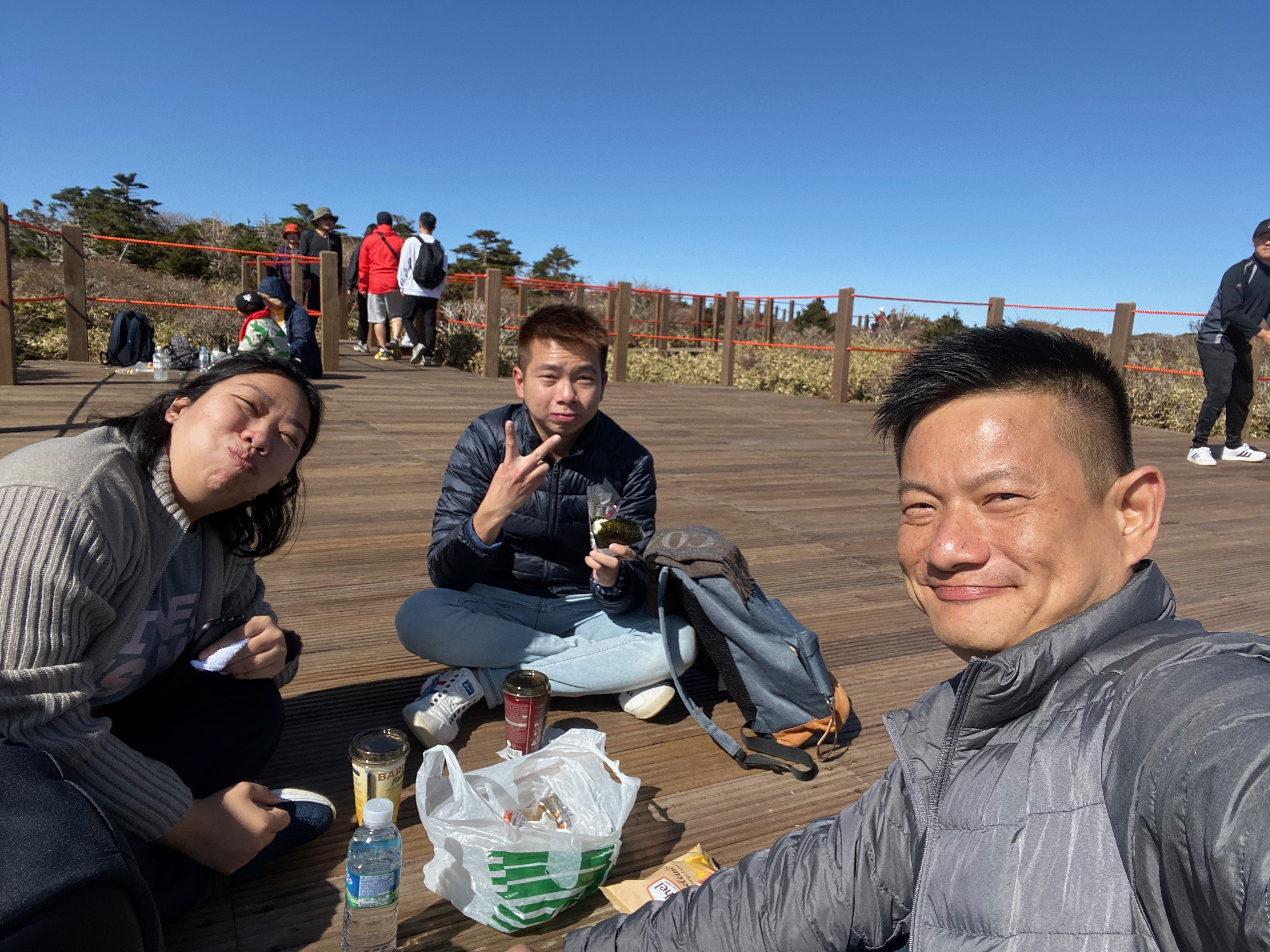
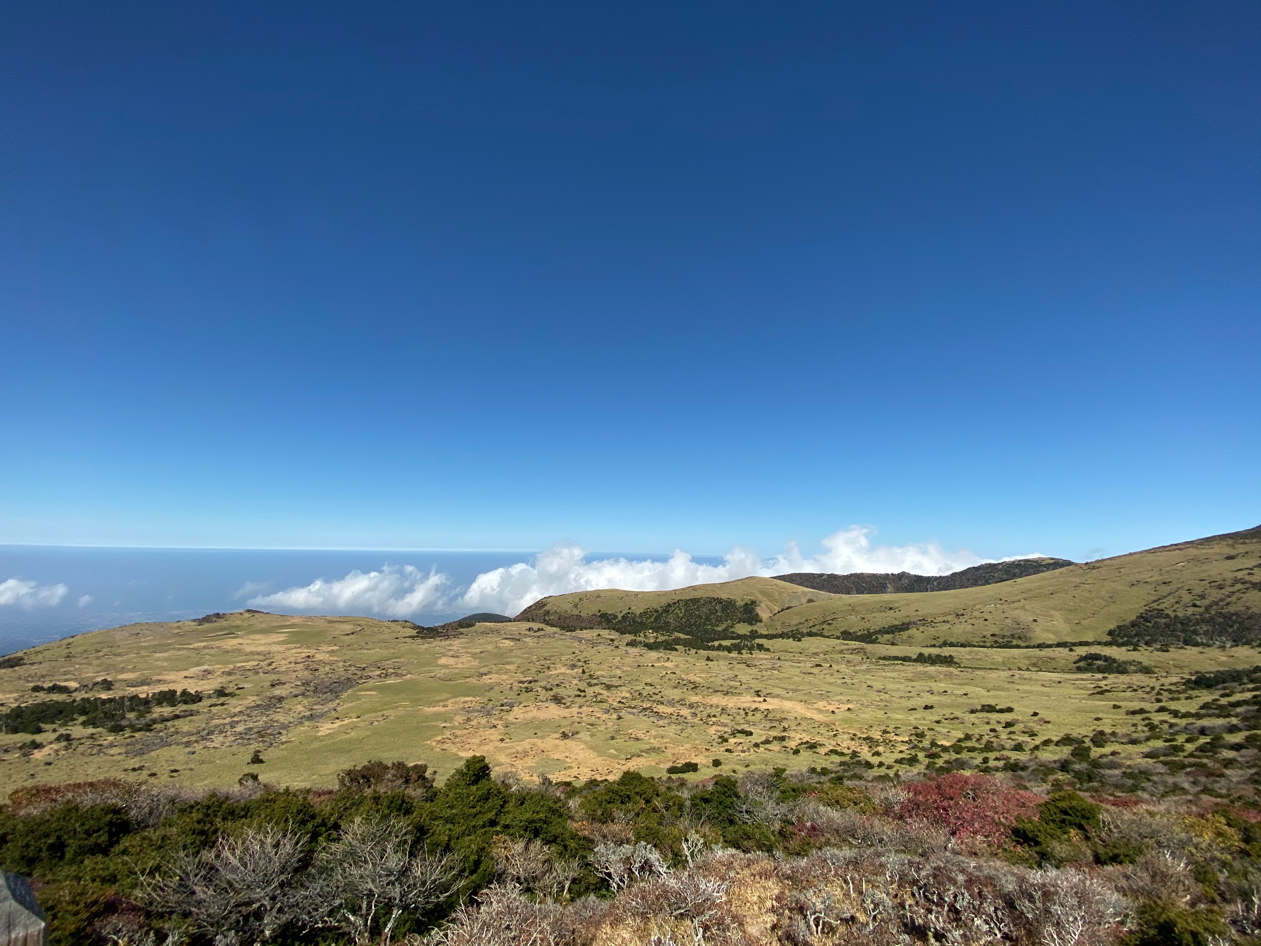
After 1½ hours of climbing from the steep staircase, the elevation of the slope became gentle once more. From here it is an easy walk to the end of Yeongsil Trail. The vegetation started to get thicker along the trail and soon we found ourselves walking on flat land. At this point, we were still wondering if we were near the end of the trail. We walked for another 20 mins and saw the path folks off to a huge platform. We decided to stop for a rest and had our mini picnic here with the onigiri and the coffee we bought from the 7-Eleven at Mysterious Road earlier on. Due to the flat alpine land, we can easily forget that we are actually at 1750m above sea level and we are actually on an extinct volcano. It is definitely an interesting experience picnicking on Hallasan, we wish we had bought more food to have a proper picnic. While we were resting, we saw a flight of staircase that seems to lead to an elevated peak of Hallasan. We thought that could be our endpoint and headed over. There is another viewing platform at the end of this staircase. We could see the western part of Jeju Island from this platform, and the view is exceptional. It is here that we realise we were very high up the mountain as we saw clouds below us. I highly recommend hikers on Yeongsil Trail to make a short stop here as the view is stunning. Just when we started to pat ourselves on our back for reaching the endpoint of Yeongsil Trail, I half suspected that this platform might not be the endpoint after all. We checked with a local hiker and was told our endpoint is another 10 mins walk away. My friends and I thought since we made it this far, what are another 10 mins walk.
-
- Yeongsil Trail flattens out from here
-

- There are thick vegetation on this part of the trail
-

- The flat alpine land on Hallasan
Stopping for a mini picnic on Hallasan

With the Peak of Hallasan in the background

This could be the peak of Hallasan

Panoramic shot from the elevated platform
We are above the clouds on Hallasan
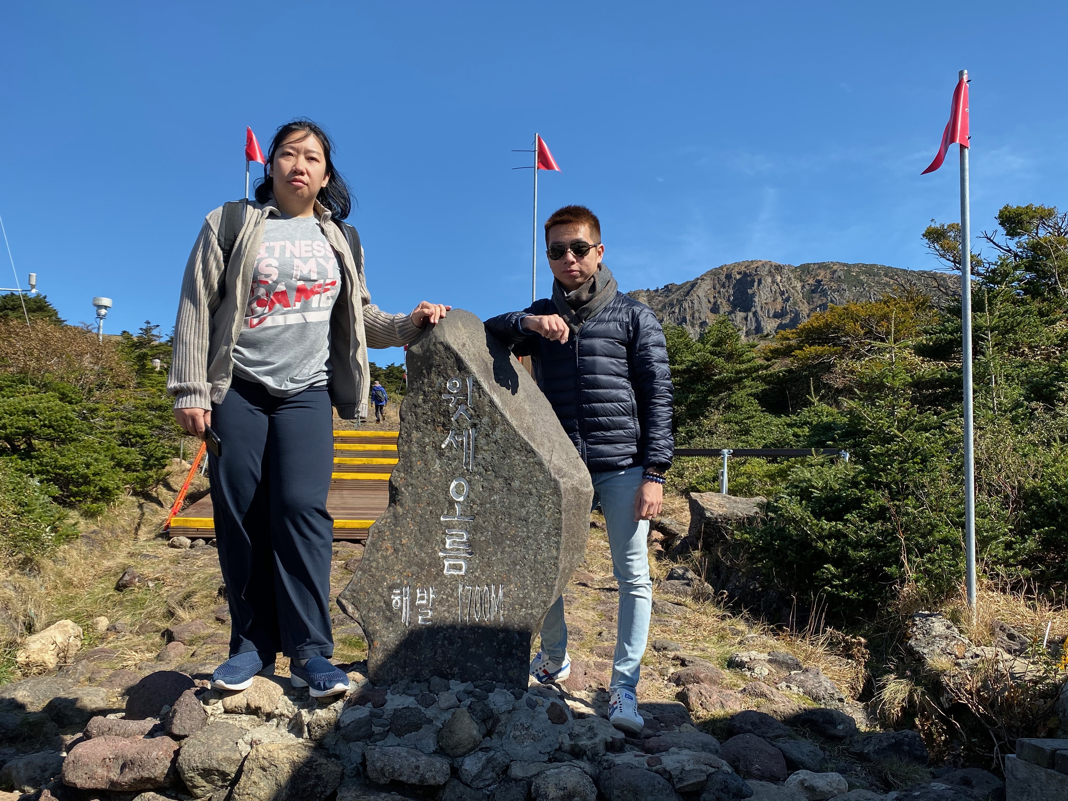
We can see part of the land below from here
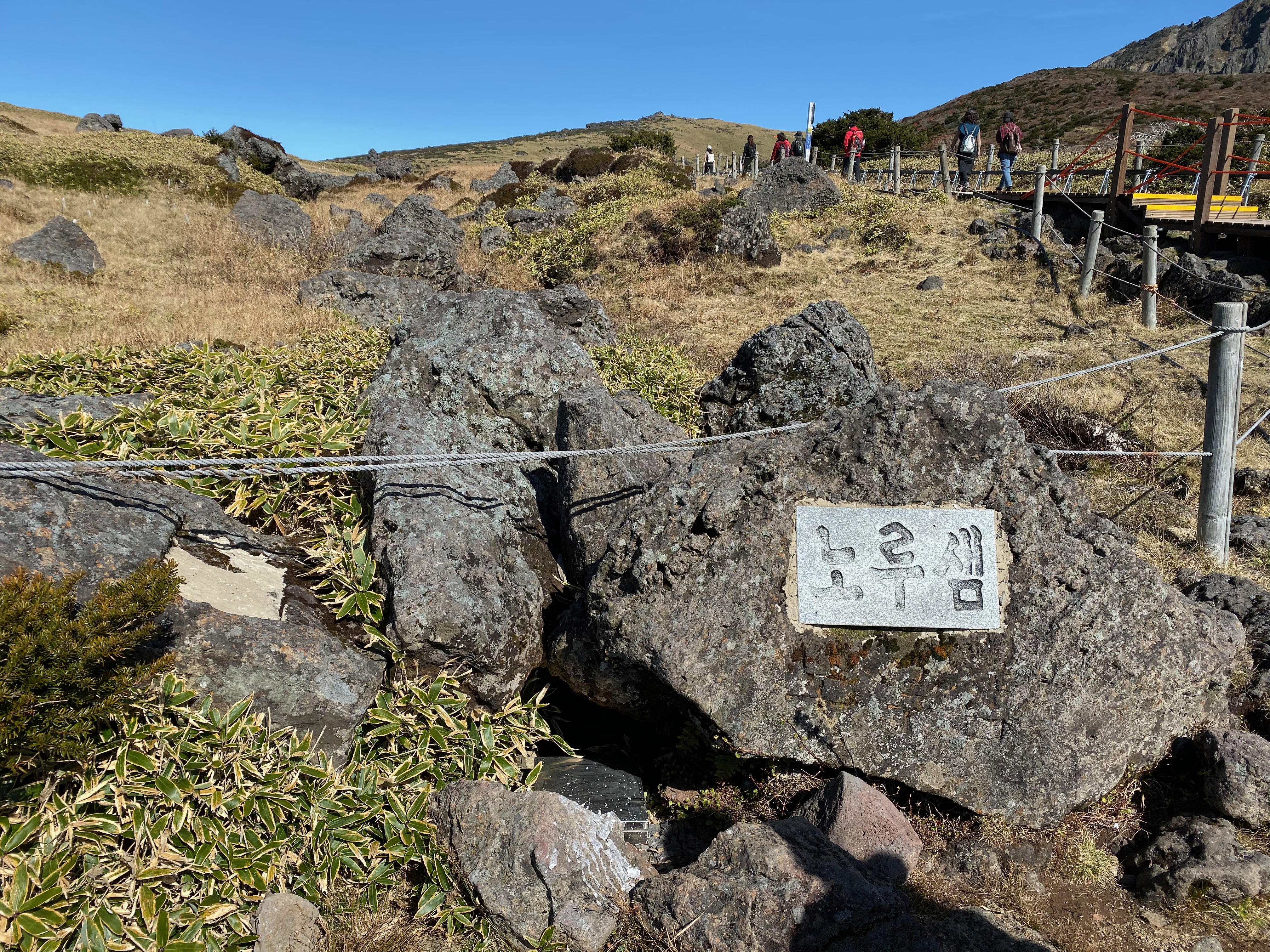
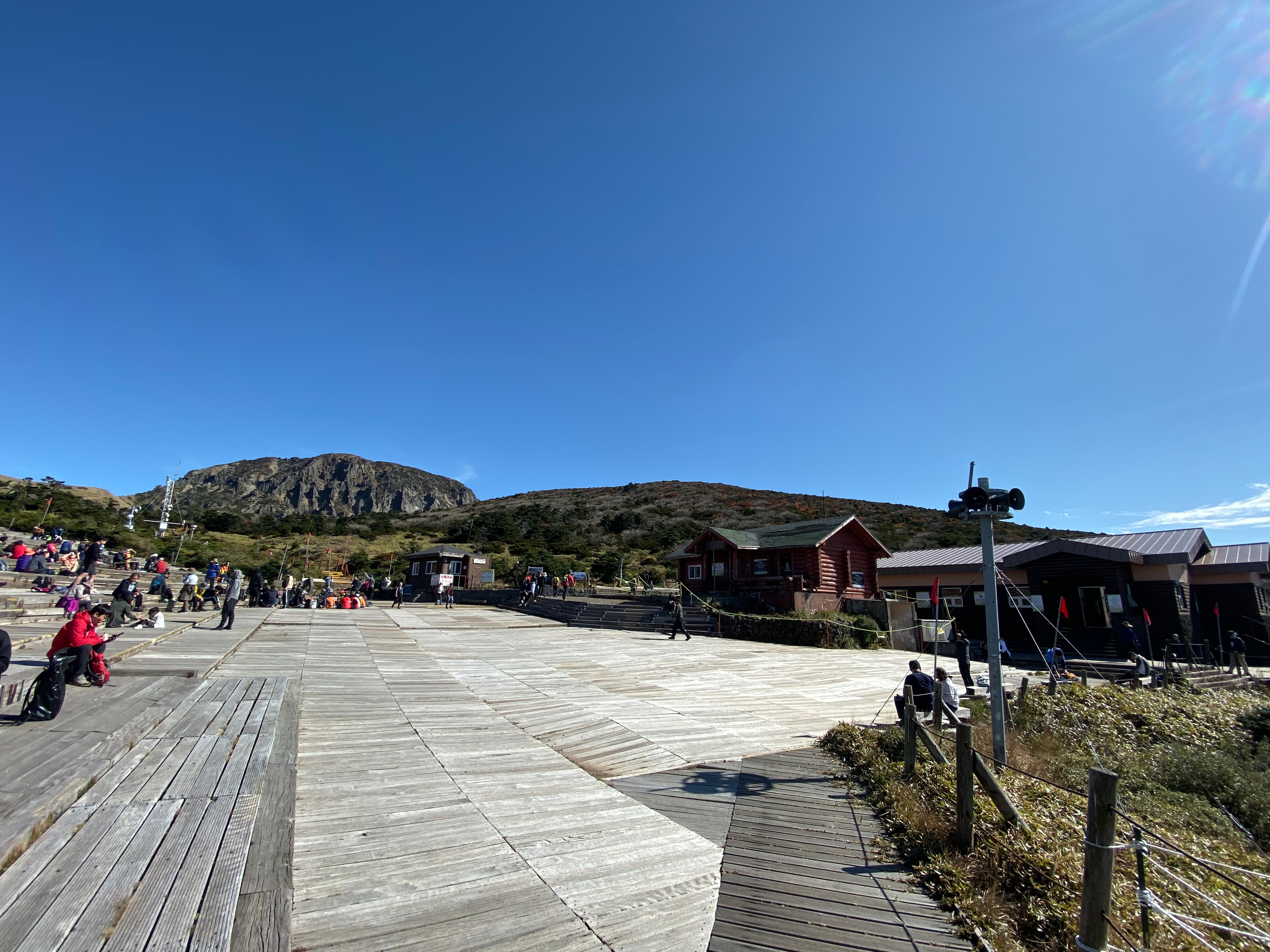
We headed down from the platform and followed the crowd on the boardwalk. Some 10 mins later the trail led us to a huge wooden platform with several wooden houses. This seems to be a place where all the hikers from the other trails on Hallasan converge. At this point, we can confirm that we had reached our destination on Hallasan, Witseoreum Shelter which is situated at 1700m above sea level. As we were walking around, we saw several elderly Koreans picnicking here. It took us about 3 hours to reach our endpoint on Hallasan. At Witseoreum Shelter, there are paths that lead to other trails on Hallasan. There is even a trail that leads to the peak of Hallasan. After some pictures with a stone that states the elevation, we started to hike back down from where we came from to our car.
-
- We continue on the path to our destination of this hike
-
- We finally reach our destination
-
- Our destination – Witseoreum shelter
-

- Taking a wefie with the tablet at Witseoreum shelter. We are at 1700m on Hallasan
-
- My friends with the tablet. The trek to the peak of Hallasan is behind this tablet
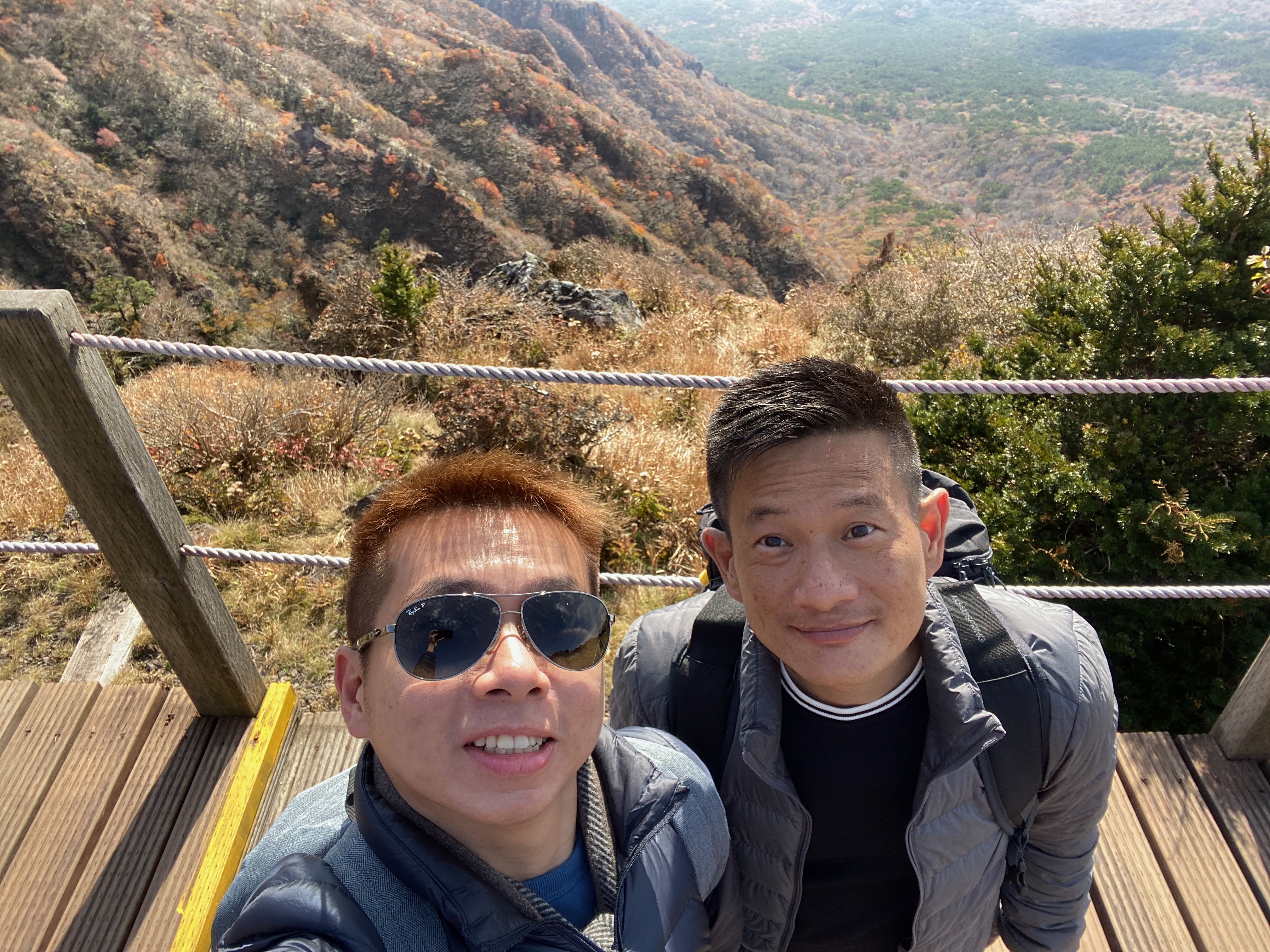
The Return Leg – Same Scenery but a Different Feel
We headed back the same way we came up from. Although it is the same path, the scenery appears different. Maybe it is because we were back facing the vast lands below when we climbed up (that did not allow us to fully appreciate the scenery) or maybe our focus is on where is the endpoint on our way up that distracted us from appreciating the scenery that is before us. On our second time on the trail, we got to see more of Hallasan that we did not notice on the way up. Nonetheless, my friends and I can never get tired of the scenery that was before our eyes. We stopped occasionally to take pictures of the surroundings. The hike down Yeongsil Trail took us 1½ hours to reach the car park. We were surprised that the hike down took significantly lesser time compared to the way up. After a short toilet break, we felt hungry and drove to nearby our next destination for lunch.
-

- Commencing our descend on Hallasan
-

- We got a better look of the land below on our way down
-

- View of Byeongpung Bawi Rock
Taking a wefie on our way down
One last look of Jeju from Hallasan

The Byeongpung Bawi Rock on Hallasan
Posing for a shot on the stairs we climbed
-
- We reached the forested part of Yeongsil Trail
-
- The red leaves on the trees in the forested part of Yeongsil Trail
-
- Autumn foliage with Hallasan in the background
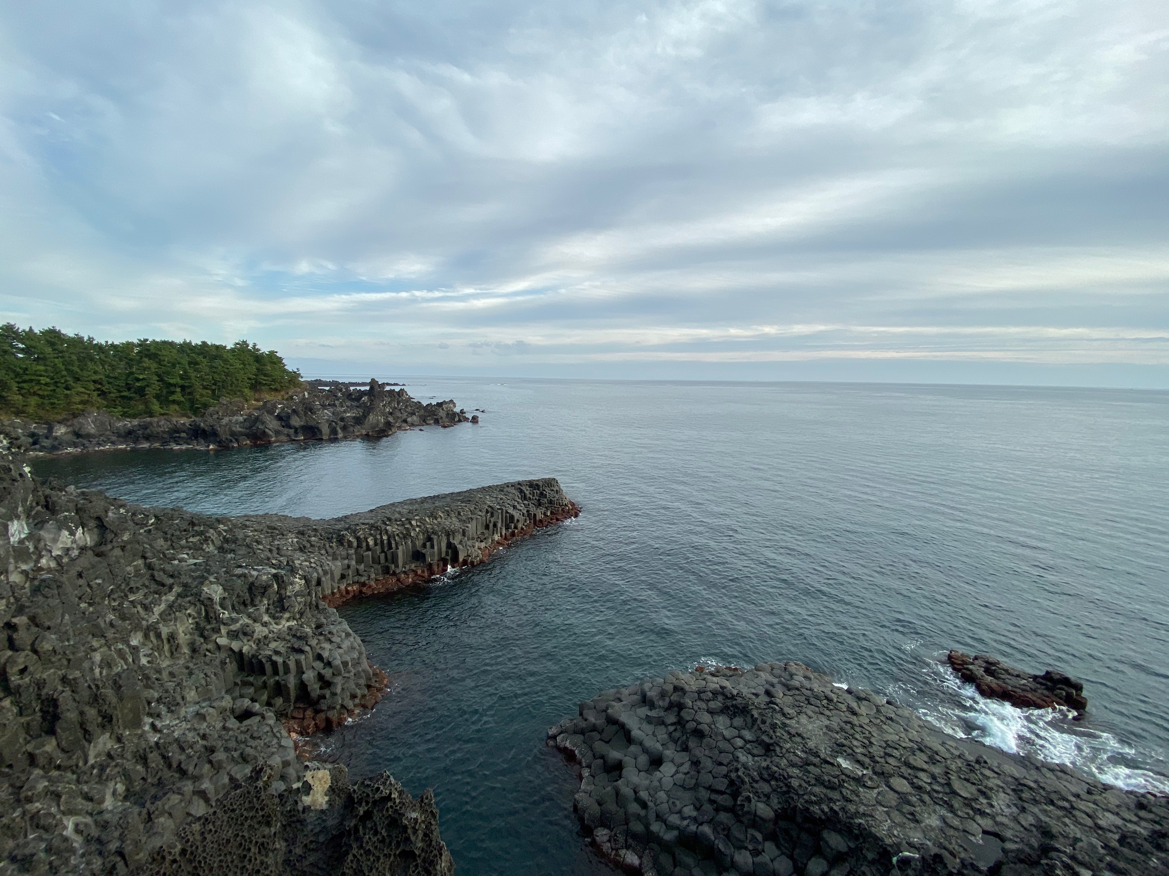
Jusangjeolli Cliff – Nature’s Wonder Hexagonal Coast
We settled our lunch at a Mcdonald’s near our next destination. After lunch, it is a 15 mins drive to the Jusangjeolli Cliff. Entrance to Jusangjeolli Cliff costs KRW2,000 per person and car parking is chargeable at KRW1,000 per car. It took us a mere 5 mins walk from the car park to the viewing platform at Jusangjeolli Cliff. Jusangjeolli Cliff is characterised by its unique pillar hexagonal coastal rocks are formed when the volcanic lava from Hallasan erupted and cooled by the sea 250,000 years ago. There is only a small stretch of the viewing platform that allows visitors to get a good view of Jusangjeolli Cliff. It is a little crowded at the time of our visit as everyone congregates on this platform to marvel at this masterpiece of Mother Nature. Despite the crowded, my friends and I were still able to get a good view of Jusangjeolli Cliff. What makes this place worth visiting is the view of the southern sea which seems to stretch forever. The view is especially tranquil and we felt we could stay here for a few more moments. The hexagon coast of Jusangjeolli Cliff is just a small part of this area. We only stayed here for around 5 mins and left for our next destination.
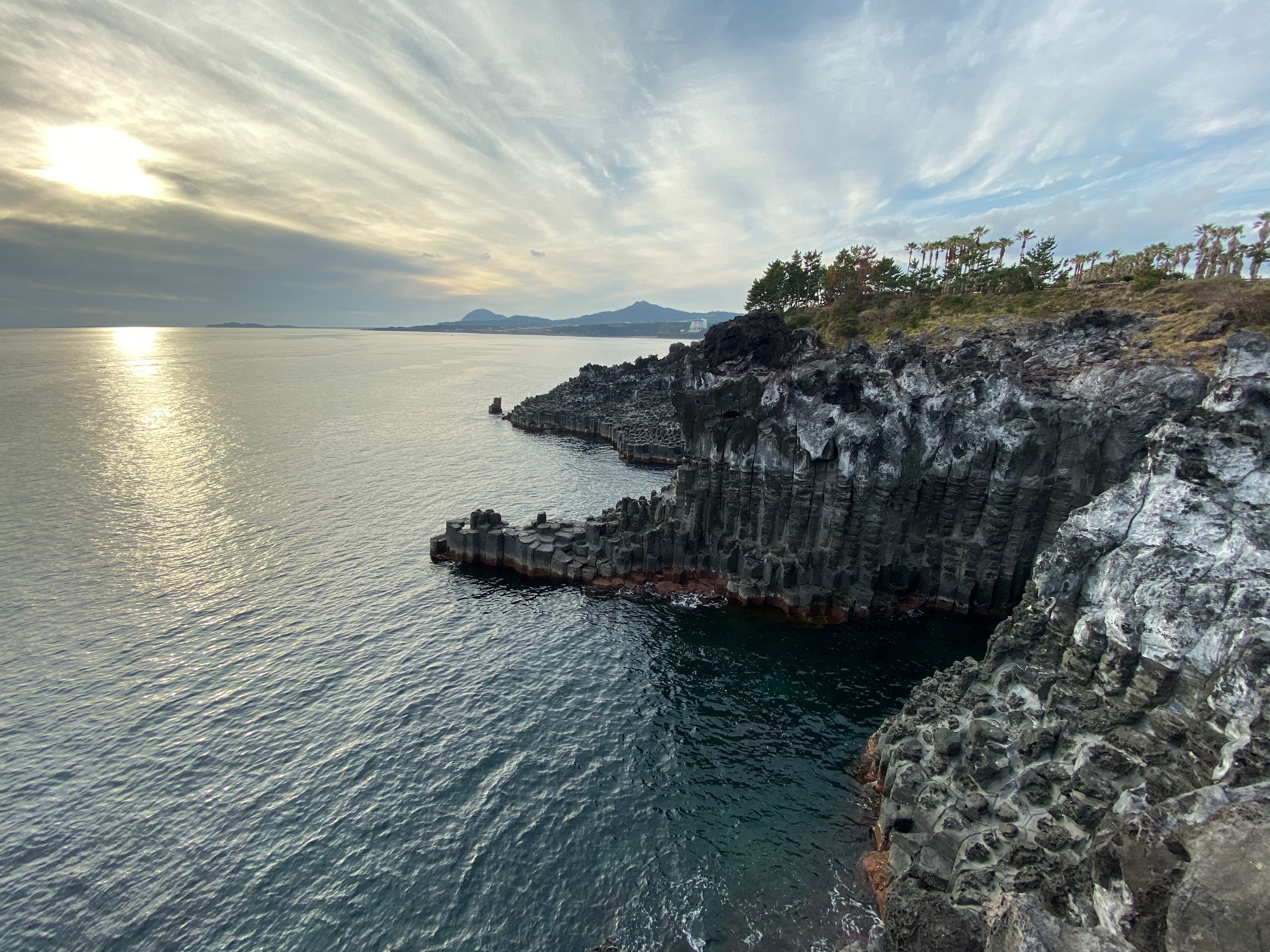
The hexagon pillar Jusangjeolli Cliff
-

- The dramatic coastline at Jusangjeolli Cliff
-
- Jusangjeolli Cliff
-
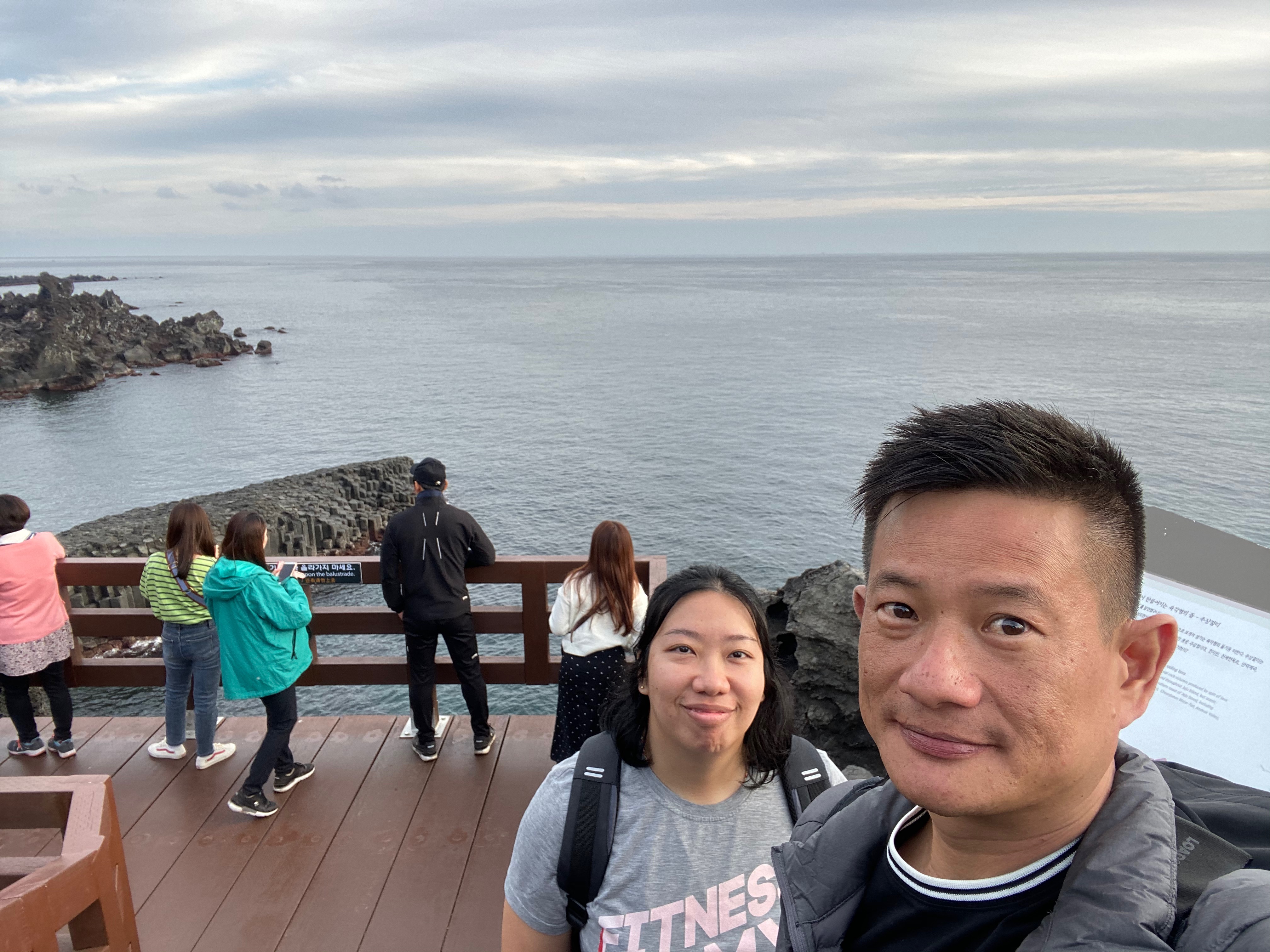
- Wefie with Jusangjeolli Cliff
-
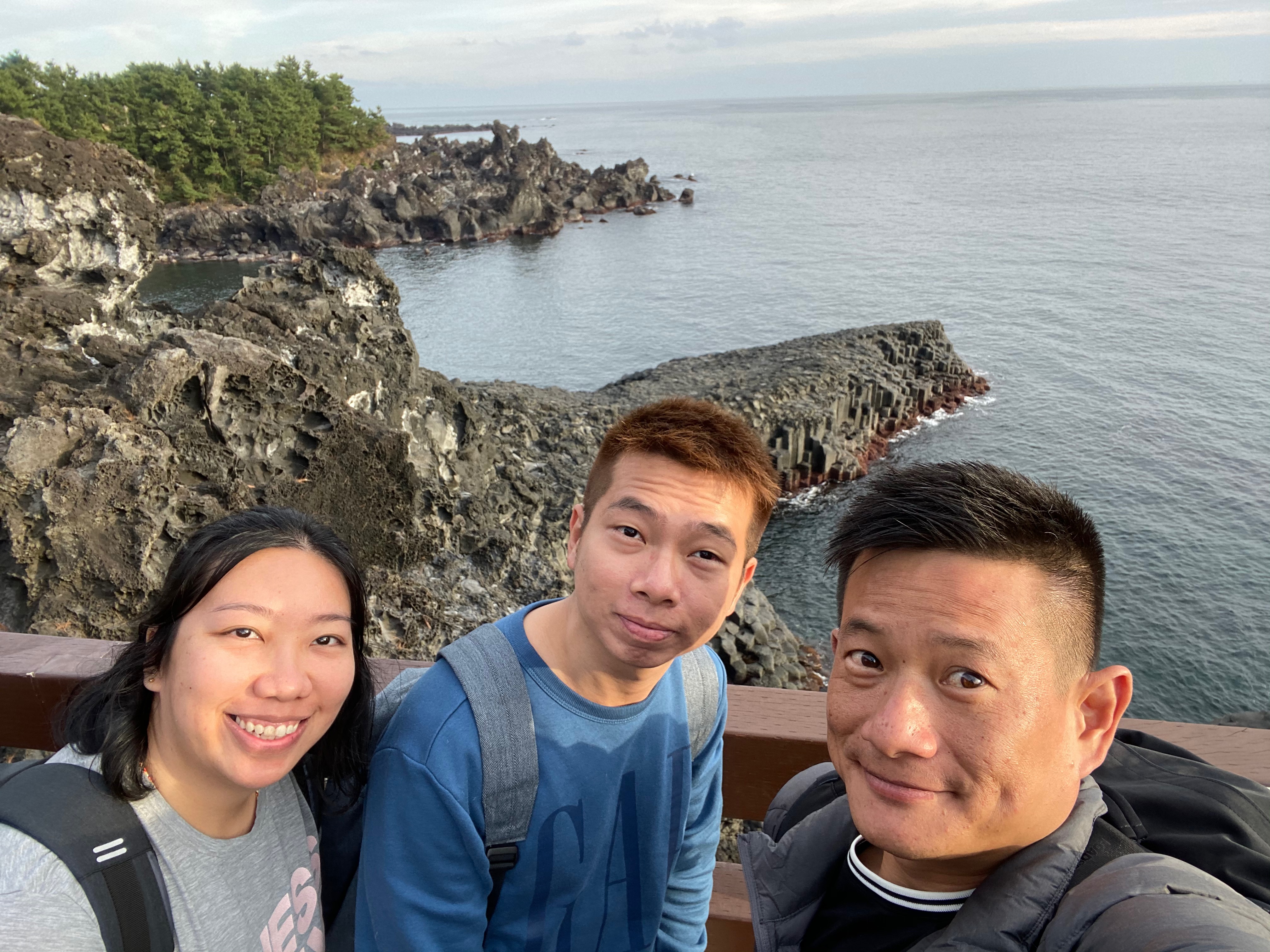
- Another wefie with Jusangjeolli Cliff

Sun is almost setting at Jusangjeolli Cliff

One last wefie before we leave Jusangjeolli Cliff
Innisfree Jeju House
We originally planned to visit Cheonjeyeon Waterfall, we decided to give this a miss partly due to the disappointing Cheonjiyeon Waterfall we visited yesterday, and partly due to our tiredness after the hike on Hallasan. Instead, we decided to head west and visit the Innisfree Jeju House. Initially, we thought we can do some shopping at Innisfree Jeju House, we were soon disappointed upon arriving. The merchandise on sale is very limited, as though selling their products is not the main purpose here. The main attractions in Innisfree Jeju House are the tea plantation and the cafe. We left after staying 5 mins here and bought a green tea lava cake as well as some coffee. Innisfree Jeju House is not worth visiting unless one has ample time on their hands in Jeju or wanted to try their green tea lava cake, which is quite delicious.
-

- Innisfree Jeju House is more of a cafe than a retail shop
-
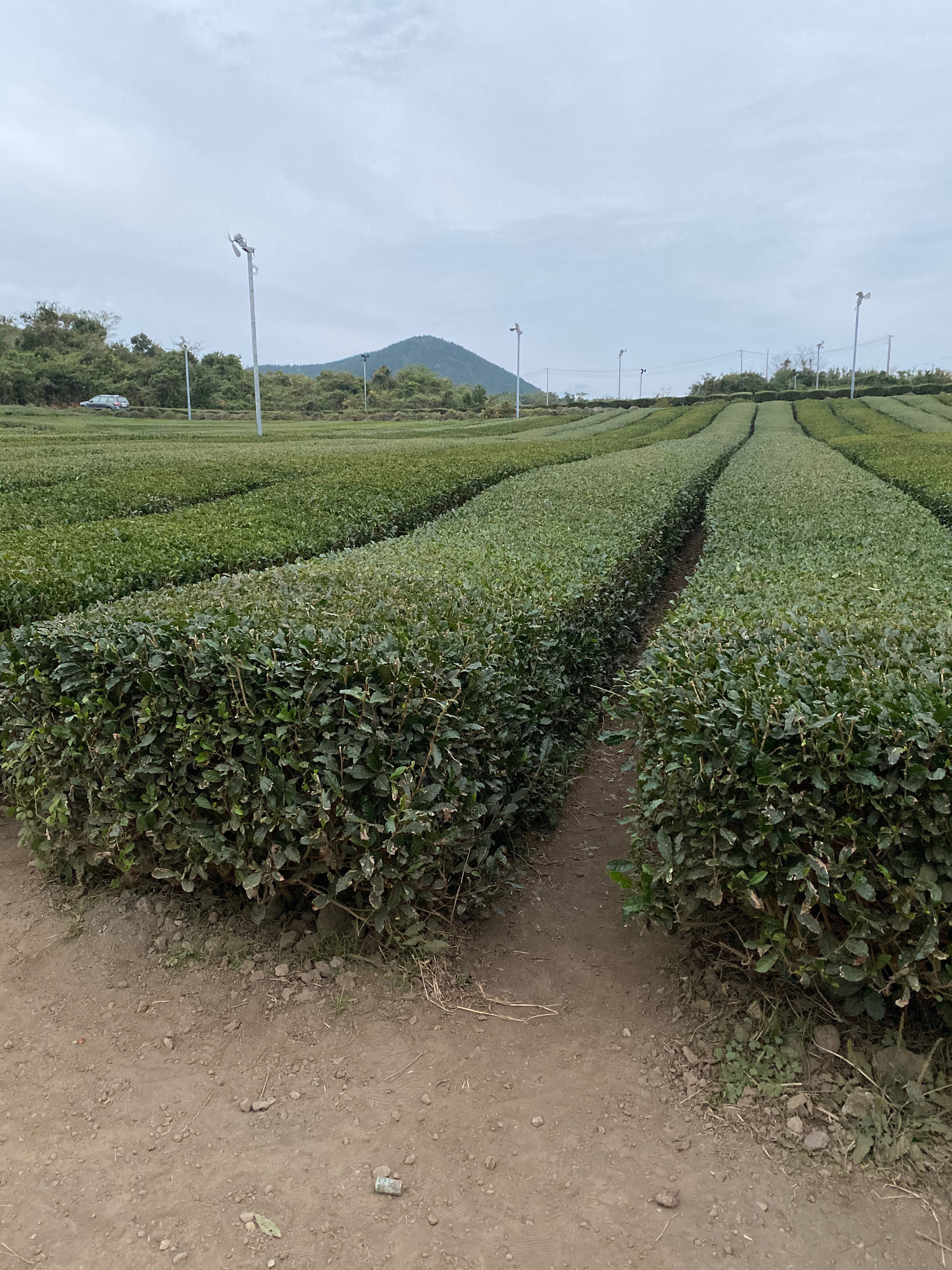
- Tea plantation at Innisfree Jeju House
-

- Innisfree Jeju House
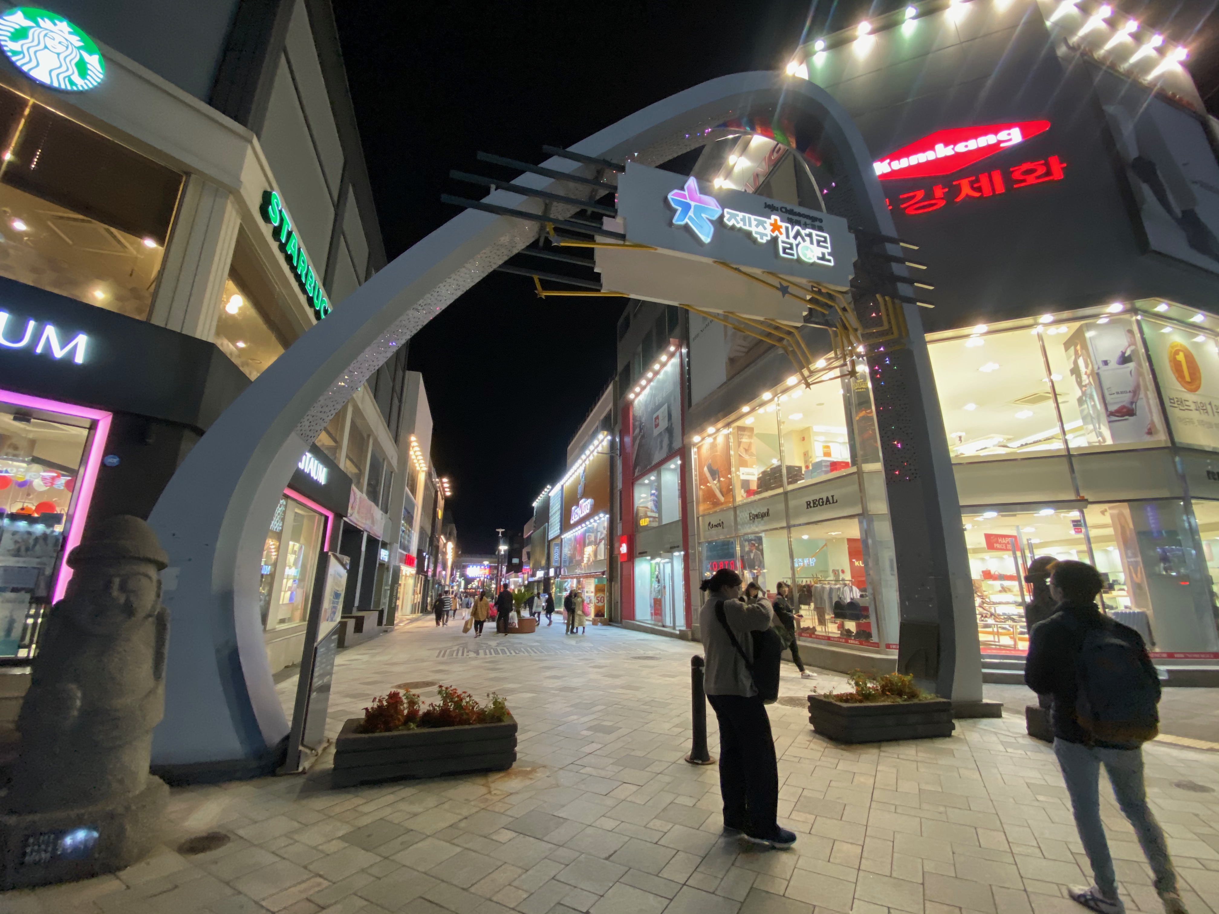
Back to Jeju-si
Although the sun has set, however, it is still relatively early. We took the 1hr drive to Dongmun market area in Jeju-si for dinner and to buy breakfast for tomorrow as we would have to wake up early to catch our flight to Busan the next day. After parking our car, we strolled along the underground shopping street and the shopping street on the surface. Jeju-si is deserted today. There are hardly anyone on the streets. After strolling for around 30 mins (with nothing to buy), we packed some food and brought back to our Airbnb accommodation. We rested early tonight for an early flight out of Jeju tomorrow. In the short span of 3 days, we managed to cover most of the attractions in Jeju. We thought 3 days is just nice for a road trip in Jeju.
-
- Jeju-si shopping street
-

- Wefie at the shopping street in Jeju-si
Pingback: Jeju/Busan/Seoul Day 12 (6 Nov 19) – Bye Bye Seoul, Bye Bye South Korea: A Conclusion of our South Korea Trip | Zephyrous Travels